Situation Summary
Ghana remains at composite global threat rank #158 with a moderate risk profile dominated by Greater Accra Region volatility. High-profile political statements and ongoing anti-illegal-mining operations have created a multi-layered security environment combining labor/political tension, organized crime at extraction sites, and persistent transnational spillover risk from the Burkina Faso–Ghana border. The trajectory is stable but contingent on the political temperature and operational intensity of security forces in mining zones.
Key Developments
- Obuasi, Ashanti Region (17–18 July 2026): Armed clash at AngloGold Ashanti mine between Ghana Armed Forces and illegal miners resulted in approximately 8 fatalities and vehicle arson. Military reported attackers were armed with rifles, pump-action guns, and machetes; troops returned fire in self-defense. Ashanti Region risk score (5.7) reflects this volatility.
- Ahwiren/Bekwai Municipality, Ashanti Region (17 July 2026): National anti-illegal mining operation dismantled a site, disabled six excavators, and recovered two shotguns and ammunition, indicating armed organization of illegal mining networks.
- Kyebi, Eastern Region (reported 18 July 2026): Joint military-police anti-illegal-mining operation escalated into gunfire; one person shot in the leg and treated at Kibi Government Hospital.
- Accra (mid-July, reported 18–19 July 2026): Economic and Organized Crime Office (EOCO) arrest of NPP communications officer Denis "Aboagye" cited as political tension trigger with potential to elevate protest risk in the capital.
- Multi-jurisdictional (20–21 July 2026): German foreign ministry guidance flags demonstrations possible nationwide, particularly in Accra, Kumasi, Tamale, and Takoradi; northern border areas elevated due to Burkina Faso conflict spillover.
- Parliamentary, Central Bank, Chief Justice, and senior government public statements (19–20 July 2026): Multiple official entities issued statements; thematic content not fully accessible but consistent with elevated political communication activity.
Highest-Risk Areas
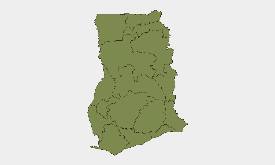
Greater Accra Region (31.8) dominates the threat landscape, driven by political concentration, protest risk, and organized crime. Bono East Region (20.7) reflects mining-related violence and illegal extraction networks. Ashanti Region (5.7), despite ranking fourth nationally, hosts the most recent armed casualties and is the primary flashpoint for security-force-versus-illegal-miner confrontations. Northern border zones (Savannah, North East, Upper East, Upper West regions all ≤2.5 individually) remain secondary but chronic concerns due to Burkinabè armed group presence and cross-border trafficking; these lower scores mask latent transnational risk.
How GeoBit Would Assist
Security teams should deploy Intel Sweep and X/Twitter & Telegram OSINT to monitor real-time political statements, protest mobilization, and labor-union activity in Accra and Kumasi. Area-of-Interest (AOI) Monitoring with alerting should cover the Obuasi mining corridor and northern border regions to detect escalation in armed mining clashes or cross-border infiltration. Early Warning & Prediction and sentiment analysis can flag political temperature shifts ahead of planned demonstrations, enabling duty-of-care teams to adjust travel or site operations before incidents materialize.
7-Day Outlook
Political activity and official statements are likely to continue at elevated frequency through late July, sustaining demonstration risk in major urban centers. Anti-illegal-mining operations are expected to persist, raising the probability of additional armed clashes in Ashanti and adjacent regions. Border tension remains chronic; no imminent regional escalation is signaled, but security posture in northern operations should remain elevated.
Highest-Risk Areas — Ranked
| # | State / Region | Risk |
|---|---|---|
| 1 | Greater Accra Region | 31.8 |
| 2 | Bono East Region | 20.7 |
| 3 | Volta Region | 8.1 |
| 4 | Ashanti Region | 5.7 |
| 5 | Upper East Region | 4.1 |
| 6 | Bono Region | 3.3 |
| 7 | Northern Region | 2.5 |
| 8 | Upper West Region | 1.8 |
| 9 | Savannah Region | 1.8 |
| 10 | North East Region | 1.8 |
| 11 | Eastern Region | 1.8 |
| 12 | Oti Region | 1.8 |
Sources
Previous Daily Briefs
A new Ghana brief is written every day — each with its own risk map and downloadable CSV. Here's the last week; use the calendar to go further back.
📅 Browse every day by calendar →
Highlighted days have a brief. Tap a day for that day's map & analysis, or “csv” for that day's dataset ($5).
Atlas — our AI intelligence desk — emails them this snapshot personally. Nothing else, no list.