Situation Summary
Ireland remains a low-threat environment with a composite global ranking of #155. The security picture over the last 24–48 hours reflects routine crime, road safety incidents, and isolated security alerts rather than systemic instability or civil unrest. Localised violent crime in counties Meath and Tipperary, combined with a hoax security device in Northern Ireland and ongoing cyber-exploitation activity targeting Irish organisations, present dispersed rather than converging risks. The threat trajectory remains stable, with no credible indicators of escalation in the near term.
Key Developments
- Portrush, Co Antrim (Northern Ireland) – attempted murder, shots fired – Thursday 16 July, evening
PSNI opened an attempted murder investigation after several shots were fired at a house in the Craigahullier area shortly before 23:00 BST; occupants were unharmed. A burnt-out vehicle found near Ballymoney in the early hours of Friday is being investigated as potentially linked.
- Manse Road, Castlereagh, East Belfast (Northern Ireland) – security alert hoax confirmed – Friday–Saturday 10–11 July
PSNI confirmed a suspicious device reported on Friday was an elaborate hoax after Ammunition Technical Officers carried out a controlled explosion; no injuries or disruption resulted.
- Navan, Co Meath – teenager fatality, assault charge – Thursday–Friday 16–17 July
Gardaí confirmed a male teenager died following a serious assault last month; a 36-year-old man has been charged with assault causing harm and is due before Trim District Court.
- Belfast, Northern Ireland – hit-and-run fatality – reported within last 48 hours
A 24-year-old woman from Tipperary died in a hit-and-run collision involving a car and two pedestrians; another man was seriously injured. A man has been arrested in connection.
- R505 near Dundrum, Co Tipperary – fatal road traffic incident – reported within last 48 hours
A male driver in his 50s died at the scene of a single-vehicle crash; investigations ongoing.
- Cork, Co Cork – yellow high-temperature weather warning – active through Friday 17 July
Met Éireann issued a Yellow alert for temperatures exceeding 27–30°C, creating potential heat-stress and infrastructure-strain risk for outdoor workers and transport operators.
- National cyber environment – Microsoft SharePoint vulnerabilities and EU/UK cyber sanctions – Thursday–Friday 17 July
EU and UK authorities announced joint cyber sanctions targeting Russian state agencies and cybercriminal networks. Active exploitation of Microsoft SharePoint Server CVEs (CVE-2026-32201, -45659, -56164) poses a current risk to Irish organisations running on-premises deployments.
Highest-Risk Areas
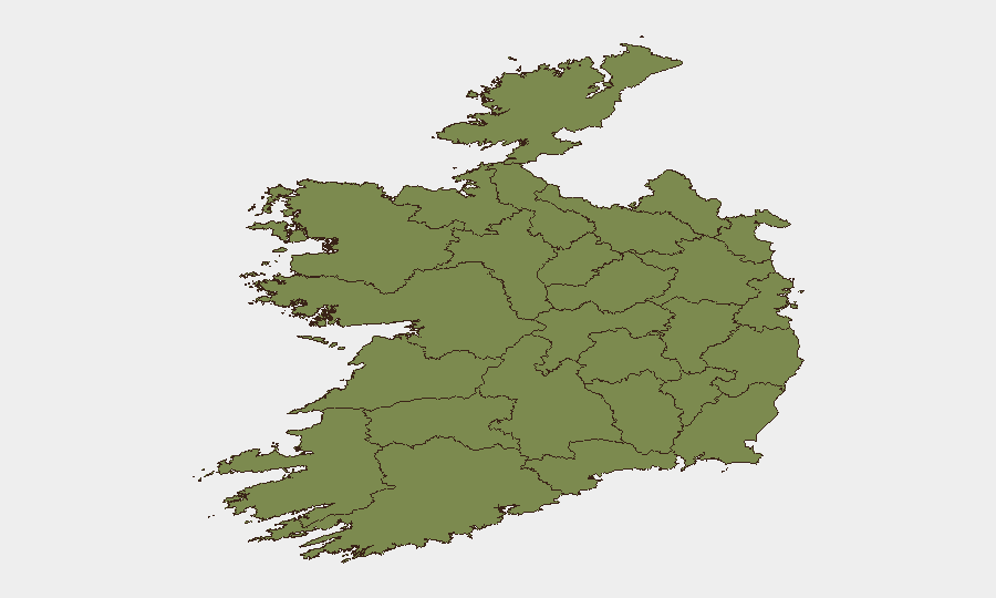
County Westmeath (31.9), Dublin (25.6), and Tipperary (24.0) drive the composite sub-national ranking, reflecting concentrations of violent crime, assault, and road-safety incidents. Recent fatalities in Navan (Meath border) and Tipperary, combined with Belfast road violence, underline that risk is primarily localised within specific crime hotspots rather than geographically dispersed. Dublin's persistently elevated risk reflects urban crime prevalence; Westmeath's spike warrants closer monitoring. Southern and western counties (Cork, Mayo, Galway, Limerick, Clare, Sligo) register substantially lower composite scores, indicating reduced event clustering.
How GeoBit Would Assist
Security teams should deploy AOI Monitoring & Early Warning on high-risk counties (Westmeath, Dublin, Tipperary) to track violent-crime signals and emerging assault incidents with alerting. Intel Sweep and OSINT fusion (X/Twitter, Telegram, local news feeds, multi-language search) would flag civil unrest, protest activity, or security alerts in near-real time. Cyber risk assessment integrated with Shodan and vulnerability tracking would allow teams to identify on-premises SharePoint exposure within corporate infrastructure and prioritise patching CVE-2026-32201 and related exploits.
7-Day Outlook
No credible indicators suggest escalation of violence, civil unrest, or infrastructure disruption over the next seven days. Road-safety risk will persist in Tipperary, Meath, and Belfast; heat-related operational stress in Cork may extend into the weekend. Cyber exploitation of SharePoint vulnerabilities will likely remain active and should be treated as an ongoing operational priority for Irish organisations.
Highest-Risk Areas — Ranked
| # | State / Region | Risk |
|---|---|---|
| 1 | County Westmeath | 31.9 |
| 2 | County Dublin | 25.6 |
| 3 | County Tipperary | 24 |
| 4 | County Wicklow | 20.8 |
| 5 | County Carlow | 19.3 |
| 6 | County Laois | 16.1 |
| 7 | County Cork | 8.2 |
| 8 | County Mayo | 5 |
| 9 | County Sligo | 3.5 |
| 10 | County Galway | 1.9 |
| 11 | County Clare | 1.9 |
| 12 | County Limerick | 1.9 |
Sources
Previous Daily Briefs
A new Ireland brief is written every day — each with its own risk map and downloadable CSV. Here's the last week; use the calendar to go further back.
📅 Browse every day by calendar →
Highlighted days have a brief. Tap a day for that day's map & analysis, or “csv” for that day's dataset ($5).
Atlas — our AI intelligence desk — emails them this snapshot personally. Nothing else, no list.