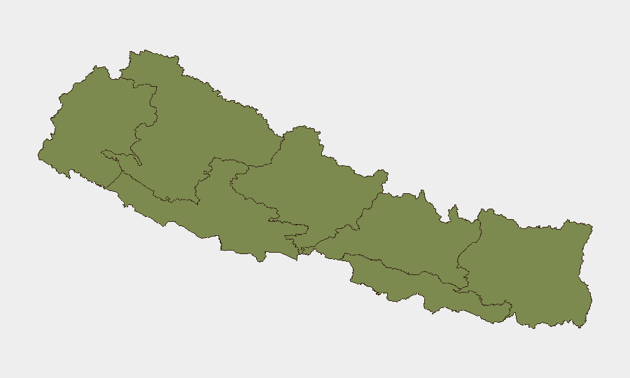
Situation Summary
Nepal faces a composite threat score of 14 (rank #81 globally) driven primarily by political instability, youth-led civil unrest, and localized public-safety incidents concentrated in Bagmati Province. The capital Kathmandu and surrounding areas remain under elevated protest risk stemming from July 10 self-immolation of a ride-sharing worker and perceived governance failures. Federal-system instability and provincial-government maneuvering are creating conditions for renewed demonstrations and administrative disruption across multiple provincial capitals through the immediate term.
Key Developments
- Kathmandu, Bagmati Province – July 18, 2026: Political media outlets flagged Nepal's federal system as facing "most severe existential crisis," with provincial-government instability and inter-party maneuvering signaling elevated risk of protests and governance crises in capital and provincial centers.
- Maitighar and central Kathmandu, Bagmati Province – through July 18, 2026: Youth-led anti-government protests demanding PM Balen Shah's resignation remain active, tied to perceived mishandling of July 10 self-immolation case; maintaining travel disruption and civil-unrest risk in central administrative zones.
- Kirtipur and Bhaktapur, Bagmati Province – last 48 hours: Heavy rainfall caused flooding at Radhaswamy Holding Center in Kirtipur, triggering emergency relocation of 89 squatters (31 families) to Kharipati Holding Center in Bhaktapur; affects infrastructure and displacement-related public-order risk in valley areas.
- Jhapa, Jajarkot, Tanahun, Banke, and Kavre districts – mid-July through July 18, 2026: Current security reporting notes unexplained deaths in these districts; circumstances remain unclear but flagged as active public-safety concerns requiring monitoring.
- Susta border area, Nawalparasi District – last 48 hours: Nepal Army initiated reinforced patrols and security-presence expansion in this India-Nepal border region, likely increasing checkpoint friction and security scrutiny for cross-border travel.
- Provincial capitals nationwide – July 18, 2026: Active political maneuvering by traditional parties to destabilize provincial governments reported as current, concentrating risk of sudden administrative changes and protest cascades in provincial centers.
Highest-Risk Areas
Bagmati Province (risk 31.9) dominates the threat landscape, encompassing Kathmandu and the valley's administrative heartland where political instability, youth protests, and flood-displacement events are converging in real time. Karnali Province (21.9) and Gandaki Province (11.4) present secondary concern tied to broader provincial-government fragility and potential spillover from federal-level crises. Remaining provinces (Lumbini, Koshi, Sudurpashchim, Madhesh) carry lower but non-negligible risk; unexplained deaths in Koshi and Lumbini districts warrant continued attention despite lower composite scores.
How GeoBit Would Assist
Security teams should deploy AOI Monitoring & Early Warning on Kathmandu's protest epicenters (Maitighar, administrative zones) and provincial capitals to track protest initiation and timing. Sentiment & temporal analysis of social media and news feeds across X/Twitter, Telegram, and YouTube would surface emerging political triggers and protest momentum before street activity escalates. Routing & Network Analysis tools enable real-time alternative-route planning around Kathmandu valley flood zones and Susta border checkpoints to minimize travel delays and security exposure.
7-Day Outlook
Political instability and provincial-government maneuvering are likely to sustain or intensify protest activity in Kathmandu and other provincial capitals over the next 7 days, particularly if federal negotiations falter. Flooding impacts in the Kathmandu Valley may ease with weather improvement, but displacement-related tensions and infrastructure disruption will persist. Border and checkpoint operations around Susta may remain elevated, extending travel friction for cross-border personnel and supply chains.
Highest-Risk Areas — Ranked
| # | State / Region | Risk |
|---|---|---|
| 1 | Bagamati Province | 31.9 |
| 2 | Karnali Province | 21.9 |
| 3 | Gandaki Province | 11.4 |
| 4 | Lumbini Province | 10.5 |
| 5 | Koshi Province | 3.3 |
| 6 | Sudurpashchim Province | 1.9 |
| 7 | Madhesh Province | 1.9 |
Sources
Previous Daily Briefs
A new Nepal brief is written every day — each with its own risk map and downloadable CSV. Here's the last week; use the calendar to go further back.
📅 Browse every day by calendar →
Highlighted days have a brief. Tap a day for that day's map & analysis, or “csv” for that day's dataset ($5).
Atlas — our AI intelligence desk — emails them this snapshot personally. Nothing else, no list.