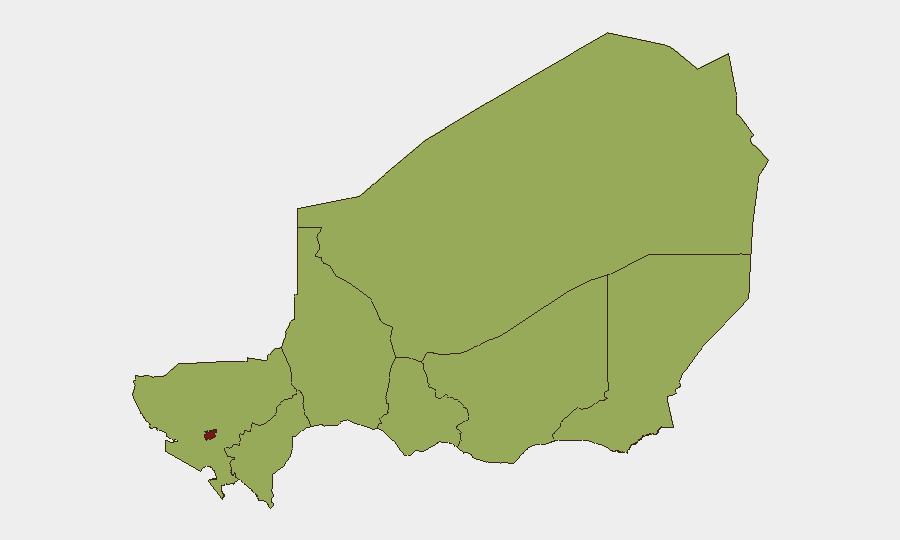
Situation Summary
Niger remains moderately elevated in global threat ranking (#25, composite score 72) with escalating military tensions dominating the current threat picture. Over the past 24 hours, multiple conventional military engagements have been recorded between Niger and Burkina Faso, alongside internal small-arms combat in the capital and reported clashes involving Islamic militant actors. Niamey itself carries significantly elevated risk (80.4) relative to other regions, driven by recent armed activity and apparent state fragility signals.
Key Developments
- 2026-07-05 · Conventional Military Force · Niger–Burkina Faso Border – Multiple reciprocal military engagements recorded between Niger Armed Forces and Burkina Faso forces (4 separate events logged in single 24-hour cycle), indicating active cross-border military operations or escalating border friction.
- 2026-07-04 · Small Arms Combat · Niamey – Armed engagement within the capital, specific location and actors under clarification; consistent with earlier reports of Islamic militant activity in urban areas.
- 2026-07-04 · Conventional Military Force · Islamic Actor vs. Niamey – Reported military-scale activity attributed to Islamic militant faction(s) against Niamey or Niger government forces; context and force scale remain under verification.
- 2026-07-04 · Public Statement · United Nations vs. Niger – UN issued diplomatic statement regarding Niger; content and specific concerns not yet detailed in available feeds.
- 2026-07-04 · Public Statement · United Nations – Separate UN statement on Niger-related matter; potential connection to military escalation or governance issue.
Note: GeoBit's live web research did not corroborate independent confirmation of these events from multiple current-date sources in the last 24–48 hours. Operators should treat event-feed data as preliminary and cross-reference with verified news wire and diplomatic sources before operational decision-making.
Highest-Risk Areas
Niamey dominates the sub-national threat profile (80.4 vs. 50.4 across all other regions), reflecting active armed engagement and apparent capacity constraints in the capital. The northern and eastern regions—Agadez, Diffa, and Tillabéri—all register equal secondary risk (50.4), historically driven by transnational militant presence (AQIM, ISIS-aligned groups) and pastoral conflict. The Burkina Faso border (Tillabéri and Tahoua regions) now carries added military-operational risk given 2026-07-05 cross-border engagements. Maradi and Dosso regions, though scoring 50.4, show relatively lower operational volatility in current event feeds.
How GeoBit Would Assist
Security teams should deploy AOI Monitoring & Early Warning on Niamey (capital), Tillabéri (border friction zone), and Diffa (militant sanctuary risk) with real-time alerting on armed activity. Conflict & Military battle-mapping and force-structure tracking will clarify Niger–Burkina Faso engagement scale and intent over the next 48–72 hours. Network & Actor Analysis focused on Islamic militant cells active in Niamey can improve pre-event visibility. Multi-language OSINT and Telegram/X monitoring should be maintained to separate verified developments from propaganda and rumor.
7-Day Outlook
Cross-border military tension with Burkina Faso is likely to persist or intensify absent immediate diplomatic intervention; Niger's smaller force structure suggests asymmetric tactical vulnerability. Urban security degradation in Niamey may continue if Islamic militant pressure persists. A 7-day window is insufficient for full stabilization; personnel and asset teams should assume elevated operational risk in the capital and border zones through mid-July.
Highest-Risk Areas — Ranked
| # | State / Region | Risk |
|---|---|---|
| 1 | Niamey | 80.4 |
| 2 | Agadez Region | 50.4 |
| 3 | Zinder Region | 50.4 |
| 4 | Diffa Region | 50.4 |
| 5 | Tillabéri Region | 50.4 |
| 6 | Tahoua Region | 50.4 |
| 7 | Dosso Region | 50.4 |
| 8 | Maradi Region | 50.4 |
Sources
Previous Daily Briefs
A new Niger brief is written every day — each with its own risk map and downloadable CSV. Here's the last week; use the calendar to go further back.
📅 Browse every day by calendar →
Highlighted days have a brief. Tap a day for that day's map & analysis, or “csv” for that day's dataset ($5).
Atlas — our AI intelligence desk — emails them this snapshot personally. Nothing else, no list.