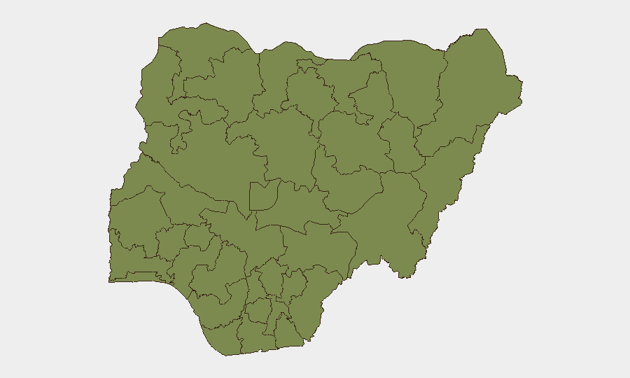
Situation Summary
Nigeria remains at composite threat rank #37 globally with 728 tracked events. Recent signal activity (2–4 July) shows elevated state-actor statements, cross-border military posturing, and unconventional violence incidents, concurrent with confirmed arrests of suspected terrorist operatives. The security environment is characterized by persistent sub-national fragmentation: Lagos dominates the risk index by a factor of 1.7 over the second-ranked state, while northern corridor states (Kaduna, Borno, Sokoto, Zamfara) sustain organized armed-group activity. The immediate trajectory reflects tactical pressure on extremist networks offset by rising inter-state and civil-military tension signals.
Key Developments
- Katsina State, Umaru Musa Yar'Adua International Airport (26 June): Nigerian Interior Ministry announced arrest and DSS handover of seven suspected Boko Haram/ISWAP commanders returning from Hajj pilgrimage, signaling intelligence coordination on returnee vetting.
- Nigeria nationwide (2 July): GeoBit detected signals of military mobilization, arrest/detention events, and cross-border unconventional violence. Specific operational locations not yet corroborated in available 24–48h reporting.
- Nigeria (4 July): Public statements by government actors and cross-border military-force signaling directed toward regional actors. Sentiment analysis indicates heightened official messaging around security posture.
- **Birnin Gwari, Kaduna State (29–30 June, *outside 24–48h window*):** Six school pupils abducted in a rural corridor with endemic bandit presence; noted as part of broader kidnapping trend in Kaduna but outside current reporting window.
- **Mokwa region, Niger State (early July, *timing under review*):** BBC reporting indicates severe flooding with rising fatalities; humanitarian access and security corridor implications for aid operations require validation of current extent.
Note: Supplied open-source coverage does not yet provide granular incident-specific detail for a full 24–48h tactical brief. A more precise daily update would require additional fresh web research or OSINT feed confirmation.
Highest-Risk Areas
Lagos State (31.8) represents over 40% of the composite national risk score, driven by urban crime, financial-sector targeting, and maritime/port vulnerability. Osun, Kaduna, and the Federal Capital Territory form a mid-tier cluster (17.6–18.7) anchored by organized armed-group activity in the north and urban crime in Abuja. Borno State (14.3), despite its historical prominence in counterterrorism operations, ranks sixth—likely reflecting both active Nigerian military presence and persistent but more-dispersed ISWAP/splinter activity. Benue and Delta states (10.4, 8.9) show lower but still significant risk tied to communal conflict and resource-access disputes. The geographic concentration in Lagos and the northern corridor indicates that duty-of-care planning should weight both mega-city crime/fraud exposure and rural/transit-corridor kidnapping and armed-group activity.
How GeoBit Would Assist
Security teams should deploy Intel Sweep and OSINT fusion (X/Telegram feeds, YouTube/podcast monitoring) to track real-time military-posture signaling and extremist-network communications. Area-of-Interest Monitoring & Early Warning on Kaduna, Lagos, and FCT corridors with persistent alerting on armed-group activity, checkpoints, and kidnapping clusters will reduce surprise and enable proactive route/journey planning via Routing & Network Analysis. Sentiment & temporal analysis on government statements and cross-border actor rhetoric provides early indication of escalation in state-level tensions before kinetic incidents.
7-Day Outlook
Expect continued tactical pressure on terrorist cells in the north concurrent with civilian security incidents in Lagos and Kaduna State. Official rhetoric suggests heightened regional military engagement; localized bandit and criminal-group activity will likely persist. Organizations should maintain elevated situational awareness in transit corridors and urban commercial zones and review contingency protocols for sudden movement restrictions or security force operations.
Highest-Risk Areas — Ranked
| # | State / Region | Risk |
|---|---|---|
| 1 | Lagos State | 31.8 |
| 2 | Osun State | 18.7 |
| 3 | Kaduna State | 17.8 |
| 4 | Federal Capital Territory | 17.6 |
| 5 | Ogun State | 14.6 |
| 6 | Borno State | 14.3 |
| 7 | Oyo State | 13 |
| 8 | Benue State | 10.4 |
| 9 | Delta State | 8.9 |
| 10 | Sokoto State | 8.2 |
| 11 | Zamfara State | 6.8 |
| 12 | Nasarawa State | 6.5 |
Sources
Previous Daily Briefs
A new Nigeria brief is written every day — each with its own risk map and downloadable CSV. Here's the last week; use the calendar to go further back.
📅 Browse every day by calendar →
Highlighted days have a brief. Tap a day for that day's map & analysis, or “csv” for that day's dataset ($5).