Situation Summary
South Sudan remains in a state of fragile conflict equilibrium characterized by persistent armed clashes, intercommunal violence, and sporadic airstrikes across multiple states. As of late July 2026, the security environment shows no discrete verified incidents in the past 24–48 hours, but underlying threat levels remain elevated across Upper Nile, Unity, Jonglei, and Equatoria regions. Government travel advisories consistently warn of high kidnapping, armed robbery, and checkpoint harassment risks, with particular concern for cross-border spillover from Sudan and Uganda. The conflict trajectory shows renewed fighting and raised casualty levels in northern and eastern states compared with earlier in the year.
Key Developments
No reliably documented, geographically specific security or conflict incidents have been verified in South Sudan during the past 24–48 hours in available open-source or social-media channels. Recent material in news feeds and X/Twitter consists primarily of situation summaries, historical context, and non-specific advisories rather than discrete, time-stamped events.
Background context (ongoing as of mid-to-late July 2026):
- Upper Nile, Unity, and Jonglei states continue to experience heightened armed clashes and intercommunal cattle-raiding violence, with casualty levels elevated relative to the first half of 2026.
- Eastern and Central Equatoria remain vulnerable to cross-border armed activity and road ambushes linked to tensions in Uganda and Sudan border zones.
- Juba and major arterial roads show persistent patterns of checkpoint extortion, occasional gunfire, and kidnapping attempts targeting both nationals and foreigners.
- Western Bahr el Ghazal and Lakes states report widespread herder-on-herder conflict involving automatic weapons and localized displacement.
Highest-Risk Areas
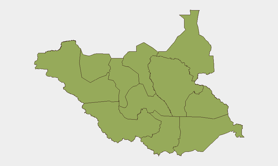
All twelve administrative divisions currently share identical composite risk scores (46.2), reflecting the pervasiveness of armed conflict and intercommunal violence nationwide. Upper Nile, Northern Bahr el Ghazal, Unity, Jonglei, and the Equatoria cluster (Western, Central, Eastern) represent the primary drivers of South Sudan's overall threat ranking, characterized by active armed clashes, airstrikes, border spillover, and cattle-raiding. The parity in sub-national scores indicates that geographic differentiation of risk is currently of limited utility; instead, corporate teams should assume country-level vigilance and apply state-specific intelligence layering—particularly for operations in oil-producing areas (Unity, Upper Nile) and border regions (Eastern Equatoria, Central Equatoria).
How GeoBit Would Assist
Security teams managing personnel or assets in South Sudan should prioritize AOI Monitoring & Early Warning on high-risk states and border zones to detect emerging clashes or displacement; Conflict & Military intelligence (battle mapping and force-structure tracking) to understand armed-group positioning and airfield activity; and Routing & Network Analysis to identify secure alternate routes and journey-planning options given persistent checkpoint and ambush risk on primary roads. Real-time X/Twitter and multi-language OSINT can flag sudden escalations or localized security incidents faster than government advisories, and Satellite & Imagery Analysis provides ground truth on displacement patterns and military activity in remote areas with limited reporting.
7-Day Outlook
No indicators suggest imminent de-escalation; fragile equilibrium is likely to persist through early August with localized flare-ups in contested areas (Jonglei, Unity, Upper Nile). Personnel travel to Juba and inter-state movement should be planned conservatively, with heightened vigilance at checkpoints and during hours of darkness. Monitoring of Sudan border tensions and Uganda-linked activity in Eastern Equatoria remains essential, as cross-border spillover can rapidly impact road and airfield security.
Highest-Risk Areas — Ranked
| # | State / Region | Risk |
|---|---|---|
| 1 | Upper Nile | 46.2 |
| 2 | Northern Bahr el Ghazal | 46.2 |
| 3 | Western Bahr el Ghazal State | 46.2 |
| 4 | Ruweng Administrative Area | 46.2 |
| 5 | Unity | 46.2 |
| 6 | Warrap | 46.2 |
| 7 | Lakes | 46.2 |
| 8 | Jonglei | 46.2 |
| 9 | Greater Pibor Administrative Area | 46.2 |
| 10 | Western Equatoria | 46.2 |
| 11 | Central Equatoria | 46.2 |
| 12 | Eastern Equatoria | 46.2 |
Sources
Previous Daily Briefs
A new South Sudan brief is written every day — each with its own risk map and downloadable CSV. Here's the last week; use the calendar to go further back.
📅 Browse every day by calendar →
Highlighted days have a brief. Tap a day for that day's map & analysis, or “csv” for that day's dataset ($5).
Atlas — our AI intelligence desk — emails them this snapshot personally. Nothing else, no list.