Situation Summary
Central African Republic remains at composite threat level #30 globally with no major tracked security events in the current 24–48-hour window. However, late June escalation in northern CAR—including a coordinated rebel coalition attack on 30 June and MINUSCA casualty evacuation operations continuing into early July—signals sustained conflict activity and elevated instability in the northern corridor toward Bangui. Official denials of coup rumors and regional disinformation campaigns by both CAR's military and Chad's Ministry of Foreign Affairs indicate heightened political sensitivity and information-warfare pressure in the capital and border zones.
Key Developments
- Bangui, 3–4 July 2026: CAR military high command issued public statement denying alleged coup-plot rumors circulating on social media and warning of disinformation campaigns designed to disturb public order; messaging underscores ongoing political-stability concerns in the capital.
- Northern CAR / Chad border, 3–4 July 2026: Chad's Ministry of Foreign Affairs categorically denied accusations (circulating on social networks) of logistical or operational support to CAR armed rebel groups, characterizing allegations as part of a broader disinformation campaign aimed at regional destabilization.
- Am Dafok, Vakaga Prefecture (northeast CAR), 30 June–early July 2026: Armed elements attacked MINUSCA Temporary Operating Base and Zambian peacekeeper patrol, injuring three peacekeepers; Sri Lanka Air Force subsequently conducted emergency casualty evacuation of 14 personnel, indicating sustained security risk in the Sudan border zone.
- Northern CAR corridor, 30 June 2026, with follow-on operations into early July: A new coalition of politico-military groups launched coordinated attack that reportedly caught government off-guard; CAR security forces engaged in active counter-operations against rebel groups attempting advances toward Bangui.
- Nationwide information environment, 3–4 July 2026: Parallel official messaging from CAR and Chad regarding coup rumors and destabilization plots signals active regional information campaigns and elevated public-order sensitivity; implications for travelers and corporate communications around CAR-related online content.
Highest-Risk Areas
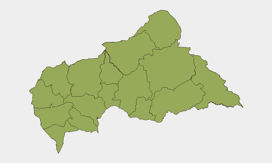
All twelve sub-national provinces are ranked at identical composite risk score (50.1), reflecting CAR's diffuse instability. However, Vakaga, Bamingui-Bangoran, and Haute-Kotto in the far north and northeast—bordering Sudan and Chad—show the most acute current threat from armed-group activity and rebel-coalition operations documented through late June and early July. The northern corridor (Ouham, Ouham-Pendé) represents the primary conflict-activity zone and vector toward the capital. Bangui itself faces heightened political volatility and information-warfare pressure linked to coup rumors, creating secondary risk to business continuity and staff safety.
How GeoBit Would Assist
Security teams operating in CAR should deploy AOI Monitoring & Early Warning on high-risk prefectures (Vakaga, Bamingui-Bangoran, Ouham) to track armed-group movements and attack patterns in real time. Network & Actor Analysis combined with X/Twitter & Telegram OSINT and multi-language search capabilities would enable continuous tracking of disinformation campaigns, coup rumors, and regional propaganda that can rapidly affect threat perception and trigger official crackdowns. Alternative routing and journey planning (Routing & Network Analysis) should be applied to any planned movements in the northern corridor to identify safer transit corridors and contingency evacuation routes around active conflict zones.
7-Day Outlook
Northern CAR conflict activity is likely to remain elevated through mid-July as the rebel coalition consolidates recent gains and government counter-operations continue. Bangui's information environment will remain volatile and politically sensitive; further official denials or crackdowns on social media are probable if coup rumors resurface. No major shift in overall threat level is anticipated without significant escalation in rebel movements toward the capital or a collapse in MINUSCA operational capacity.
Highest-Risk Areas — Ranked
| # | State / Region | Risk |
|---|---|---|
| 1 | Bamingui-Bangoran | 50.1 |
| 2 | Vakaga | 50.1 |
| 3 | Haute-Kotto | 50.1 |
| 4 | Haut-Mbomou | 50.1 |
| 5 | Mbomou | 50.1 |
| 6 | Nana-Mambéré | 50.1 |
| 7 | Ouham-Pendé | 50.1 |
| 8 | Mambéré-Kadéï | 50.1 |
| 9 | Sangha-Mbaéré | 50.1 |
| 10 | Ouham | 50.1 |
| 11 | Nana-Grébizi | 50.1 |
| 12 | Kémo | 50.1 |
Sources
Previous Daily Briefs
A new Central African Republic brief is written every day — each with its own risk map and downloadable CSV. Here's the last week; use the calendar to go further back.
📅 Browse every day by calendar →
Highlighted days have a brief. Tap a day for that day's map & analysis, or “csv” for that day's dataset ($5).
Atlas — our AI intelligence desk — emails them this snapshot personally. Nothing else, no list.