Situation Summary
France faces a dual security challenge as of 27 July 2026: active terrorism investigations in the Paris region and a severe multi-department wildfire crisis in the southwest and south, each generating distinct operational risks. The arrest of six suspects in connection with a planned Islamist attack on a synagogue in Sarcelles (Val-d'Oise) reflects continued domestic extremist activity, while concurrent wildfires have burned approximately 4,600 hectares in the Pyrénées foothills and spread across Pyrénées-Orientales and Hérault, forcing mass evacuations and infrastructure disruption. A record-high heatwave affecting 49 departments at red-alert level (temperatures near 40°C) is amplifying fire risk and straining emergency services. Overall threat trajectory remains moderate but concentrated geographically.
Key Developments
- Sarcelles (Val-d'Oise), 26–27 July 2026: French anti-terrorism prosecutors (PNAT) have six men in custody on suspicion of preparing a terrorist attack targeting a synagogue, following discovery of weapons in a vehicle parked near the synagogue. An anti-terrorism investigating judge is determining charges and detention status; PNAT has requested pre-trial detention for roles in transporting and supplying weapons.
- Paris region, 25–26 July 2026: Interior Ministry and National Anti-Terrorism Prosecutor's Office issued public statements on the Sarcelles investigation, indicating sustained focus on Jewish community security and extremist threat networks in Île-de-France.
- Pyrénées foothills (Pyrénées-Atlantiques/Hautes-Pyrénées), 26–27 July 2026: Wildfires have consumed approximately 4,600 hectares; thousands of residents have been evacuated. Local prefects reported ongoing emergency operations and road closures; authorities characterized the situation as an active "battle" against spreading fires.
- Pyrénées-Orientales and Hérault, 26–27 July 2026: Severe heatwave conditions are accelerating wildfire spread across multiple southern departments. Authorities have imposed fireworks bans and are conducting sustained evacuation operations affecting rural communities and road networks.
- National heatwave alert, 27 July 2026: French authorities placed 49 departments under red-level vigilance—a record since the alert system's establishment—with temperatures approaching 40°C. Conditions increase risk of secondary health emergencies, power grid strain, and outdoor labor disruption.
- Executive crisis response, 27 July 2026: President Macron convened a crisis cabinet meeting in Paris and announced a visit to fire-affected areas in the southwest, signaling national-level coordination of emergency response.
Highest-Risk Areas
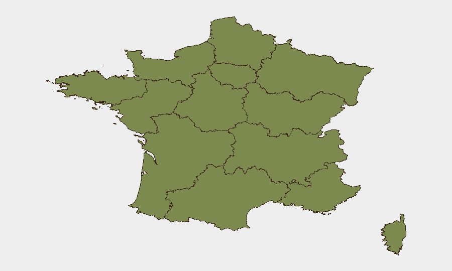
Nouvelle-Aquitaine dominates the sub-national risk ranking (32.7), driven by the active southwest wildfire crisis and associated evacuations and infrastructure strain. Île-de-France (16.9), anchored by Paris and suburbs including Sarcelles, remains elevated due to the ongoing terrorism investigation and persistent extremist recruitment/attack-planning networks in the region. Bourgogne–Franche-Comté (6.5) and Normandy (6.2) are secondary foci; all other regions carry minor scores. Corporate personnel and assets in the Paris region should anticipate heightened police/security operations around Jewish institutions, while those in southwestern departments (Pyrénées-Atlantiques, Hautes-Pyrénées) face imminent travel delays, evacuation protocols, and supply-chain disruption from wildfires.
How GeoBit Would Assist
Security teams should activate AOI Monitoring & Early Warning on Sarcelles, Île-de-France suburbs, and southwestern wildfire zones to track police activity, evacuation orders, and infrastructure status in real time. OSINT Sweep and Telegram/X monitoring can surface emerging extremist rhetoric or coordinated mobilization linked to the Sarcelles case or copycat threats. Routing & Network Analysis enables rapid alternative-route planning for personnel and supply flows around wildfire-affected road networks in Nouvelle-Aquitaine.
7-Day Outlook
The terrorism investigation is likely to remain active through formal charging and bail/detention hearings; additional arrests cannot be ruled out. Wildfire conditions will persist or intensify through early August given sustained heatwave pressure; evacuations may expand. Travel and commercial operations in the southwest should anticipate 10–14 days of significant disruption.
Highest-Risk Areas — Ranked
| # | State / Region | Risk |
|---|---|---|
| 1 | Nouvelle-Aquitaine | 32.7 |
| 2 | Ile-de-France | 16.9 |
| 3 | Bourgogne – Franche-Comté | 6.5 |
| 4 | Normandy | 6.2 |
| 5 | Auvergne-Rhône-Alpes | 4.7 |
| 6 | Provence-Alpes-Côte d'Azur | 4.2 |
| 7 | Hauts-de-France | 3.8 |
| 8 | Grand Est | 3.8 |
| 9 | Occitania | 3 |
| 10 | Brittany | 2.8 |
| 11 | Centre-Val de Loire | 2.7 |
| 12 | Pays de la Loire | 2.7 |
Sources
Previous Daily Briefs
A new France brief is written every day — each with its own risk map and downloadable CSV. Here's the last week; use the calendar to go further back.
📅 Browse every day by calendar →
Highlighted days have a brief. Tap a day for that day's map & analysis, or “csv” for that day's dataset ($5).
Atlas — our AI intelligence desk — emails them this snapshot personally. Nothing else, no list.