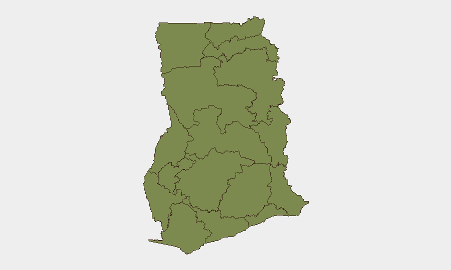
Situation Summary
Ghana remains a stable West African state (global rank #157; composite threat score 5) but faces acute localized security pressures in Greater Accra and Ashanti regions. The past 48 hours have seen escalating violence tied to illegal mining enforcement, a politically sensitive arrest in Accra, and mob-driven fatalities in Kumasi. These developments—while contained geographically—reflect underlying tensions around resource conflict, law-enforcement credibility, and political polarization that warrant active duty-of-care monitoring.
Key Developments
- Obuasi, Ashanti Region (17–18 July): Armed illegal miners clashed with soldiers at the AngloGold Ashanti mine, resulting in approximately eight fatalities, multiple injuries, four vehicles burned, and follow-on vandalism and tire-burning by local residents.
- Obuasi, Ashanti Region (18–19 July): Post-clash unrest persisted; President Mahama ordered an immediate probe and directed security agencies to prevent recurrence, signaling political attention but also sustained volatility.
- Kumasi / Sabon Zongo, Ashanti Region (19 July): A man, Yusuf Zakari, was attacked at a cattle kraal and died from injuries; police arrested suspects in connection with the mob killing.
- Kumasi, Ashanti Region (21 July): Ghana Police arrested and arraigned three suspects in the Sabon Zongo fatality, indicating active law-enforcement response but also ongoing community tension.
- Accra, Greater Accra Region (mid-July): EOCO arrested opposition NPP communications officer Denis "Aboagye" over undisclosed charges; the arrest raised political tension and protest risk in the capital.
- Greater Accra Region (last 48 hours as of 19 July): Multiple law-enforcement escalations and political tensions documented across the capital region, confirming Accra as the country's primary current risk center.
- Eastern Region (last 48 hours as of 19 July): Armed clashes between galamsey (illegal) miners and security forces reported, with fatalities, property damage, and localized instability continuing.
Highest-Risk Areas
Greater Accra Region (risk 32) dominates the national threat profile due to concentrated political activity, law-enforcement actions, and the capital's role as a flashpoint for opposition mobilization and civil unrest. Bono East Region (risk 11) and Ashanti Region (risk 7) follow, driven primarily by armed illegal mining conflicts—clashes between galamsey operators and soldiers that have produced multiple fatalities and property destruction in the past 48 hours. Eastern Region, though not in the top three, is also active on illegal mining violence. The remaining regions carry minimal risk; Upper West, Savannah, North East, and Oti remain below risk 3.
How GeoBit Would Assist
Security teams managing personnel or assets in Ghana should employ AOI Monitoring & Early Warning on Greater Accra, Ashanti, and Eastern regions to track protest activity, law-enforcement operations, and mining-related flashpoints in near-real time. OSINT Fusion & Corroboration (X/Twitter, Telegram, YouTube, multi-language search) will provide early signals of political mobilization or community violence before localized escalation. Routing & Network Analysis can identify safe corridors for staff movement in Accra and mining zones, while Conflict & Military tracking will monitor security-force deployments and illegal-mining group activity to inform duty-of-care decisions.
7-Day Outlook
The illegal mining conflict in Ashanti and Eastern regions is likely to persist absent swift de-escalation; security-force operations may intensify, raising the risk of further clashes and fatalities. Political tension in Accra, driven by the recent arrest and broader opposition sentiment, carries moderate protest risk over the next week. Overall national stability remains intact, but localized volatility in Ashanti and Accra warrants heightened vigilance for corporate operations and expatriate staff in those zones.
Highest-Risk Areas — Ranked
| # | State / Region | Risk |
|---|---|---|
| 1 | Greater Accra Region | 32 |
| 2 | Bono East Region | 11 |
| 3 | Ashanti Region | 7 |
| 4 | Upper East Region | 5 |
| 5 | Volta Region | 5 |
| 6 | Bono Region | 4 |
| 7 | Northern Region | 3 |
| 8 | Upper West Region | 2 |
| 9 | Savannah Region | 2 |
| 10 | North East Region | 2 |
| 11 | Eastern Region | 2 |
| 12 | Oti Region | 2 |
Sources
Previous Daily Briefs
A new Ghana brief is written every day — each with its own risk map and downloadable CSV. Here's the last week; use the calendar to go further back.
📅 Browse every day by calendar →
Highlighted days have a brief. Tap a day for that day's map & analysis, or “csv” for that day's dataset ($5).
Atlas — our AI intelligence desk — emails them this snapshot personally. Nothing else, no list.