Situation Summary
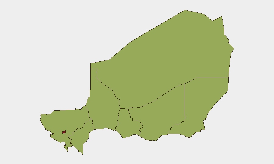
Niger remains a fragmented security environment with composite threat ranking #23 globally (score 75/100) driven by a convergence of armed-group activity, state fragility, and escalating cross-border military tensions. The capital, Niamey, accounts for the majority of recent threat signals and carries the highest sub-national risk score (82.8), reflecting concentration of both conventional military activity and small-arms incidents. Event clustering over 2–5 July indicates active military operations involving Niger's armed forces, Islamic militant actors, and Burkina Faso forces, with UN engagement suggesting diplomatic pressure and potential humanitarian or political fallout. The trajectory suggests continued instability through the near term, with particular risk in Niamey and the northern/eastern regions.
Key Developments
- 2026-07-05, Niamey Region: Multiple conventional military clashes reported between Niger and Burkina Faso forces (at least three engagements logged 2026-07-05), indicating cross-border incursion or sustained tactical operations rather than isolated incident.
- 2026-07-04, Niamey: Small-arms combat incident recorded; context and combatant identity under clarification but consistent with urban armed-group or factional activity near seat of government.
- 2026-07-04, Niamey: Conventional military force engagement logged involving Islamic armed actors and Niamey-based forces, suggesting active militant operations in or near capital.
- 2026-07-04, Multi-lateral: UN public statements issued regarding Niger (context: likely referencing military escalation, humanitarian impact, or political crisis); formal international engagement underway.
- 2026-07-06, Niger: Government public statement released (content/substance pending clarification); timing suggests official response to preceding 48–72 hour developments.
Note: Detailed incident sourcing and location specificity remain constrained by open-source gaps (see research note, above). Security teams with on-ground presence should cross-validate with embassy, NGO, and local-source reporting.
Highest-Risk Areas
Niamey dominates the threat landscape with a composite risk score of 82.8—nearly 30 points above all other regions—driven by concentration of military activity, small-arms incidents, and state-actor presence. The seven peripheral regions (Agadez, Zinder, Diffa, Tillabéri, Tahoua, Dosso, Maradi) cluster at risk scores of 52.8–53.9, reflecting endemic armed-group presence, jihadist activity, and ungoverned-space dynamics characteristic of the Sahel, but with significantly lower immediate event density than the capital. The Niamey spike appears to reflect acute escalation (military clashes, UN engagement) rather than chronic instability; peripheral regions represent persistent, lower-frequency but dispersed threats. Corporate assets and personnel in Niamey face elevated immediate risk; operations in Agadez and Diffa carry long-term kidnap, militant, and trafficking risks.
How GeoBit Would Assist
Security teams should employ AOI Monitoring & Early Warning configured on Niamey and cross-border zones to detect tactical military movement and armed-group activity in near-real time. Intel Sweep and conflict-focused search capabilities will surface official statements, military announcements, and cross-border incident reporting to fill gaps in open-source incident detail and clarify actors/motives. Network & Actor Analysis can map militant and state-force relationships to predict escalation vectors and sanctuary shifts, especially given Burkina Faso involvement.
7-Day Outlook
Cross-border military tension with Burkina Faso is likely to persist or escalate absent rapid diplomatic de-escalation; Niamey will remain the primary friction point. Armed-group activity in peripheral regions is unlikely to spike significantly but will continue to constrain freedom of movement and increase kidnap/ambush risk for mobile teams. UN and diplomatic engagement may accelerate in coming days, potentially triggering curfews, checkpoints, or evacuations in the capital.
Highest-Risk Areas — Ranked
| # | State / Region | Risk |
|---|---|---|
| 1 | Niamey | 82.8 |
| 2 | Agadez Region | 53.9 |
| 3 | Zinder Region | 52.8 |
| 4 | Diffa Region | 52.8 |
| 5 | Tillabéri Region | 52.8 |
| 6 | Tahoua Region | 52.8 |
| 7 | Dosso Region | 52.8 |
| 8 | Maradi Region | 52.8 |
Sources
Previous Daily Briefs
A new Niger brief is written every day — each with its own risk map and downloadable CSV. Here's the last week; use the calendar to go further back.
📅 Browse every day by calendar →
Highlighted days have a brief. Tap a day for that day's map & analysis, or “csv” for that day's dataset ($5).
Atlas — our AI intelligence desk — emails them this snapshot personally. Nothing else, no list.