Situation Summary
The United Arab Emirates faces an active and escalating regional military threat environment following a sustained Iranian missile and drone campaign over the past 48 hours. At least 52 airborne threats (17 missiles, 35 drones) have targeted UAE territory, with UAE air defenses achieving significant intercept rates but unable to prevent all debris-related civilian and industrial casualties. Civilian impact incidents—including deaths and injuries across multiple emirates and damage to critical petroleum and industrial infrastructure—signal a shift toward higher collateral-risk exposure despite successful air defense engagement.
Key Developments
- Abu Dhabi (Habshan gas complex), July 14: Debris from intercepted Iranian missiles and drones struck the Habshan gas facility, injuring three workers and causing limited damage to non-critical infrastructure within a larger 48-hour barrage.
- Abu Dhabi (residential), July 14: Iranian missile or intercepted-missile debris killed one Palestinian national in a civilian vehicle in an Abu Dhabi residential area, marking a direct civilian casualty from the ongoing campaign.
- Southern Dubai (residential neighborhoods), July 14: Falling debris from UAE air-defense intercepts of Iranian UAVs over Dubai injured four civilians (Indian, Bangladeshi, Sri Lankan nationals) in residential areas; authorities confirmed no direct hits on critical infrastructure.
- Jebel Ali petroleum facility (Dubai area), July 14: An Iranian drone evaded interception and struck a petroleum industrial site tied to alternative UAE oil export routes, causing a major fire and injuring three Indian nationals with moderate burns and blast injuries.
- Emirates Global Aluminium (EGA) industrial complex, Abu Dhabi/Dubai corridor, July 14: Iranian strikes and interception debris caused significant damage to EGA facilities, prompting emergency closure and resulting in 12 injured workers (primarily Nepali and Indian nationals).
- Strait of Hormuz (Al Bahiyah & Mombasa tankers), early July 14: Two ADNOC crude tankers transiting Omani waters were struck by Iranian cruise missiles, killing one Indian crew member and injuring eight others (six Indian, two Ukrainian); fires on both vessels were later controlled.
- U.S. Embassy Advisory, Abu Dhabi & Dubai, July 13–15: The U.S. Embassy canceled all consular appointments and ordered non-emergency U.S. government personnel to depart the UAE due to regional missile and drone threats.
Highest-Risk Areas
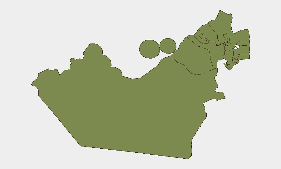
Dubai (risk 31.5) and Abu Dhabi Emirate (risk 26.8) account for the vast majority of tracked threat events and incident concentration. Both emirates host critical petroleum infrastructure, busy international shipping lanes, densely populated residential and commercial zones, and major expatriate workforces—creating overlapping exposure to direct strikes, interception debris, and secondary fires. The remaining northern emirates (Sharjah, Ajman, Ras al-Khaimah, Fujairah, Umm al-Quwain) register minimal current risk, suggesting that threat concentration remains centered on the two largest economic and population centers.
How GeoBit Would Assist
Security teams should deploy AOI Monitoring & Early Warning on high-risk facilities (petroleum, aluminium, ports, residential clusters) in Dubai and Abu Dhabi to detect incoming threats and debris impact in near-real time. Conflict & Military battle mapping and Maritime & Aviation tracking capabilities enable tracking of missile/drone signatures, interception patterns, and maritime chokepoint activity (Strait of Hormuz). Intelligence & OSINT fusion (including X/Telegram conflict monitoring, YouTube mapping content, and regional media aggregation) provides continuous signal corroboration and early indicators of campaign intensity or targeting shifts.
7-Day Outlook
The Iranian campaign appears sustained rather than a single strike event; debris-impact incidents will likely persist as long as air-defense engagement continues. Risk of secondary escalation (retaliatory strikes, maritime interdiction, industrial sabotage) remains elevated. Expatriate workforce safety, supply-chain continuity, and insurance/liability exposure should be prioritized in operational planning through at least mid-week.
Highest-Risk Areas — Ranked
| # | State / Region | Risk |
|---|---|---|
| 1 | Dubai | 31.5 |
| 2 | Abu Dhabi Emirate | 26.8 |
| 3 | Sharjah Emirate | 1.5 |
| 4 | Ajman Emirate | 1.5 |
| 5 | Ras al-Khaimah | 1.5 |
| 6 | Fujairah Emirate | 1.5 |
| 7 | Umm al-Quwain | 1.5 |
Sources
Previous Daily Briefs
A new United Arab Emirates brief is written every day — each with its own risk map and downloadable CSV. Here's the last week; use the calendar to go further back.
📅 Browse every day by calendar →
Highlighted days have a brief. Tap a day for that day's map & analysis, or “csv” for that day's dataset ($5).
Atlas — our AI intelligence desk — emails them this snapshot personally. Nothing else, no list.