Situation Summary
Central African Republic remains classified as a moderate global security concern (rank #29, composite threat score 75), with uniformly elevated risk across all twelve provinces. No discrete security incidents have been recorded in the current 24–48-hour reporting window. The security environment is characterized by diffuse, endemic risks rather than acute crisis dynamics; baseline instability persists across the periphery and border regions, sustained by longstanding governance fragmentation and armed-group presence.
Key Developments
No corroborated security events have been identified in Central African Republic during the last 24–48 hours. Available open-source reporting from the immediate window does not contain verified incident data, location specifics, or dated event confirmations for CAR. Duty-of-care teams should note that absence of reported events does not indicate absence of underlying threat; rather, reporting lag and information density in CAR are characteristically low. GeoBit recommends engagement of persistent AOI monitoring and early-warning feeds for real-time signal capture in priority locations.
Highest-Risk Areas
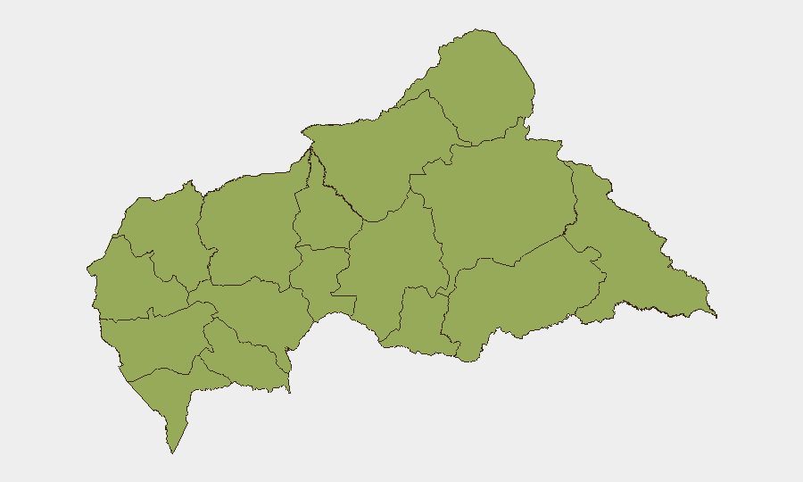
All twelve provinces carry identical composite risk scores (52.5), reflecting systemic, nationwide vulnerability rather than localized hotspots. The ranking includes frontier and eastern zones—Vakaga, Bamingui-Bangoran, Haut-Mbomou, and Mbomou—where armed groups, informal governance, and cross-border movement are most pronounced. Western and central provinces (Nana-Mambéré, Ouham-Pendé, Mambéré-Kadéï, Ouham, Kémo) present parallel structural vulnerabilities: limited state authority, informal economy dominance, and porous borders with Cameroon and Chad. Sangha-Mbaéré and Haute-Kotto remain geographically remote and administratively marginal, limiting both oversight and rapid response capacity. Organizations with dispersed operations or supply routes across CAR should treat the entire country as requiring equivalent vigilance.
How GeoBit Would Assist
Security teams monitoring CAR should prioritize persistent AOI (Area-of-Interest) monitoring and early-warning alerts on provincial hubs, border crossings, and key transit corridors to detect emerging incidents before traditional reporting surfaces. Multi-language OSINT fusion—combining X/Twitter, local radio SIGINT, Telegram networks, and YouTube content—will capture early signals missed by formal news cycles. Network and actor analysis, coupled with entity extraction and sentiment analysis, enables tracking of armed-group messaging, checkpoint activity, and administrative stability shifts that precede broader security deterioration. For teams with mobile assets or personnel, routing and network analysis capabilities support dynamic alternative-route planning around emerging constraints.
7-Day Outlook
The near-term trajectory suggests continued baseline instability without acute escalation. Monitor for secondary effects of rainy-season logistics disruption, border tension spillover from Chad and Cameroon, and informal-economy friction around taxation and supply-route control. Escalation triggers remain diffuse and localized; corporate security posture should emphasize persistent monitoring, flexible contingency planning, and early-warning activation rather than imminent-threat response. Engagement with persistent AOI monitoring will provide earliest notice of material changes in this environment.
Highest-Risk Areas — Ranked
| # | State / Region | Risk |
|---|---|---|
| 1 | Bamingui-Bangoran | 52.5 |
| 2 | Vakaga | 52.5 |
| 3 | Haute-Kotto | 52.5 |
| 4 | Haut-Mbomou | 52.5 |
| 5 | Mbomou | 52.5 |
| 6 | Nana-Mambéré | 52.5 |
| 7 | Ouham-Pendé | 52.5 |
| 8 | Mambéré-Kadéï | 52.5 |
| 9 | Sangha-Mbaéré | 52.5 |
| 10 | Ouham | 52.5 |
| 11 | Nana-Grébizi | 52.5 |
| 12 | Kémo | 52.5 |
Sources
Previous Daily Briefs
A new Central African Republic brief is written every day — each with its own risk map and downloadable CSV. Here's the last week; use the calendar to go further back.
📅 Browse every day by calendar →
Highlighted days have a brief. Tap a day for that day's map & analysis, or “csv” for that day's dataset ($5).
Atlas — our AI intelligence desk — emails them this snapshot personally. Nothing else, no list.