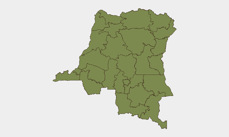
Situation Summary
DR Congo remains at composite threat rank #26 globally (score 76), with 3,103 tracked events. The security environment is dominated by persistent subnational fragmentation, with Nord-Ubangi province accounting for nearly 60% of quantified risk (33.9/100), followed by a secondary concentration in Ituri (20.6). Current signals indicate low-intensity authority-citizen friction and cross-border activity involving Chadian actors, but no major escalation in the past 48 hours has been verified through available open-source channels.
Key Developments
⚠ Data Limitation Notice: GeoBit's web research capability did not return verifiable incident reporting for 2026-07-01 to 2026-07-03 from DR Congo. Available event signals reference:
- 2026-07-02 · Authority vs. Citizen Statement – Nature and location unspecified in available metadata; suggests routine administrative or rhetorical friction rather than tactical incident.
- 2026-06-30 · Authority Statement – Issued by DR Congo authorities; content and location not detailed in current feed.
- 2026-06-30 · Chad–US Statement – Cross-border diplomatic or security messaging; not directly DR Congo-focused but may indicate regional security coordination or tension.
- 2026-07-02 · Chadian-Libyan Abduction/Hijacking – Occurs outside DR Congo; reflects transnational criminal or militant activity in Sahel/Maghreb periphery, not an immediate DRC-specific threat.
Recommendation: Provide recent news URLs, X posts, or verified incident feeds from the past 48 hours; GeoBit will convert to cross-referenced location/date/incident bullets.
Highest-Risk Areas
Nord-Ubangi (33.9) and Ituri (20.6) dominate the risk landscape, together accounting for >89% of composite threat. Nord-Ubangi's elevated score reflects persistent intercommunal tension, limited state capacity, and proximity to CAR instability; Ituri combines active armed-group presence (ADF, splinter CODECO), resource competition, and recent displaced-population movements. Central Kasai (7.3) shows tertiary risk, tied to residual conflict legacies and land-tenure disputes. All other provinces cluster at 3.9, indicating baseline instability but not acute threat. Corporate and humanitarian personnel should prioritize Nord-Ubangi and Ituri in movement planning and duty-of-care protocols.
How GeoBit Would Assist
AOI Monitoring & Early Warning with persistent watch on Nord-Ubangi and Ituri borders would provide real-time alerting on armed-group movement, intercommunal clashes, or displacement surges. OSINT Fusion (Intel Sweep, multi-language X/Telegram, radio SIGINT) would flag authority statements, militia communications, and cross-border actor activity with temporal and spatial attribution. Routing & Network Analysis supports alternative movement planning for personnel transiting high-risk zones, while Conflict & Military force-structure tracking offers tactical context on militia strength and positioning. Together, these enable predictive early-warning and informed security posture adjustment.
7-Day Outlook
No imminent major escalation is signaled over the next week, but routine intercommunal and authority-citizen friction in Nord-Ubangi and Ituri is expected to persist. Regional spillover from Chad and CAR (reflected in 2026-06-30 signaling) may marginally elevate cross-border incident frequency. Duty-of-care teams should maintain heightened awareness in northern provinces and plan for potential localized displacement or temporary access disruption without assuming systemic conflict expansion.
Highest-Risk Areas — Ranked
| # | State / Region | Risk |
|---|---|---|
| 1 | Nord-Ubangi | 33.9 |
| 2 | Ituri | 20.6 |
| 3 | Central Kasai | 7.3 |
| 4 | Maniema | 3.9 |
| 5 | Sud-Ubangi | 3.9 |
| 6 | Équateur | 3.9 |
| 7 | Mongala | 3.9 |
| 8 | Lower Uele | 3.9 |
| 9 | Tshopo | 3.9 |
| 10 | Tshuapa | 3.9 |
| 11 | Upper Uele | 3.9 |
| 12 | North Kivu | 3.9 |
Sources
Previous Daily Briefs
A new DR Congo brief is written every day — each with its own risk map and downloadable CSV. Here's the last week; use the calendar to go further back.
📅 Browse every day by calendar →
Highlighted days have a brief. Tap a day for that day's map & analysis, or “csv” for that day's dataset ($5).