Situation Summary
France remains a moderate-threat environment (composite score 12, rank #99 globally) but faces a convergence of acute near-term stressors: active wildfires in the southwest driven by the third heatwave since May, a suspected terrorist plot disruption in the Paris metropolitan area, and unusual civil-military tensions flagged in the event stream. Overall stability is intact, but operational disruptions and resource strain are measurable across emergency services and critical infrastructure.
Key Developments
- Southwest France (Pyrénées-Orientales / Hérault), 25–26 July 2026 — Wildfires escalated during an early heatwave, prompting military intervention (cargo aircraft deploying flame retardants) and evacuation of civilian populations. Emergency services were redeployed from other priorities, including security event coverage.
- Sarcelles, Val-d'Oise (greater Paris), 25–26 July 2026 — French authorities arrested six individuals suspected of planning a terrorist attack targeting a synagogue. The arrest followed a suspicious-vehicle incident detected on 12 July near the same site and a subsequent investigation.
- France nationwide, 28 July 2026 — Major food-delivery platforms (Uber Eats, Deliveroo) announced mandatory work breaks for delivery cyclists during peak heat hours; temperatures reached 40°C in multiple regions. This signals operational strain on supply-chain and last-mile logistics.
- US–France diplomatic tension, 28 July 2026 — An event signal indicates reduced relations between the United States and France; context and specifics remain under verification.
- Spain–France military activity, 27 July 2026 — Bilateral conventional military force signals logged; operational context and scale remain unconfirmed pending analysis.
- Domestic civil-military friction, 27 July 2026 — Event signals indicate military mobilization, firefighter deployment, and reduced relations with authorities. Signals suggest coordination strain or resource competition, likely linked to wildfire response.
Highest-Risk Areas
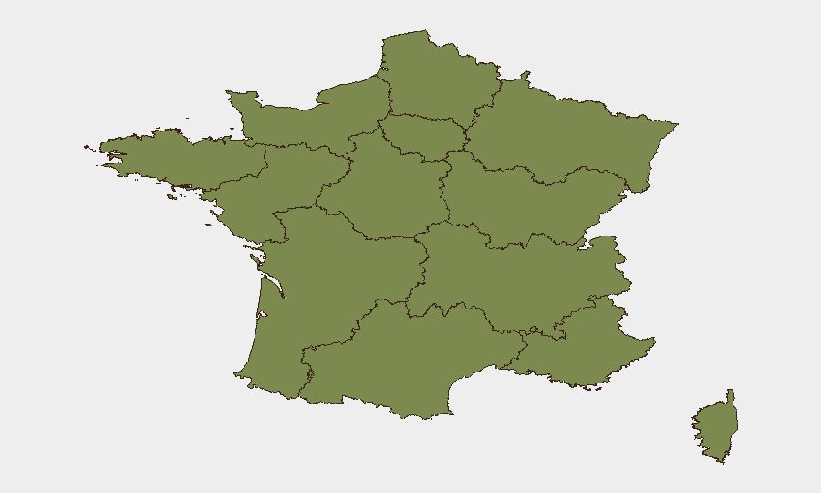
Nouvelle-Aquitaine (score 32.2) and Île-de-France (19.8) dominate the sub-national ranking and account for the majority of tracked risk events. Nouvelle-Aquitaine's elevated score reflects the active southwest wildfire threat and associated resource constraints; Île-de-France concentration reflects the Paris metropolitan area's density, the recent terrorism disruption in Val-d'Oise, and routine civil-disorder and protest activity in and around the capital. The remaining ten regions show markedly lower composite scores (≤6.3), indicating risk is geographically concentrated rather than dispersed.
How GeoBit Would Assist
Security teams with personnel or assets in France should deploy AOI Monitoring & Early Warning on high-risk regions (Nouvelle-Aquitaine, Île-de-France, Bourgogne–Franche-Comté) to track wildfire spread, security incidents, and infrastructure disruption in real time. Intel Sweep and multi-language OSINT (X/Twitter, Telegram, radio SIGINT) provide continuous signal capture on emerging tensions, extremist planning, and civil-military friction. GIS & Spatial Analysis coupled with Routing & Network Analysis enable dynamic assessment of evacuation corridors, supply-chain detours, and safe zones as heat and fire conditions evolve.
7-Day Outlook
The heatwave is forecast to persist through early August, sustaining wildfire and logistics risk in the southwest and nationwide. Terrorism threat level in Île-de-France remains elevated pending completion of the Sarcelles investigation. Diplomatic and military signals with the US and Spain require monitoring; if escalation occurs, France may impose additional mobilization or border controls, affecting corporate travel and supply routes.
Highest-Risk Areas — Ranked
| # | State / Region | Risk |
|---|---|---|
| 1 | Nouvelle-Aquitaine | 32.2 |
| 2 | Ile-de-France | 19.8 |
| 3 | Bourgogne – Franche-Comté | 6.3 |
| 4 | Normandy | 4.9 |
| 5 | Provence-Alpes-Côte d'Azur | 3.3 |
| 6 | Centre-Val de Loire | 3.2 |
| 7 | Grand Est | 3.1 |
| 8 | Auvergne-Rhône-Alpes | 3.1 |
| 9 | Pays de la Loire | 2.4 |
| 10 | Brittany | 2.3 |
| 11 | Occitania | 2.3 |
| 12 | Hauts-de-France | 2.2 |
Sources
Previous Daily Briefs
A new France brief is written every day — each with its own risk map and downloadable CSV. Here's the last week; use the calendar to go further back.
📅 Browse every day by calendar →
Highlighted days have a brief. Tap a day for that day's map & analysis, or “csv” for that day's dataset ($5).
Atlas — our AI intelligence desk — emails them this snapshot personally. Nothing else, no list.