Situation Summary
Ireland's overall security environment remains low-risk (composite threat score 37/global ranking #null) with routine law-enforcement activity dominating the threat landscape. The most recent 24–48-hour period shows localised public-order incidents in Dublin and North Belfast, minor regulatory changes to urban mobility (e-scooter controls), and ongoing targeted policing operations against street-level crime and anti-social behaviour. No nationwide security escalation, conflict activity, or travel warnings have been issued; standard duty-of-care precautions remain appropriate for corporate operations and personnel.
Key Developments
- Skerries, Co. Dublin (18 July, update 20 July): An Garda Síochána issued an official update on a public-order incident on Harbour Road involving disorder and arrests; investigation remains open with potential impacts on local movement and perceived safety in this coastal area.
- Dublin north inner city (mid-July, reported 20 July): Gardaí conducted targeted patrols following community complaints, resulting in arrests, drug seizures, and confiscation of e-scooters; reflects ongoing enforcement against street-level crime and anti-social behaviour.
- Duncairn Parade, North Belfast, Northern Ireland (20 July): Police arrested three men (30s–40s) on suspicion of attempted murder following a serious assault on Monday; remains under investigation.
- National e-scooter regulation change (20 July): Authorities raised the minimum age to 18 and delayed a possible full ban in response to public-safety and criminal-activity concerns linked to e-scooter misuse in urban areas, particularly Dublin.
- Official travel advisory status (checked within 24–48h): Australia's Smartraveller and peer advisories maintain "exercise normal safety precautions" guidance for Ireland; no new nationwide security or conflict-related escalation noted.
Highest-Risk Areas
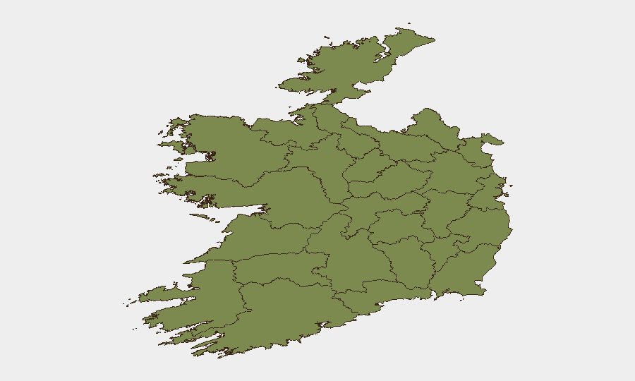
County Tipperary (risk 31.3) and County Dublin (risk 27.7) drive the national composite score, with all other counties below 3.0. Dublin's elevated risk reflects high population density, concentrated street-level crime, and ongoing public-order incidents (Skerries, north inner city); Tipperary's risk profile warrants further event-level breakdown to determine whether it reflects isolated incidents or a trend. The sharp drop-off below Dublin suggests risk is heavily concentrated in one metropolitan region; corporate teams with assets or personnel in Dublin should prioritise routine monitoring of local law-enforcement updates and community safety reports, while Tipperary operations merit specific event review.
How GeoBit Would Assist
Security and risk teams would deploy AOI Monitoring & Early Warning (persistent area-of-interest watch on Dublin, Tipperary, and other high-footprint corporate locations) coupled with Intel Sweep and OSINT fusion (tracking Garda statements, local incident feeds, and social-media sentiment around public-order flashpoints) to receive real-time alerting on incidents affecting personnel or asset security. Risk & Threat Assessment and Routing & Network Analysis would enable rapid identification of safe travel corridors and alternative journey planning in Dublin during periods of elevated street-level enforcement activity. Temporal and sentiment analysis of open-source signals would also flag emerging anti-social behaviour trends or regulatory changes (e.g., e-scooter bans) that affect corporate operations and mobility.
7-Day Outlook
No significant escalation is forecast. Routine law-enforcement activity, focused on public order and street-level crime, will likely persist in Dublin's north inner city and coastal areas; regulatory enforcement (e-scooter controls) will continue. Corporate duty-of-care teams should maintain baseline monitoring for updates to the Skerries and North Belfast investigations, but no travel restrictions or nationwide alerts are anticipated.
Highest-Risk Areas — Ranked
| # | State / Region | Risk |
|---|---|---|
| 1 | County Tipperary | 31.3 |
| 2 | County Dublin | 27.7 |
| 3 | County Kerry | 2.9 |
| 4 | County Mayo | 1.3 |
| 5 | County Sligo | 1.3 |
| 6 | County Galway | 1.3 |
| 7 | County Clare | 1.3 |
| 8 | County Limerick | 1.3 |
| 9 | County Donegal | 1.3 |
| 10 | County Leitrim | 1.3 |
| 11 | County Roscommon | 1.3 |
| 12 | County Cavan | 1.3 |
Sources
Previous Daily Briefs
A new Ireland brief is written every day — each with its own risk map and downloadable CSV. Here's the last week; use the calendar to go further back.
📅 Browse every day by calendar →
Highlighted days have a brief. Tap a day for that day's map & analysis, or “csv” for that day's dataset ($5).
Atlas — our AI intelligence desk — emails them this snapshot personally. Nothing else, no list.