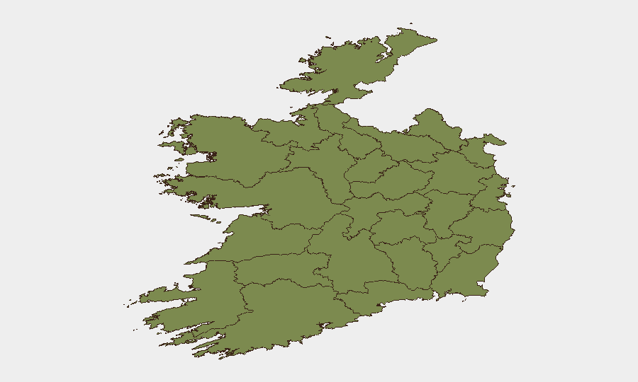
Situation Summary
Ireland remains a low-threat environment globally (rank #108), but localized public-order and violent-crime activity—concentrated in County Dublin—presents material operational risk for personnel and assets in urban centres. The past 48 hours have seen continued Garda enforcement against dangerous driving, youth disorder, and group violence, alongside notable criminal convictions. The threat trajectory is stable but requires geographic precision: Dublin accounts for 79% of tracked risk events, while most other counties register minimal incident density.
Key Developments
- Dublin City Centre, 22 July 2026 – Garda Síochána deployed a new aerial surveillance unit (drone-based) to enforce against dangerous driving and vehicle-crime activity involving scramblers, e-scooters, and e-bikes. Operations are ongoing and reflect expanded urban monitoring capability.
- Skerries, County Dublin, 18–22 July 2026 – Follow-up arrests and charges continue following a serious public-order incident (18 July) in which a vehicle was driven at a crowd during a faction-linked group fight, injuring three teenagers. At least one man in his 20s has been charged; additional suspects remain under investigation.
- Finglas, Dublin, 22 July 2026 – A 31-year-old man (Boyd) was convicted of murder in a stabbing case (Mark Carroll), described as a determined attack following a domestic row. Conviction coverage in local media underscores ongoing violent-crime adjudication in Dublin courts.
- National, 22 July 2026 – Garda Síochána reissued public communications emphasizing emergency reporting (999/112) and anonymous crime reporting (Garda Confidential 1800 666 111) as part of sustained public-safety operations.
Highest-Risk Areas
County Dublin is by a substantial margin the primary risk driver (composite score 31.4, representing 76% of national tracked risk). This is attributable to youth disorder, group violence, vehicle-crime activity, and criminal investigations concentrated in the greater Dublin area—particularly in peripheral suburbs and harbour districts (Skerries, Finglas). County Waterford registers the second-highest score (17.8) but remains significantly lower in absolute terms. All other counties score below 3.5 and reflect minimal operational risk. For duty-of-care and asset-protection purposes, Dublin City Centre and suburban districts warrant elevated awareness; non-Dublin regions carry baseline national-average risk.
How GeoBit Would Assist
Intel Sweep and OSINT Fusion across Irish news, Garda communications, and social platforms enable real-time identification of emerging public-order incidents, arrests, and court activity—allowing security teams to correlate operational activity with personnel location. AOI Monitoring & Early Warning pinpointed to Dublin suburbs (Skerries, Finglas, Finglas periphery) and city-centre districts would provide persistent alerting on group violence, vehicle-crime clusters, and Garda enforcement operations that could affect commute routes or office access. Routing & Network Analysis helps security teams plan alternative transport corridors and emergency egress during active incidents, reducing exposure to localized disorder.
7-Day Outlook
Public-order activity and youth gang involvement are expected to remain concentrated in Dublin, with Garda enforcement—including aerial surveillance—likely to intensify. No significant escalation is anticipated at the national level. Security teams should maintain heightened awareness of Dublin suburban incidents, particularly evening/weekend group gatherings, and monitor court dockets for related case developments that may trigger secondary disorder.
Highest-Risk Areas — Ranked
| # | State / Region | Risk |
|---|---|---|
| 1 | County Dublin | 31.4 |
| 2 | County Waterford | 17.8 |
| 3 | County Kerry | 3.5 |
| 4 | County Cork | 2.8 |
| 5 | County Clare | 2.1 |
| 6 | County Mayo | 1.4 |
| 7 | County Sligo | 1.4 |
| 8 | County Galway | 1.4 |
| 9 | County Limerick | 1.4 |
| 10 | County Donegal | 1.4 |
| 11 | County Leitrim | 1.4 |
| 12 | County Roscommon | 1.4 |
Sources
Previous Daily Briefs
A new Ireland brief is written every day — each with its own risk map and downloadable CSV. Here's the last week; use the calendar to go further back.
📅 Browse every day by calendar →
Highlighted days have a brief. Tap a day for that day's map & analysis, or “csv” for that day's dataset ($5).
Atlas — our AI intelligence desk — emails them this snapshot personally. Nothing else, no list.