Situation Summary
Nepal remains a low-threat environment globally (composite score 10/100) but faces concentrated risk in the Bagamati Province, which encompasses Kathmandu Valley and surrounding districts. Over the past 24–48 hours, law-enforcement activity has intensified significantly—with 169 arrests in Kathmandu Valley alone, concurrent traffic enforcement against 400+ individuals, and specialized operations (fugitive sweeps, drone surveillance) in border-proximate districts. Underlying volatility is driven by recent political and administrative statements (presidential, ministerial, and judicial actions on 24–26 July) and localized tensions (village-government disputes, inter-communal statements), with road safety and organized crime (narcotics trafficking) adding operational friction.
Key Developments
- Kathmandu Valley, past 24 hours: Valley Police arrested 169 individuals (156 from Kathmandu proper) and apprehended 26 fugitives; traffic police simultaneously fined 2,550 vehicles and enforced actions against 400+ for speeding, drunk driving, and safety violations. This indicates sustained, intensive policing that will increase stop-and-search encounters and travel delays across the Valley.
- Nationwide, past 24 hours: Nepal Police reported seven fatalities and 105 injured in road-traffic accidents during the latest 24-hour cycle, reflecting elevated monsoon-period road risk across all major routes.
- Dhankuta District, Koshi Highway, recent operation: Police seized 775 kg of marijuana from a mini-truck on the Koshi Highway and arrested the driver, signaling active narcotics trafficking and likely heightened police presence on this critical transport corridor.
- Rautahat District, single-day operation: 21 convicted fugitives were arrested in a specialized enforcement drive; concurrently, police deployed drone surveillance over Gaur and surrounding areas, indicating expanded law-enforcement reach and monitoring in this border-proximate district.
- Political and administrative friction, 24–26 July: Presidential, ministerial, and judicial statements alongside village-government disputes and inter-communal rhetoric signal ongoing administrative and social tensions; no large-scale protest or violence confirmed, but sentiment remains volatile.
- Chitwan District, Bharatpur, Saturday night (48 hours ago): Wild elephant attack killed a woman and four-year-old child in a residential area, underscoring rural/peri-urban wildlife risk, particularly at night.
- Gulmi District, recent report: Domestic homicide recorded in Isma Rural Municipality, reflecting persistent gender-based violence risks in rural areas.
Highest-Risk Areas
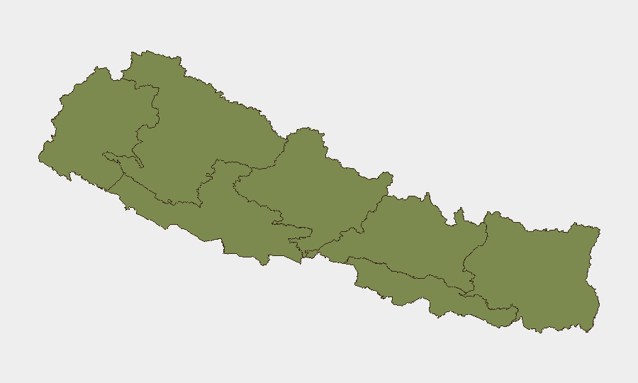
Bagamati Province (risk score 31.3) dominates Nepal's threat profile, driven by Kathmandu Valley's concentration of political activity, law-enforcement operations, and population density. The recent spike in arrests, traffic enforcement, and political/judicial statements all center here. Karnali Province (7.6) and Lumbini Province (5.8) carry secondary risk from administrative and village-level tensions; remaining provinces fall below 5, indicating dispersed, low-level concerns. The intensity of current policing in Bagamati and surveillance expansion in Rautahat (Koshi Province border area) suggest heightened scrutiny is likely to persist through the coming week.
How GeoBit Would Assist
Security teams would deploy AOI Monitoring & Early Warning on Kathmandu Valley and Rautahat to track police operations, checkpoint locations, and administrative activity; OSINT fusion (social media, local news, sentiment analysis) to detect early signals of political escalation or protest mobilization ahead of public announcement; and Routing & Network Analysis to identify alternative transport corridors around high-enforcement zones and road-accident hotspots during monsoon season.
7-Day Outlook
Policing intensity in Kathmandu Valley and fugitive/narcotics operations along major highways are expected to continue or intensify through early August. Political and administrative tensions remain unresolved, carrying low-to-moderate risk of localized friction but no imminent large-scale unrest. Road-safety risk will remain elevated through the monsoon period.
Highest-Risk Areas — Ranked
| # | State / Region | Risk |
|---|---|---|
| 1 | Bagamati Province | 31.3 |
| 2 | Karnali Province | 7.6 |
| 3 | Lumbini Province | 5.8 |
| 4 | Koshi Province | 3.1 |
| 5 | Sudurpashchim Province | 1.3 |
| 6 | Gandaki Province | 1.3 |
| 7 | Madhesh Province | 1.3 |
Sources
Previous Daily Briefs
A new Nepal brief is written every day — each with its own risk map and downloadable CSV. Here's the last week; use the calendar to go further back.
📅 Browse every day by calendar →
Highlighted days have a brief. Tap a day for that day's map & analysis, or “csv” for that day's dataset ($5).
Atlas — our AI intelligence desk — emails them this snapshot personally. Nothing else, no list.