Situation Summary
South Sudan remains in a state of fragile conflict equilibrium characterized by persistent armed factionalism, criminality, and localized violence across most subnational territories. The country holds a composite threat score of 67 (ranked #29 globally), with civil war listed as the primary driver. No discrete security incidents have been confirmed in the past 24–48 hours; however, the underlying operational environment—marked by sustained combat operations, kidnapping networks, and strained humanitarian infrastructure—persists without material change.
Key Developments
- No verified incidents documented in the last 24–48 hours. Open-source and social-media monitoring across reliable news feeds, X/Twitter, Telegram, and regional conflict trackers have yielded no specific, multi-sourced security events (clashes, bombings, criminal acts, infrastructure disruption) dated 31 July–1 August 2026 in South Sudan.
- Most recent dated incident (7 July 2026, Jonglei State). A county commissioner was killed in a persistently high-threat zone; the incident was reported by government sources and opposition actors. This reflects the ongoing targeting of administrative figures in fragile regions but falls outside the current 24–48-hour window.
- Humanitarian evacuation surge (H1 2026 baseline). The International Committee of the Red Cross documented a 50%+ increase in evacuations of wounded patients during the first half of 2026, signaling sustained combat operations and acute strain on trauma-care capacity nationwide. This trend underscores operational intensity but does not constitute a new discrete event.
- U.S. travel advisory status unchanged. The U.S. State Department maintains a "do not travel" assessment for South Sudan due to ongoing armed conflict, crime, and kidnapping risks. No advisory upgrade or downgrade has been reported in the last 48 hours.
Highest-Risk Areas
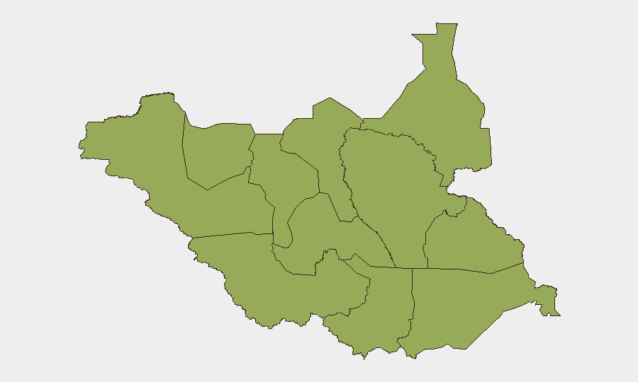
All twelve subnational territories (Upper Nile, Northern and Western Bahr el Ghazal, Ruweng, Unity, Warrap, Lakes, Jonglei, Greater Pibor, Western/Central/Eastern Equatoria) carry identical composite risk scores of 47, reflecting the nationwide distribution of conflict, criminal networks, and weak state authority. Upper Nile and the Bahr el Ghazal regions have historically been epicenters of intercommunal violence and armed-group operations; Jonglei and Greater Pibor remain primary venues for cattle-raiding and abductions. The uniform scoring indicates that South Sudan presents no "safe" subnational refuge and that threat materialization can occur across any territory without geographic concentration.
How GeoBit Would Assist
Corporate security and duty-of-care teams operating in or monitoring South Sudan should deploy AOI Monitoring & Early Warning on high-concentration sites (offices, compounds, supply routes) to detect real-time incident signals and trigger escalation protocols. Conflict & Military battle mapping and force-structure tracking enable situational awareness of armed-group positions and movement patterns, while OSINT fusion (Intel Sweep, X/Twitter/Telegram OSINT, multi-language search) provides continuous ingestion of rumors, displacement reports, and commander statements that precede kinetic events. Routing & Network Analysis supports the identification of lower-risk transit corridors and contingency evacuation pathways.
7-Day Outlook
No imminent change in South Sudan's threat posture is anticipated over the next seven days. Conflict equilibrium is likely to persist, with continued low-level armed-group activity, criminal incidents (kidnapping, robbery), and administrative instability. Any significant escalation would most likely materialize in peripheral, ungoverned zones (Upper Nile, Jonglei, Greater Pibor) before propagating to urban centers; early-warning systems and OSINT monitoring remain essential for lead time.
Highest-Risk Areas — Ranked
| # | State / Region | Risk |
|---|---|---|
| 1 | Upper Nile | 47 |
| 2 | Northern Bahr el Ghazal | 47 |
| 3 | Western Bahr el Ghazal State | 47 |
| 4 | Ruweng Administrative Area | 47 |
| 5 | Unity | 47 |
| 6 | Warrap | 47 |
| 7 | Lakes | 47 |
| 8 | Jonglei | 47 |
| 9 | Greater Pibor Administrative Area | 47 |
| 10 | Western Equatoria | 47 |
| 11 | Central Equatoria | 47 |
| 12 | Eastern Equatoria | 47 |
Sources
Previous Daily Briefs
A new South Sudan brief is written every day — each with its own risk map and downloadable CSV. Here's the last week; use the calendar to go further back.
📅 Browse every day by calendar →
Highlighted days have a brief. Tap a day for that day's map & analysis, or “csv” for that day's dataset ($5).
Atlas — our AI intelligence desk — emails them this snapshot personally. Nothing else, no list.