Situation Summary
Burkina Faso remains at composite elevated threat level (#14 globally, score 76) driven primarily by persistent insurgency activity across multiple northern and eastern regions. No clearly verified kinetic incidents have been independently corroborated within the last 24–48 hours; however, the threat environment remains characterized by ongoing military operations, curfews, movement restrictions, and border-security tensions. Recent international scrutiny—including placement on human-rights watchlists due to junta crackdowns on civil society—has added political and reputational pressure alongside the operational security burden.
Key Developments
- National (diplomatic/governance): 1 August 2026 – Burkina Faso added to international human-rights watchlist following junta crackdown on civil-society organizations and political rivals; reflects trend of increased governance instability and potential for civil unrest rather than discrete kinetic event.
- National (security posture): through 2 August 2026 – No independently verified new attack, armed clash, or major incident reported within the last 24–48 hours; security apparatus continues curfew enforcement, checkpoint operations, and movement restrictions across multiple regions.
- Border security (national): 1–2 August 2026 – Elevated diplomatic and operational friction reported at borders; exact nature and locations not yet specified in available corroborated reporting, but consistent with historical cross-border militant transit and state-boundary tensions.
- Intelligence gap: current – Absence of high-fidelity incident reporting in the 24–48 hour window may reflect communication blackouts, operational security by militant actors, or delayed open-source disclosure; risk of unconfirmed events remains non-trivial.
Highest-Risk Areas
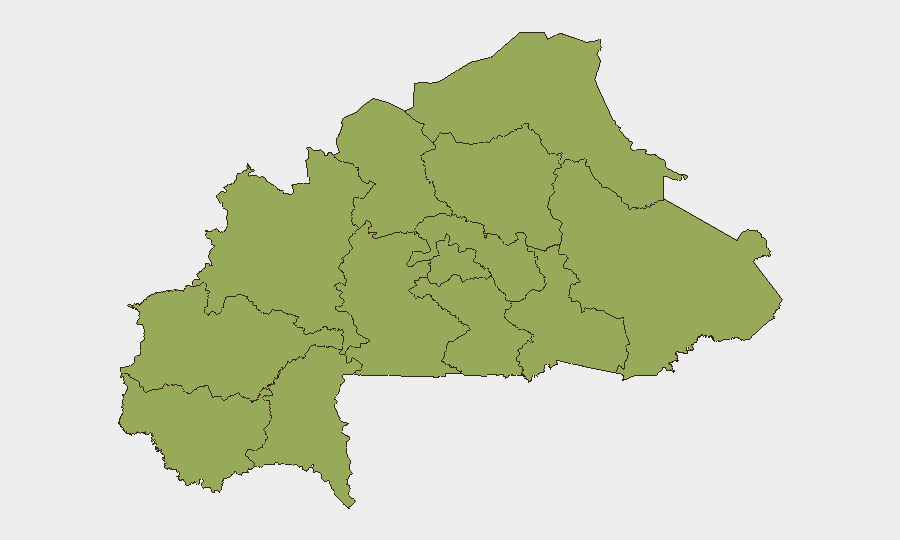
All twelve tracked regions (Upper-Basins, Boucle du Mouhoun, Central-West, Central-South, Central-East, Waterfalls, Southwest, Sahel, Central-North, East, North, Centre) currently register equivalent composite risk scores of 53.1, indicating diffuse, multi-regional threat distribution rather than geographic concentration. This pattern reflects the nationwide reach of JNIM and affiliated insurgent networks operating since mid-2026; no region has materially de-escalated. The parity in scores underscores that personnel and assets across the country face similar militant activity, supply-chain disruption, and movement-restriction risks, with no safe haven within national borders.
How GeoBit Would Assist
Security teams operating in or supplying Burkina Faso would leverage AOI Monitoring & Early Warning to maintain persistent watch on high-risk localities (Gayéri, Solhan, Sebba, and cross-border transit zones) with automated alerting on credible attack, checkpoint activity, or curfew changes. Multi-language OSINT fusion (Intel Sweep, Telegram/X monitoring, radio SIGINT) would continuously aggregate fragmented reports from local media, military communiqués, and activist networks to close the intelligence gap evident in the current 24–48 hour reporting void. Routing & Network Analysis would support duty-of-care teams in planning alternative travel corridors and supply chains around active military operations and checkpoint concentrations.
7-Day Outlook
Expect continuation of elevated but episodic threat posture: no imminent nationwide collapse or major escalation is currently signaled, but localized attacks and security-force operations will likely resume within days as recent quiet may reflect tactical pause rather than de-escalation. Border tensions and international scrutiny of governance will create secondary risks (visa delays, asset freezes, NGO restrictions) that may compound operational disruption for corporate teams. Monitoring for any militant communiqué claiming recent operations will provide earliest indication of new incident cycles.
Highest-Risk Areas — Ranked
| # | State / Region | Risk |
|---|---|---|
| 1 | Upper-Basins | 53.1 |
| 2 | Boucle du Mouhoun | 53.1 |
| 3 | Central-West | 53.1 |
| 4 | Central-South | 53.1 |
| 5 | Central-East | 53.1 |
| 6 | Waterfalls | 53.1 |
| 7 | Southwest | 53.1 |
| 8 | Sahel | 53.1 |
| 9 | Central-North | 53.1 |
| 10 | East | 53.1 |
| 11 | North | 53.1 |
| 12 | Centre | 53.1 |
Sources
Previous Daily Briefs
A new Burkina Faso brief is written every day — each with its own risk map and downloadable CSV. Here's the last week; use the calendar to go further back.
📅 Browse every day by calendar →
Highlighted days have a brief. Tap a day for that day's map & analysis, or “csv” for that day's dataset ($5).
Atlas — our AI intelligence desk — emails them this snapshot personally. Nothing else, no list.