Situation Summary
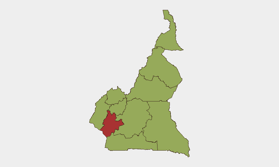
Cameroon remains a fragmented security environment with distinct threat clusters: Anglophone separatist violence concentrated in the Northwest and Southwest regions, Boko Haram and affiliated groups active in the Far North, and opportunistic criminal activity across urban centers including Douala. The threat landscape has not materially escalated in the past 24–48 hours, though confirmed incidents in mid-to-late July demonstrate sustained operational tempo across multiple regions. Littoral Region, home to Cameroon's primary economic hub and port infrastructure, carries the highest composite risk score (79.3) despite lower incident frequency, reflecting vulnerability concentration and critical-asset exposure.
Key Developments
- No major security incidents confirmed in the last 24–48 hours. Web research sources explicitly report absence of new verified events within this window, though open-source reporting lags confirm developing situations from 14–20 July remain under monitoring.
- Bamenda–Ndop corridor (Northwest, 18–19 July): Seven passengers kidnapped from a commercial vehicle in Ngoketunjia Division; hostages reportedly moved into forested areas. Incident consistent with separatist-group activity patterns.
- Bali Nyonga (Northwest, 19–20 July overnight): Gunmen believed affiliated with separatist movements conducted armed attack in a bar, killing one civilian and injuring two others.
- Mutengene, Fako Division (Southwest, 18–19 July): Security force counter-separatist sweep included mass arrests and random detention operations; scale and methods reported as heightened.
- Ossing village, Manyu Division (Southwest, 18 July): Two Traditional Council officials kidnapped by individuals claiming separatist affiliation; targeting of governance structures noted.
- Dabanga village, Waza district (Far North, 17–18 July overnight): Suspected Boko Haram raid killed seven villagers and injured multiple others; first significant confirmed incident in Far North within reporting window.
- Douala-Bonabéri Port reinforcement (Littoral, mid-July): Authorities established new Rapid Intervention Battalion base to strengthen logistics hub security, indicating elevated institutional risk assessment at critical infrastructure.
Highest-Risk Areas
Littoral Region dominates the composite risk ranking (79.3) despite fewer recent violent incidents, driven by economic concentration, port infrastructure criticality, and urban density vulnerability. The Northwest and Southwest regions (both 49.3) are primary active-conflict zones where Anglophone separatist groups maintain sustained kidnapping, armed assault, and governance-disruption capabilities. Far North Region (49.3) remains a secondary but persistent threat locus due to Boko Haram operational presence and cross-border sanctuary dynamics. Risk elevation in Littoral reflects institutional and asset concentration rather than incident frequency, making it the highest-priority region for corporate duty-of-care planning despite lower violence counts.
How GeoBit Would Assist
Security teams would employ Area-of-Interest Monitoring & Early Warning on Littoral's port and logistics network, Northwest/Southwest separatist-active divisions, and Far North border zones to receive alerting on emerging threats before mainstream reporting. Conflict mapping, force-structure tracking, and network-actor analysis would provide near-real-time assessment of separatist group capabilities, Boko Haram operational tempo, and security-force posture. Alternative routing and network analysis would support journey planning for personnel and supply movements, identifying lower-risk corridors in high-threat regions.
7-Day Outlook
Incident frequency is expected to remain consistent with mid-July baseline: sporadic kidnappings and armed assaults in Northwest/Southwest, intermittent Boko Haram activity in Far North, and low but present criminal risk in Douala and Littoral urban zones. No evidence suggests imminent escalation, though separatist and militant groups typically operate on operationally autonomous timelines resistant to short-term prediction. Institutional hardening at critical infrastructure (ports, transport nodes) will likely continue.
Highest-Risk Areas — Ranked
| # | State / Region | Risk |
|---|---|---|
| 1 | Littoral | 79.3 |
| 2 | Northwest | 49.3 |
| 3 | Southwest | 49.3 |
| 4 | West | 49.3 |
| 5 | Adamawa | 49.3 |
| 6 | Centre | 49.3 |
| 7 | South | 49.3 |
| 8 | Far-North | 49.3 |
| 9 | North | 49.3 |
| 10 | East | 49.3 |
Sources
Previous Daily Briefs
A new Cameroon brief is written every day — each with its own risk map and downloadable CSV. Here's the last week; use the calendar to go further back.
📅 Browse every day by calendar →
Highlighted days have a brief. Tap a day for that day's map & analysis, or “csv” for that day's dataset ($5).
Atlas — our AI intelligence desk — emails them this snapshot personally. Nothing else, no list.