Situation Summary
Canada remains a low-threat environment globally (rank #141, composite score 5.0), but sub-national disparities are pronounced, with Ontario and Nunavut driving elevated risk profiles. The 13 July snapshot reflects scattered event signals across multiple actor types (government, community, media, military, intelligence) and incident categories (small arms, statements, investigations, arrests) concentrated on 11–12 July. Overall trajectory suggests manageable risk for most corporate operations, with localized volatility in Ontario and Arctic regions requiring sector-specific monitoring.
Key Developments
Transparency caveat: GeoBit's event signals for 11–12 July are catalogued but lack sufficient corroborating detail (specific locations, confirmed incident times, casualty/impact data) from available OSINT sources at publication. The following reflect flagged signal categories; security teams should cross-reference with local law enforcement, industry networks, and government advisories:
- Small Arms Incidents: Signals flagged for Toronto (12 July) and one undated Ontario location (11 July). No casualty or motive confirmation available; recommend contact with Toronto Police Service and Ontario Provincial Police for incident details.
- Government & Intelligence Activity: Arrest/detention signal involving Canadian government and intelligence actors (11 July, location unspecified). May relate to foreign interference, counter-intelligence, or internal security matter; monitor public government statements and media reporting.
- Inter-Actor Disputes: Public statements flagged between Canada/Government, Community/Worker, Tanker/Regulatory Body, and Waterloo/Canada (all 11 July). These suggest labor, regulatory compliance, or municipal governance friction; insufficient detail on severity or geographic concentration.
- Media & Law Enforcement Interaction: Investigation signal between media and police (11 July), possibly related to transparency or incident disclosure; monitor media releases and police statements for emerging narrative.
- Conventional Military Signal: One signal flagged involving Polish military actor (11 July). Context unclear; may relate to NATO activity, training, or diplomatic engagement unrelated to domestic Canadian security.
Recommended Action: Pending detailed OSINT confirmation, security teams with assets in Ontario and Toronto should activate sector-specific channels (retail, transportation, government contracting) for incident reporting and coordinate with local law enforcement liaison officers.
Highest-Risk Areas
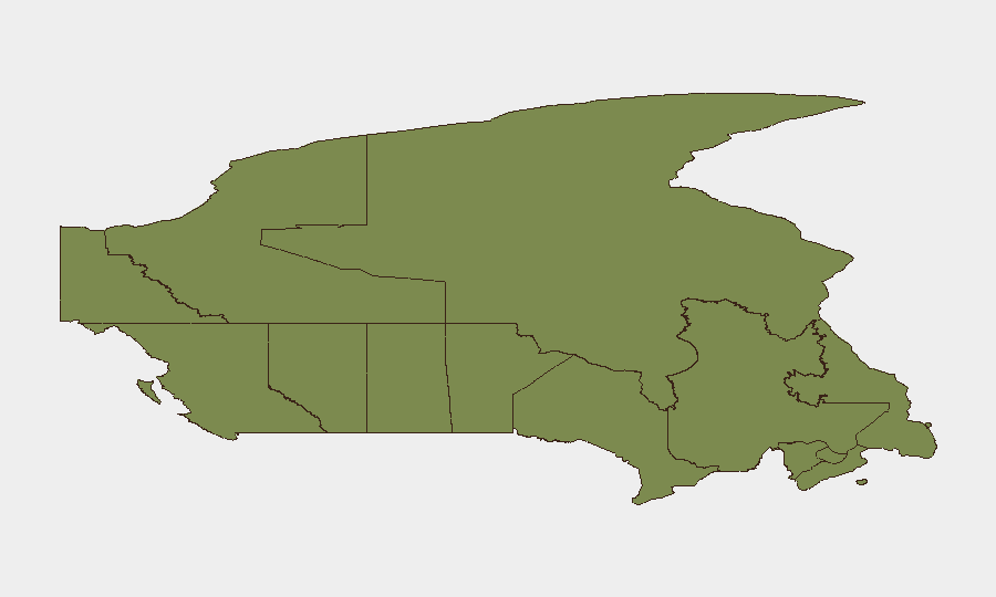
Ontario (31.5) significantly outranks other provinces and accounts for roughly 40 % of national tracked-event concentration, driven by high-density urban centers (Toronto, Ottawa, GTA) and government/intelligence activity. Nunavut (24.6), despite lower population, reflects elevated Arctic risk—resource-sector security, indigenous-government tension, and remote-area incident clustering. British Columbia (14.1) shows third-tier risk centered on port security, supply-chain vulnerabilities, and cross-border activity. All other provinces remain below 10.0 composite score. Corporate duty-of-care focus should prioritize Ontario operations and any Arctic/resource operations in Nunavut; Montreal, Calgary, and Vancouver remain low-to-moderate risk.
How GeoBit Would Assist
Persistent monitoring: AOI (Area-of-Interest) Monitoring & Early Warning on key cities (Toronto, Ottawa, Montreal, Vancouver) and industrial sites (ports, energy infrastructure, government facilities) provides 24/7 alerting on emerging events. Multi-source correlation: Intel Sweep and OSINT Fusion across government advisories, police media releases, X/Telegram, and local news identify confirmed incidents faster than manual monitoring. Threat assessment: Risk & Threat Assessment coupled with Network & Actor Analysis clarifies motive and escalation risk for flagged signals, enabling proportionate response by corporate security teams.
7-Day Outlook
No major national incidents are forecast; risk concentration remains sub-national (Ontario, Nunavut). Summer travel season and potential industrial labor activity may sustain minor event frequency in urban and resource-sector areas through mid-July. Geopolitical or cross-border developments should be monitored as potential exogenous drivers.
Highest-Risk Areas — Ranked
| # | State / Region | Risk |
|---|---|---|
| 1 | Ontario | 31.5 |
| 2 | Nunavut | 24.6 |
| 3 | British Columbia | 14.1 |
| 4 | Manitoba | 9.9 |
| 5 | Newfoundland and Labrador | 9.7 |
| 6 | Quebec | 6.9 |
| 7 | Alberta | 4.6 |
| 8 | Saskatchewan | 4.4 |
| 9 | Northwest Territories | 2.3 |
| 10 | New Brunswick | 2.1 |
| 11 | Yukon | 1.5 |
| 12 | Prince Edward Island | 1.5 |
Sources
Previous Daily Briefs
A new Canada brief is written every day — each with its own risk map and downloadable CSV. Here's the last week; use the calendar to go further back.
📅 Browse every day by calendar →
Highlighted days have a brief. Tap a day for that day's map & analysis, or “csv” for that day's dataset ($5).
Atlas — our AI intelligence desk — emails them this snapshot personally. Nothing else, no list.