Situation Summary
Central African Republic remains a persistently fragmented security environment with diffuse armed-group activity and limited state capacity across much of the territory. GeoBit's composite threat score of 76 places CAR at #29 globally; no discrete security events have been recorded in the current 24–48-hour window. The security picture is characterized by chronic instability rather than acute escalation, though all twelve tracked sub-national regions carry uniform elevated risk scores (53), indicating systemic rather than localized threat exposure.
Key Developments
No credible, time-stamped security incidents in the Central African Republic have been identified in the last 24–48 hours.
Open-source news, social-media, and wire-service searches conducted across July 5–7, 2026 have not surfaced verified reports of armed clashes, civil unrest, crime targeting foreign nationals, infrastructure disruption, or political instability triggers within that window. GeoBit's event-signal monitoring similarly recorded zero discrete incidents in the current reporting period. Historical context—including low-intensity armed-group operations, banditry, and governance fragmentation—remains relevant to baseline risk but does not constitute recent developments.
Should verified incidents emerge, GeoBit's Intel Sweep, X/Twitter & Telegram OSINT, and multi-language search capabilities will surface and corroborate them; duty-of-care teams should anticipate updates within 2–4 hours of confirmed reporting.
Highest-Risk Areas
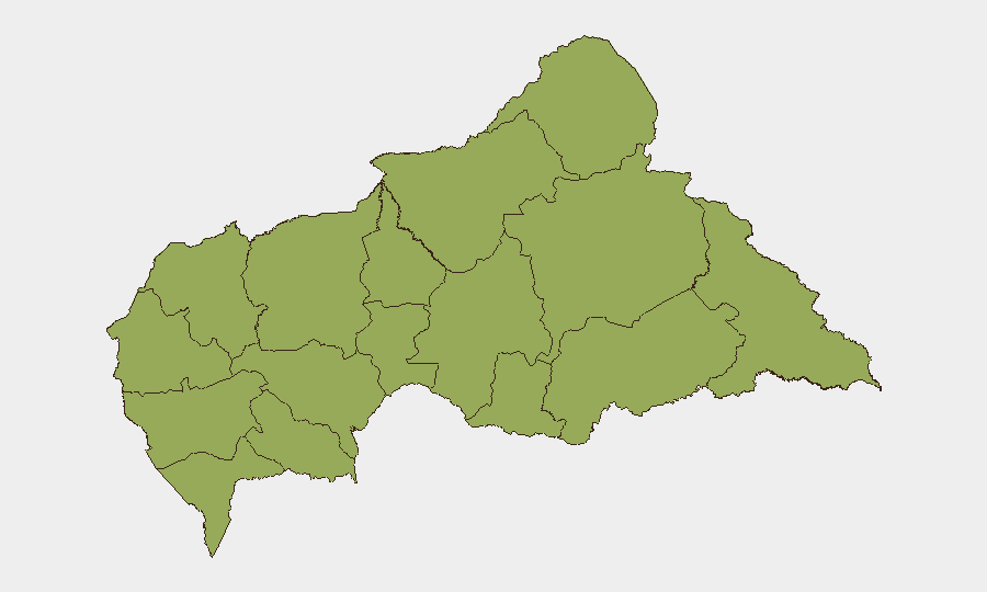
All twelve tracked regions—Bamingui-Bangoran, Vakaga, Haute-Kotto, Haut-Mbomou, Mbomou, Nana-Mambéré, Ouham-Pendé, Mambéré-Kadéï, Sangha-Mbaéré, Ouham, Nana-Grébizi, and Kémo—carry identical composite risk scores of 53, reflecting systemic rather than hotspot-driven threat patterns. This uniformity suggests that armed-group presence, banditry, weak state authority, and limited rule of law are distributed across the country rather than concentrated in specific flashpoints. Eastern and northern regions (Vakaga, Bamingui-Bangoran, Haute-Kotto, Haut-Mbomou) historically experience higher infiltration by transnational armed actors and trafficking networks; western regions (Mambéré-Kadëi, Sangha-Mbaéré) face persistent communal and resource-driven tensions. Duty-of-care teams should treat the entire country as elevated-risk and avoid assuming safer corridors.
How GeoBit Would Assist
Security and risk teams should deploy AOI Monitoring & Early Warning on high-concentration facilities (compounds, offices, supply routes) to detect movement anomalies or gathering patterns indicative of planned activity. Conflict & Military battle mapping and force-structure tracking will clarify armed-group positioning and likely operational areas; Network & Actor Analysis will identify key commanders and faction splinters. Routing & Network Analysis can support alternative-route planning for essential personnel movement, avoiding known banditry and checkpoint hotspots. Continuous OSINT fusion & corroboration across news, social media, and Telegram will provide 2–4-hour alert velocity on emerging incidents.
7-Day Outlook
No major escalation is anticipated in the next seven days; however, the uniform risk profile across all regions means that localized clashes, banditry, or administrative disruption could occur with limited warning. Dry-season mobility typically supports armed-group and criminal activity in CAR; teams should maintain heightened vigilance and pre-positioned contingency protocols. Regular check-ins with local contacts and embassy networks will remain the most reliable early-warning mechanism.
Highest-Risk Areas — Ranked
| # | State / Region | Risk |
|---|---|---|
| 1 | Bamingui-Bangoran | 53 |
| 2 | Vakaga | 53 |
| 3 | Haute-Kotto | 53 |
| 4 | Haut-Mbomou | 53 |
| 5 | Mbomou | 53 |
| 6 | Nana-Mambéré | 53 |
| 7 | Ouham-Pendé | 53 |
| 8 | Mambéré-Kadéï | 53 |
| 9 | Sangha-Mbaéré | 53 |
| 10 | Ouham | 53 |
| 11 | Nana-Grébizi | 53 |
| 12 | Kémo | 53 |
Sources
Previous Daily Briefs
A new Central African Republic brief is written every day — each with its own risk map and downloadable CSV. Here's the last week; use the calendar to go further back.
📅 Browse every day by calendar →
Highlighted days have a brief. Tap a day for that day's map & analysis, or “csv” for that day's dataset ($5).
Atlas — our AI intelligence desk — emails them this snapshot personally. Nothing else, no list.