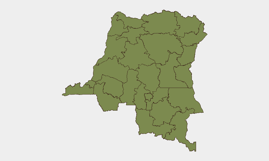
Situation Summary
DR Congo ranks #28 globally in composite threat severity (score 71) with 2,068 tracked security events. The security environment has deteriorated noticeably in late June 2026, driven by escalating M23 activity and cross-border military incursions in the eastern provinces. Civilian displacement and instability remain acute across North Kivu, South Kivu, and Ituri, with Goma remaining under M23 control as of late June. The country-level threat profile remains substantial, though geographically concentrated in the east and Kasai region.
Key Developments
GeoBit's event signal data for the past 48 hours is limited to three flagged items:
- 2026-07-04 · Arrest/Detain incident involving Chad; location and context not yet fully verified in available sources.
- 2026-07-02 · Public Statement recorded between authorities and a citizen; specific jurisdiction and subject matter not detailed in current feeds.
- 2026-07-02 · Abduction/Hijacking/Hostage incident involving Chadian and Libyan actors; geographic linkage to DR Congo requires confirmation.
*Note:* Real-time incident-level reporting for DR Congo in the past 24–48 hours remains sparse in publicly available sources. The most recent confirmed security assessment (June 27, 2026) documented escalating M23 operations and cross-border incursions in eastern DRC, but did not specify individual incident timestamps or discrete locations suitable for duty-of-care alert. Teams should monitor X/Twitter feeds from UN MONUSCO, regional news outlets (Africanews, Radio Okapi), and conflict monitors for granular updates.
Highest-Risk Areas
Central Kasai dominates sub-national risk (score 33.9), substantially higher than all other provinces (which cluster at 3.9). This disparity reflects ongoing militia violence, artisanal mining disputes, and communal conflict in the region. Eastern DRC—North Kivu, South Kivu, and Ituri—collectively sustains the second-order threat layer, driven by M23 military operations, armed-group proliferation, and civilian targeting. Nord- and Sud-Ubangi in the northwest, plus Équateur, Mongala, and Kasai tributaries, remain active but lower-intensity conflict zones. Any corporate presence in Central Kasai, or supply-chain routing through eastern border crossings, faces elevated exposure.
How GeoBit Would Assist
Security teams should deploy AOI (Area-of-Interest) Monitoring & Early Warning on Central Kasai, North Kivu, and Goma to surface incidents within hours of occurrence. Multi-language OSINT (X/Twitter, Telegram, local news feeds, radio SIGINT) combined with entity extraction and sentiment analysis will capture emerging threats—militia movements, arrests, displacement spikes—before they mature into corporate impact. Conflict mapping and force-structure tracking should maintain current visibility of M23 disposition, armed-group locations, and military cordon lines to inform travel routing and asset positioning. Satellite and GIS analysis can monitor displacement camps and infrastructure damage near operational areas.
7-Day Outlook
M23 consolidation in the east is expected to persist, with sporadic cross-border incursions and militia responses in Kasai likely to continue. Displacement pressures and humanitarian access constraints will remain acute. No immediate de-escalation signals are evident; monitor official UN peacekeeping (MONUSCO) assessments and diplomatic statements for any ceasefire signals, which would be a primary early-warning indicator of shifting trajectory.
Highest-Risk Areas — Ranked
| # | State / Region | Risk |
|---|---|---|
| 1 | Central Kasai | 33.9 |
| 2 | Maniema | 3.9 |
| 3 | Sud-Ubangi | 3.9 |
| 4 | Équateur | 3.9 |
| 5 | Nord-Ubangi | 3.9 |
| 6 | Mongala | 3.9 |
| 7 | Lower Uele | 3.9 |
| 8 | Tshopo | 3.9 |
| 9 | Tshuapa | 3.9 |
| 10 | Upper Uele | 3.9 |
| 11 | Ituri | 3.9 |
| 12 | North Kivu | 3.9 |
Sources
Previous Daily Briefs
A new DR Congo brief is written every day — each with its own risk map and downloadable CSV. Here's the last week; use the calendar to go further back.
📅 Browse every day by calendar →
Highlighted days have a brief. Tap a day for that day's map & analysis, or “csv” for that day's dataset ($5).