Situation Summary
France remains at moderate risk (global rank #103, composite score 12) with 400 tracked threat events, but the past 48 hours have seen a clustering of security incidents—including a mass-casualty knife attack in Paris, ongoing counter-terrorism operations, mosque closure for radical content, and severe wildfires affecting western regions. Multiple concurrent threats spanning violent extremism, public safety, and infrastructure disruption are elevating operational risk across the Paris region and Gironde, with knock-on effects on transport and civilian movement. The security posture shows both elevated counter-terror activity and emergency response strain.
Key Developments
- Paris (Porte de Clichy), knife attack – 27 July 2026
A man armed with two kitchen knives attacked three women near Porte de Clichy in north-west Paris, seriously injuring two; suspect arrested at scene. Two victims reported in critical condition; national anti-terrorism prosecutor monitoring the case, motive unclear.
- Paris (north), mosque closure – 27 July 2026
Authorities ordered closure of a mosque in northern Paris (~10 miles from knife-attack site) for propagating radical Islamist ideology, legitimizing jihad, and glorifying martyrdom aligned with terrorist organisation rhetoric.
- Paris region (Sarcelles), ongoing terrorism investigation – case developments reported 27 July 2026
Six men due to appear before investigating judge (25 July) in relation to suspected planned attack after weapons found in car (11 July); eight additional men arrested in Paris region (21 July) suspected of transporting vehicle or supplying weapons.
- Paris region, metro/tram disruption – 27 July 2026
Police closed metro and tram stations near Porte de Clichy following the knife attack, causing localized transport disruption in north Paris for commuters and travelers.
- Gironde (west of Bordeaux), mass-casualty wildfires – 28 July 2026 (ongoing)
Large forest fires around Lacanau and coastal areas prompted evacuation of approximately 4,000 holidaymakers from Lacanau as preventive measure. Fires have burned ~42,000 hectares; approximately 220,000 people evacuated from southern areas since late last week.
- Haute-Savoie, gendarme fatality – late July 2026
A 38-year-old gendarme assigned to G7 security operation fatally struck by vehicle; two other gendarmes injured. Incident highlights operational risks linked to heightened security deployments around major political events.
Highest-Risk Areas
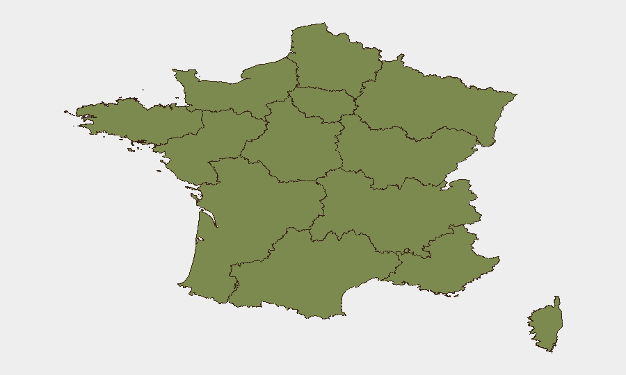
Nouvelle-Aquitaine (score 32.1) and Île-de-France (19.6) account for the majority of France's tracked risk, with the Paris region driving terrorism and violent-crime signals and the Bordeaux region now heavily impacted by uncontrolled wildfire and mass evacuation. Bourgogne–Franche-Comté (7.7) represents a secondary cluster; remaining regions show lower but distributed risk. The divergence reflects acute urban security threats in Paris and acute natural-disaster strain in Gironde, both with significant duty-of-care implications for corporate operations.
How GeoBit Would Assist
Security teams should deploy AOI Monitoring & Early Warning on high-risk Paris arrondissements and Gironde transport corridors to flag emerging attack signals or evacuation-zone changes in real time. Intel Sweep and multi-language OSINT (X, Telegram, local news feeds) would detect radicalization narratives and extremist cell activity before escalation. Routing & Network Analysis and satellite imagery would enable alternative-route planning and situational awareness as wildfires and security cordons disrupt primary transport arteries.
7-Day Outlook
Counter-terrorism operations and extremism investigations will likely remain elevated across the Paris region through early August, with risk of secondary incidents or copy-cat attacks. Gironde wildfires are expected to persist for several days, sustaining evacuation and infrastructure strain. Travel disruption, transport closures, and heightened police presence should be factored into operational planning and duty-of-care protocols for the week ahead.
Highest-Risk Areas — Ranked
| # | State / Region | Risk |
|---|---|---|
| 1 | Nouvelle-Aquitaine | 32.1 |
| 2 | Ile-de-France | 19.6 |
| 3 | Bourgogne – Franche-Comté | 7.7 |
| 4 | Normandy | 4.8 |
| 5 | Grand Est | 3.2 |
| 6 | Provence-Alpes-Côte d'Azur | 3.2 |
| 7 | Centre-Val de Loire | 3 |
| 8 | Auvergne-Rhône-Alpes | 3 |
| 9 | Hauts-de-France | 2.2 |
| 10 | Pays de la Loire | 2.2 |
| 11 | Occitania | 2.2 |
| 12 | Brittany | 2.1 |
Sources
Previous Daily Briefs
A new France brief is written every day — each with its own risk map and downloadable CSV. Here's the last week; use the calendar to go further back.
📅 Browse every day by calendar →
Highlighted days have a brief. Tap a day for that day's map & analysis, or “csv” for that day's dataset ($5).
Atlas — our AI intelligence desk — emails them this snapshot personally. Nothing else, no list.