Situation Summary
Mali remains West Africa's highest-volatility conflict environment, ranked #10 globally with active armed group activity, inter-communal violence, and state fragmentation across multiple regions. The past 48 hours show scattered but geographically dispersed incidents involving statements and investigative actions, primarily tied to external actors (Somalia, U.S., Israel) rather than direct Mali-based operations. Timbuktu region continues to anchor the threat profile as the single highest-risk zone; however, widespread elevated risk across nine other regions—many with composite scores of 70—indicates threat distribution rather than concentration, complicating security resource allocation.
Key Developments
- 2026-07-02 · Physical Assault (British national) – Location not yet geographically confirmed in available signals; incident type suggests potential criminal rather than armed-group targeting, but context requires verification.
- 2026-07-01 to 2026-07-02 · Multiple Public Statements & Investigative Actions (Somalia-linked actors) – Statements directed at United States and Israeli entities; no direct Mali territorial impact identified but may reflect regional proxy positioning or diaspora activism affecting Mali's international standing and foreign-fighter recruitment climate.
- 2026-06-30 · Small Arms Combat (National Guard vs. Somalia-attributed forces) – One of the few direct armed engagements in the signal set; location and casualty count not yet specified in current brief data; requires field confirmation of combatant identity and terrain.
- Additional signals (Disapprove, Reject, Investigate) – Scattered across 2026-07-01 to 2026-07-02; lack specificity on location and targeting; suggest ongoing administrative/legal friction or low-level tension rather than imminent escalation.
Data Gap: Event signals provided lack precise geographic coordinates, casualty figures, and verified source attribution. Confirmation of actual territorial impact in Mali versus external actor activity affecting Mali's security posture is pending.
Highest-Risk Areas
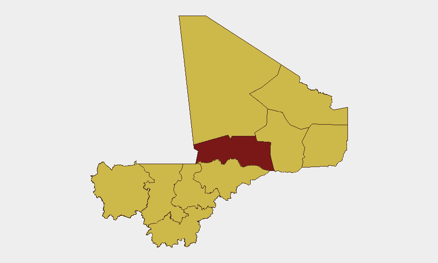
Timbuktu (risk score 100) remains the acute epicenter, reflecting chronic armed-group presence, limited state control, and trafficking networks. Bamako (73.3), despite being the capital, shows elevated risk driven by crime, protest dynamics, and insider threats within fragmented security institutions. The nine regions rated at 70—including Ménaka, Gao, Mopti, Kayes, Kidal, Taoudénit, Koulikoro, and Ségou—form a broad arc of instability spanning northern and central Mali, indicating that threat is not confined to a single front but distributed across ungoverned and semi-governed spaces. This geographic spread reflects the reality of multi-front insecurity: jihadist cells, criminal networks, and localized armed groups operate in parallel rather than in sequence.
How GeoBit Would Assist
Security teams should deploy AOI Monitoring & Early Warning on Timbuktu, Bamako, and the Ménaka–Gao corridor to establish persistent watch for armed-group movement, checkpoint activity, and civilian displacement. Intel Sweep and multi-language OSINT (X/Twitter, Telegram, regional news) would disambiguate the current signal set—distinguishing external actor statements from ground-truth Mali incidents and flagging emerging threats before they scale. Battle Mapping and Conflict Search capabilities provide near-real-time force-positioning data to support duty-of-care decisions on personnel routing and facility hardening in high-risk regions.
7-Day Outlook
No imminent large-scale escalation is signaled, but the dispersed nature of current events suggests underlying instability is steady rather than diminishing. Timbuktu and northern corridors will remain high-friction zones; Bamako may see increased security operations or administrative friction. Monitoring for foreign-fighter mobilization (tied to Somalia-linked rhetoric) and cross-border infiltration should remain elevated through early July.
Highest-Risk Areas — Ranked
| # | State / Region | Risk |
|---|---|---|
| 1 | Timbuktu | 100 |
| 2 | Bamako | 73.3 |
| 3 | Ménaka | 70 |
| 4 | Kayes | 70 |
| 5 | Taoudénit Region | 70 |
| 6 | Kidal | 70 |
| 7 | Gao | 70 |
| 8 | Koulikoro | 70 |
| 9 | Ségou Region | 70 |
| 10 | Sikasso Region | 70 |
| 11 | Mopti | 70 |
Previous Daily Briefs
A new Mali brief is written every day — each with its own risk map and downloadable CSV. Here's the last week; use the calendar to go further back.
📅 Browse every day by calendar →
Highlighted days have a brief. Tap a day for that day's map & analysis, or “csv” for that day's dataset ($5).