Situation Summary
New Zealand remains a low-threat environment globally (rank #137, composite score 3), with 41 tracked security events recorded. However, recent signal activity suggests emerging tensions across institutional, agricultural, and regional governance domains, concentrated heavily in the Waikato region. The current trajectory shows scattered but sustained pressure points rather than systemic instability, though parliamentary and local administrative friction warrants monitoring.
Key Developments
- 2026-07-27 · Parliament Demand – A formal demand issued to Parliament; scope and substantive nature not yet clarified in available reporting. Location: Wellington (risk 11.4).
- 2026-07-27 · Waikato Administrative Sanctions & Disapproval – Waikato regional authorities have imposed sanctions against a farmer entity and issued public disapproval statements. Waikato remains the highest-risk region nationally (31.4). Date and trigger require further clarification.
- 2026-07-25 · Farmer Arrest/Detention – A farmer was arrested or detained; administrative sanctions followed within 48 hours. Geographic jurisdiction unclear but possibly Waikato-linked. Context: potential land-use, regulatory, or resource-management dispute.
- 2026-07-27 · University Rejection – An unspecified proposal or demand was rejected by a New Zealand university institution. Location not yet identified; relevance to broader unrest pattern unclear.
- 2026-07-26 · Christchurch–Catholic Public Statement – Public statement issued in Christchurch (Canterbury, risk 8.1) involving Catholic institutional interests. Tone and subject require source verification.
- 2026-07-27 · National Investigation Initiated – A national-level investigation was launched (subject and scope not yet detailed in available signals).
- 2026-07-27 · Wellington Public Statement & Mayor Disapproval – Wellington authorities and municipal leadership issued public statements and expressions of disapproval on unspecified matters (Wellington risk 11.4).
- 2026-07-26 · Chief Executive vs. United Kingdom Statement – A chief executive issued a public statement in opposition or dispute with United Kingdom interests or policy; relevance to domestic New Zealand security unclear.
Highest-Risk Areas
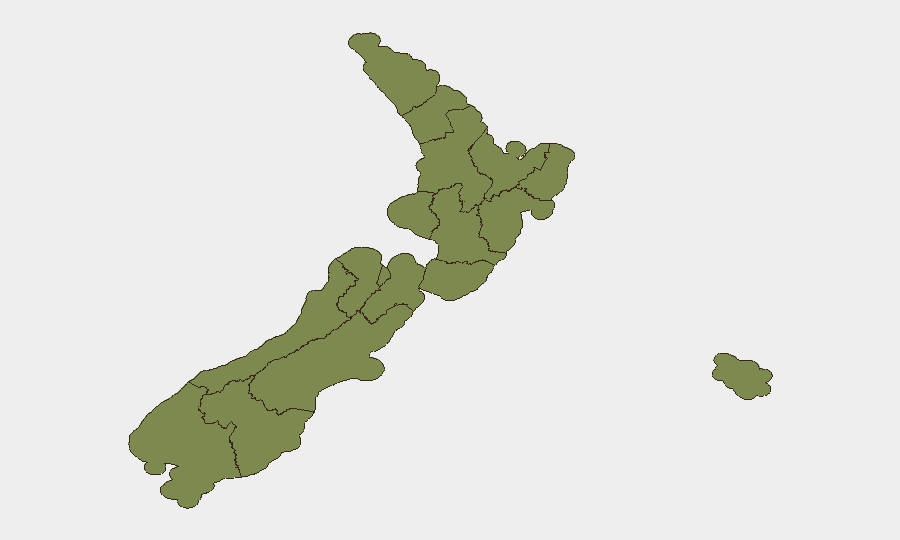
Waikato (31.4) and Southland (26.4) dominate the risk profile and account for the majority of tracked event signals. Waikato's elevation is driven by administrative sanctions, farmer detention, and regional disapproval actions—suggesting agricultural policy, land-use disputes, or regulatory enforcement as underlying triggers. Hawke's Bay (23.1) and Wellington (11.4) show secondary but significant signals, pointing to distributed institutional and governance friction across the North Island. Rural and primary-sector tensions appear to be the common denominator across highest-risk regions.
How GeoBit Would Assist
Teams protecting people or assets in New Zealand should employ AOI Monitoring & Early Warning to track Waikato, Southland, and Hawke's Bay for escalating regulatory or civil tensions; Entity Extraction & Network Analysis to map relationships between farmer groups, regional authorities, and parliamentary actors; and Sentiment & Temporal Analysis on official statements, social media, and local media to forecast whether current friction resolves administratively or hardens into protest or disruption activity.
7-Day Outlook
Current signals suggest administrative and policy friction rather than acute security risk. The next 7 days will clarify whether the farmer detention and Waikato sanctions resolve through courts/negotiation or trigger organized agricultural opposition. Parliamentary and university rejections suggest institutional resistance to policy; escalation probability remains low unless coordination emerges across sectors or regions.
Highest-Risk Areas — Ranked
| # | State / Region | Risk |
|---|---|---|
| 1 | Waikato | 31.4 |
| 2 | Southland | 26.4 |
| 3 | Hawke's Bay | 23.1 |
| 4 | Wellington | 11.4 |
| 5 | Auckland | 9.7 |
| 6 | West Coast | 8.1 |
| 7 | Canterbury | 8.1 |
| 8 | Tasman | 3.1 |
| 9 | Chatham Islands | 1.4 |
| 10 | Northland | 1.4 |
| 11 | Taranaki | 1.4 |
| 12 | Bay of Plenty | 1.4 |
Sources
Previous Daily Briefs
A new New Zealand brief is written every day — each with its own risk map and downloadable CSV. Here's the last week; use the calendar to go further back.
📅 Browse every day by calendar →
Highlighted days have a brief. Tap a day for that day's map & analysis, or “csv” for that day's dataset ($5).
Atlas — our AI intelligence desk — emails them this snapshot personally. Nothing else, no list.