Situation Summary
South Sudan remains in a state of chronic civil conflict and institutional fragility, with a composite threat score of 66 (global rank #28) driven primarily by ongoing armed competition and state collapse. No new major security events have been verified in the past 24–48 hours, though the operating environment remains consistently high-risk across most subnational territories. The absence of reported incidents does not indicate de-escalation; rather, it reflects the baseline condition of diffuse, localized violence and instability across the country. Corporate personnel and assets face persistent exposure to armed group activity, intercommunal conflict, and criminal predation, particularly outside Juba.
Key Developments
- No verified incidents in the last 24–48 hours — Web research and available OSINT feeds did not surface cross-confirmed security, civil-unrest, crime, or infrastructure events in South Sudan (nationwide) falling within the 2026-08-01 to 2026-08-02 window. Absence of reporting does not indicate absence of risk.
- Juba / Central Equatoria State — Ongoing criminal operations — Open-source notices reference reactivation of anti-gang task forces and reported abductions in the capital, but available snippets do not anchor these developments to the immediate 24–48-hour window; recommend real-time monitoring for confirmation.
- Jonglei State — Convoy/supply-line vulnerability persistent — Historical convoy attacks in counties such as Duk remain a pattern-indicator for road-corridor risk; no specific incident confirmed in the last 48 hours, but the threat profile remains active.
Highest-Risk Areas
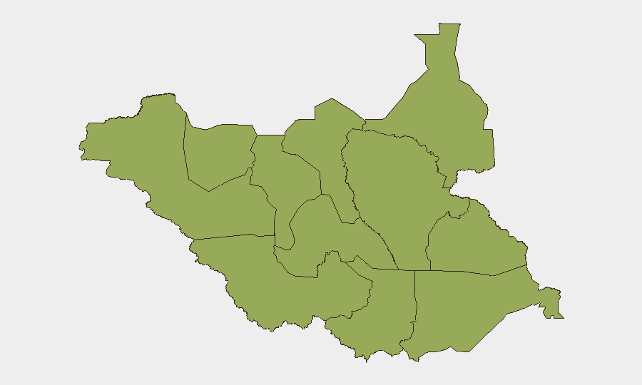
All twelve major subnational divisions are assessed at identical composite risk (46.3), reflecting nationwide instability rather than geographic concentration. Upper Nile, Northern and Western Bahr el Ghazal, Unity, Warrap, and the administrative areas (Ruweng, Greater Pibor) carry highest exposure to armed-group presence, inter-factional competition, and supply-line interdiction. Central Equatoria, encompassing Juba, faces distinct urban crime (abduction, armed robbery, gang activity) alongside broader state fragility. Eastern and Western Equatoria, while lower in absolute population density, remain contested and subject to armed group incursion. The uniform risk plateau across the country underscores that no region offers materially reduced threat exposure.
How GeoBit Would Assist
Organizations with personnel or assets in South Sudan should employ AOI (Area-of-Interest) Monitoring & Early Warning with persistent watch on Juba, supply corridors, and operational sites, coupled with OSINT fusion (X/Twitter, Telegram, radio SIGINT, and multi-language feeds) to detect emerging incidents, armed-group movements, and criminal activity in near-real time. Conflict & Military mapping and Network & Actor Analysis enable tracking of factional positions, force movements, and militia leadership changes that may signal localized escalation or safe-passage opportunities. Routing & Network Analysis supports identification of alternative transportation and evacuation routes when primary corridors face interdiction or ambush risk.
7-Day Outlook
No significant shift in the underlying conflict dynamics is anticipated in the near term. Localized violence, criminal predation, and supply-line disruption will likely continue at current operational tempo. Security teams should maintain heightened vigilance around personnel movements, supply convoys, and facility perimeters, with contingency planning for rapid deterioration in any subnational zone.
Highest-Risk Areas — Ranked
| # | State / Region | Risk |
|---|---|---|
| 1 | Upper Nile | 46.3 |
| 2 | Northern Bahr el Ghazal | 46.3 |
| 3 | Western Bahr el Ghazal State | 46.3 |
| 4 | Ruweng Administrative Area | 46.3 |
| 5 | Unity | 46.3 |
| 6 | Warrap | 46.3 |
| 7 | Lakes | 46.3 |
| 8 | Jonglei | 46.3 |
| 9 | Greater Pibor Administrative Area | 46.3 |
| 10 | Western Equatoria | 46.3 |
| 11 | Central Equatoria | 46.3 |
| 12 | Eastern Equatoria | 46.3 |
Sources
Previous Daily Briefs
A new South Sudan brief is written every day — each with its own risk map and downloadable CSV. Here's the last week; use the calendar to go further back.
📅 Browse every day by calendar →
Highlighted days have a brief. Tap a day for that day's map & analysis, or “csv” for that day's dataset ($5).
Atlas — our AI intelligence desk — emails them this snapshot personally. Nothing else, no list.