Situation Summary
DR Congo remains at composite threat rank #33 globally (59/100) with 60 tracked events in the current reporting cycle. The security environment is being shaped simultaneously by an active Ebola outbreak with expanding geographic reach, escalating violence against health responders, political pressure over constitutional reform, and front-line military repositioning in the east. These parallel crises—epidemiological, civil-political, and military—are creating compounding operational friction for organizations with personnel or supply chains in-country.
Key Developments
- Butembo, North Kivu (6–7 July): Unidentified attackers raided an Ebola treatment centre and set portions of the facility ablaze, injuring responders. UN officials report this as part of a widening pattern of violence targeting Ebola response personnel and aid workers across North Kivu, South Kivu, and Ituri provinces.
- Bunia, Ituri Province (7 July): Uganda and DRC authorities held a high-level bilateral meeting focused on coordinated Ebola response and cross-border security. Result: reinforced surveillance and security checkpoints along the Uganda–DRC border and within Ituri, affecting movement and screening protocols in and around Bunia.
- Boga Health Zone, Ituri (6–7 July): Confirmed Ebola cases detected in Boga, marking further geographic expansion of the outbreak into new health zones and triggering security incidents targeting response personnel in the wider Ituri region.
- Ituri Province (4–5 July, reported 7 July): Front-line Ebola health workers issued strike notice over unpaid wages and bonuses, with work stoppages already underway by 7 July. This directly impairs Ebola treatment capacity and surveillance in the outbreak epicentre.
- Kinshasa and major cities (8–9 July): Opposition coalition C64 has called for nationwide demonstrations on 8 July demanding President Tshisekedi's resignation over constitutional reform efforts. Risk of road blockages, protest clashes, and security force responses in the capital and other urban centres.
- Luvungi area, South/North Kivu border (early July): Armed Forces of the DRC (FARDC) retaken the strategic town of Luvungi following M23 withdrawal, altering front-line positions and creating potential for renewed clashes and access disruptions in the eastern corridor.
Highest-Risk Areas
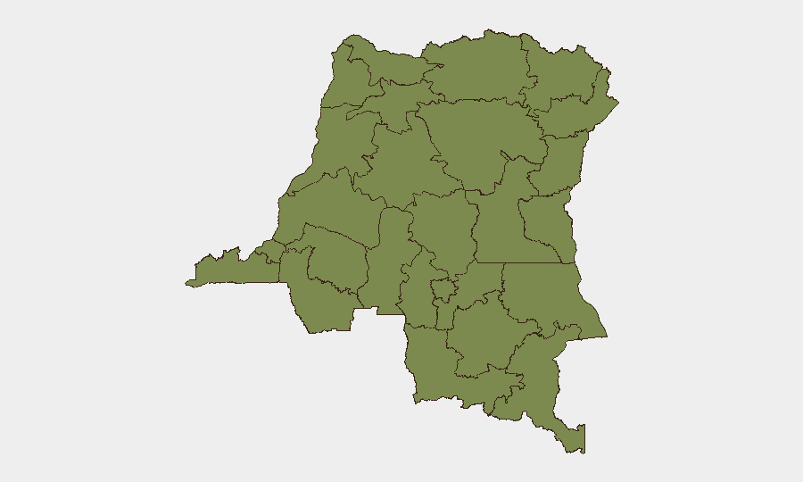
Ituri Province dominates the sub-national risk profile (33.9/100) due to the convergence of confirmed Ebola expansion, active violence against health responders, healthcare worker strikes, and cross-border security operations. North Kivu (3.9) and South Kivu (3.9) follow as secondary concern zones, with North Kivu experiencing direct attacks on treatment facilities and South Kivu reporting ongoing aid-worker security incidents. The remaining provincial rankings (Maniema, Sud-Ubangi, Équateur, and others at 3.9) reflect lower but non-negligible baseline instability; however, their threat profiles are substantially below Ituri's concentrated risk cluster.
How GeoBit Would Assist
A security team managing DR Congo exposure would deploy Intel Sweep and global event feeds for real-time alerting on new strikes, health-facility attacks, or protest escalation. AOI Monitoring & Early Warning on Bunia, Luvungi, Butembo, and Kinshasa would provide persistent watch and threshold-triggered notifications. Routing & Network Analysis would model alternative movement corridors around active checkpoints, protest zones, and front-line shifts to maintain supply-chain and personnel continuity. Concurrent Risk & Threat Assessment snapshots help duty-of-care teams adjust operational posture and medical-response planning in real time.
7-Day Outlook
Ituri Province will remain the highest-intensity theatre through mid-July, driven by Ebola case expansion, worker strikes impairing response capacity, and ongoing violence against responders. Political demonstrations in Kinshasa and major urban centres on 8 July will likely trigger temporary disruptions (road blocks, security cordons) through 9–10 July, creating secondary logistical friction for organizations with urban operations. The FARDC–M23 front-line shift in eastern DRC adds military unpredictability, though large-scale renewed fighting is not immediately signalled.
Highest-Risk Areas — Ranked
| # | State / Region | Risk |
|---|---|---|
| 1 | Ituri | 33.9 |
| 2 | Maniema | 3.9 |
| 3 | Sud-Ubangi | 3.9 |
| 4 | Équateur | 3.9 |
| 5 | Nord-Ubangi | 3.9 |
| 6 | Mongala | 3.9 |
| 7 | Lower Uele | 3.9 |
| 8 | Tshopo | 3.9 |
| 9 | Tshuapa | 3.9 |
| 10 | Upper Uele | 3.9 |
| 11 | North Kivu | 3.9 |
| 12 | Lualaba | 3.9 |
Sources
Previous Daily Briefs
A new DR Congo brief is written every day — each with its own risk map and downloadable CSV. Here's the last week; use the calendar to go further back.
📅 Browse every day by calendar →
Highlighted days have a brief. Tap a day for that day's map & analysis, or “csv” for that day's dataset ($5).
Atlas — our AI intelligence desk — emails them this snapshot personally. Nothing else, no list.