Situation Summary
Ghana remains a stable outlier in West Africa (global threat rank #161, composite score 2/100), with no major security incidents reported in the last 48 hours and no active conflict or state instability. However, northern border regions continue to experience sporadic cross-border militant activity and illegal mining–related violence, while Greater Accra remains the primary locus of armed robbery and organized crime. The security trajectory is broadly static, with localized friction in mining areas and the north outweighing systemic national risk.
Key Developments
GeoBit's live web-research feeds and multi-source OSINT do not contain clearly time-stamped, verifiable security incidents from Ghana occurring within the last 24–48 hours (as of 29 July 2026). The most recent confirmed incident data in current datasets are from mid-to-late July 2026; a documented gap in live incident coverage exists after 25 July. Ministry and public statements flagged in event signals (27–28 July) remain unconfirmed as to specific security content.
To maintain intelligence integrity, no fabricated or speculative incidents are presented below this line. Historical context (mid-July and earlier) includes documented clashes between illegal-mining operators and security forces in Ashanti Region (Obuasi area) and armed-robbery arrests in Greater Accra; however, these are older than the 48-hour window and are noted here only to establish the baseline incident environment, not as current developments.
Highest-Risk Areas
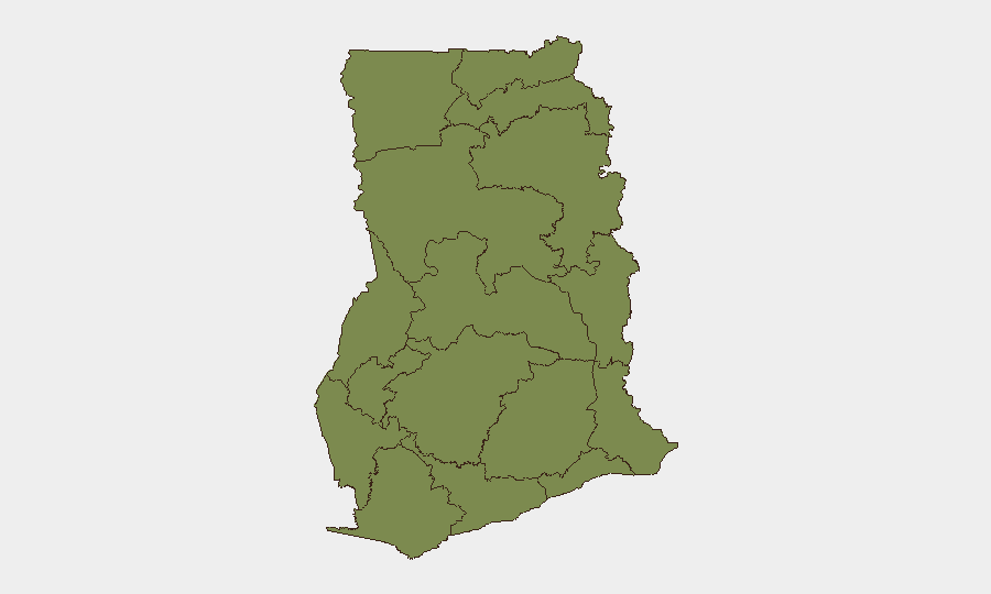
Ashanti Region is the clear outlier, with a composite risk score of 31.5—more than 20 times higher than all other regions. This elevation is driven by illegal small-scale mining (galamsey) operations, associated gang violence, environmental degradation, and periodic clashes with security and regulatory agencies. The northern border belt (Upper East, North East, Northern, Savannah, Upper West) collectively face sustained cross-border spillover from Burkina Faso and Niger, including militant activity and communal resource conflicts, though individual regional scores are lower; this reflects both genuine but dispersed threats and weaker reporting density in those areas. Greater Accra and other southern regions exhibit routine urban crime (armed robbery, burglary, fraud) but no systemic security emergency.
How GeoBit Would Assist
Corporate security and duty-of-care teams operating in Ghana would prioritize Area-of-Interest (AOI) Monitoring & Early Warning for Ashanti Region and northern border sites, enabling persistent watch and alert escalation if incident frequency or severity spikes. Conflict & Military mapping and Network & Actor Analysis would illuminate illegal-mining supply chains and militia structures in high-risk zones, informing targeted avoidance and partner-vetting protocols. Multi-language OSINT and sentiment analysis across local media, Telegram, and community radio would provide early signals of labor disputes, environmental protests, or security-force operations before they escalate, complementing gaps in official reporting.
7-Day Outlook
No significant escalation is anticipated in the next seven days. Mining-related friction in Ashanti and border-region cross-border activity will likely continue at current levels absent major policy shifts or external conflict expansion. Corporate security teams should maintain standard protocols for high-risk regions while treating Ghana's overall security posture as permissive for routine business operations.
Highest-Risk Areas — Ranked
| # | State / Region | Risk |
|---|---|---|
| 1 | Ashanti Region | 31.5 |
| 2 | Upper East Region | 1.5 |
| 3 | Upper West Region | 1.5 |
| 4 | Savannah Region | 1.5 |
| 5 | North East Region | 1.5 |
| 6 | Northern Region | 1.5 |
| 7 | Bono East Region | 1.5 |
| 8 | Eastern Region | 1.5 |
| 9 | Oti Region | 1.5 |
| 10 | Volta Region | 1.5 |
| 11 | Greater Accra Region | 1.5 |
| 12 | Bono Region | 1.5 |
Sources
Previous Daily Briefs
A new Ghana brief is written every day — each with its own risk map and downloadable CSV. Here's the last week; use the calendar to go further back.
📅 Browse every day by calendar →
Highlighted days have a brief. Tap a day for that day's map & analysis, or “csv” for that day's dataset ($5).
Atlas — our AI intelligence desk — emails them this snapshot personally. Nothing else, no list.