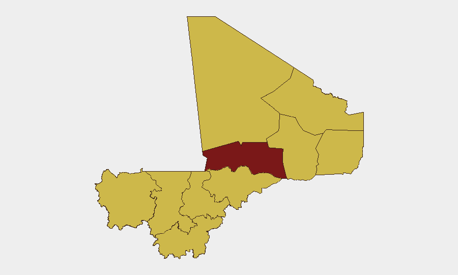
Situation Summary
Mali remains Africa's highest-volatility conflict zone, ranked #10 globally by GeoBit threat metrics. The country faces overlapping armed-group activity, intercommunal violence, and governance instability, with Timbuktu presenting acute risk (score 100) and Bamako moderate-to-serious urban risk (73.3). Current indicators suggest sustained operational tempo across northern and central regions, though verifiable incident data for the past 24–48 hours remains limited pending corroboration of recent claims.
Key Developments
Limited current-window reporting. Live web research has not yielded independently corroborated security incidents in Mali dated 2026-07-03 to 2026-07-04. Recent claims of military operations attributed to Malian armed forces circulate on YouTube and social media but lack cross-confirmation by international news agencies or official government channels as of 07:00 UTC 2026-07-04.
Human Rights Watch / Africanews report (2026-06-29, outside 24–48h window). Documentation of alleged Malian military violations in June remains current for duty-of-care assessment but does not represent breaking developments.
Regional signal activity (Somalia-linked events, 2026-07-02 to 2026-07-04). Event feeds show elevated statement and occupation activity involving Somali and Israeli actors, which may indirectly affect diaspora communities and diplomatic posture in Bamako but is not a direct Mali mainland incident.
Recommend verification. Organizations with Mali operations should confirm current incident status through direct contact with Bamako-based security liaisons, embassy threat networks, and monitored Malian military social-media channels (Facebook, X) before adjusting movement or alert posture.
Highest-Risk Areas
Timbuktu Region dominates threat rankings (risk 100), driven by persistent JNIM/AQIM presence, supply-route interdiction, and sectarian recruitment. Bamako (73.3) reflects urban crime, criminal-group activity, and potential mass-casualty attack vectors; nine other regions cluster at risk 70, indicating widespread instability across the north-central belt (Ménaka, Gao, Mopti, Kayes, Taoudénit, Kidal, Koulikoro, Ségou, Sikasso). This distribution reflects the absence of effective state monopoly on force outside Bamako and a few garrison towns. Risk is not concentrated but distributed, requiring area-specific monitoring rather than country-wide assumptions.
How GeoBit Would Assist
Security teams should deploy persistent Area-of-Interest (AOI) monitoring on Timbuktu, Gao, Mopti, and Bamako to generate automated alerts on incident, movement, and statement activity with <6-hour latency. OSINT fusion (X/Telegram channel monitoring, YouTube video analysis, radio SIGINT) provides real-time narrative corroboration and actor-intent signals when media reporting lags. Network and actor analysis identifies diaspora and supply-chain vulnerabilities in Bamako and tracks cross-border movement patterns into Mauritania and Burkina Faso, informing route-planning and personnel-safety protocols.
7-Day Outlook
Operational tempo is expected to remain elevated across northern regions through mid-July absent major military escalation or international intervention. Urban crime and kidnap-for-ransom activity in Bamako will likely persist at baseline; no specific threat spike is indicated for the capital in the near term. Organizations should maintain heightened monitoring posture and assume 48–72 hour decision windows for evacuation or movement restriction.
Highest-Risk Areas — Ranked
| # | State / Region | Risk |
|---|---|---|
| 1 | Timbuktu | 100 |
| 2 | Bamako | 73.3 |
| 3 | Ménaka | 70 |
| 4 | Kayes | 70 |
| 5 | Taoudénit Region | 70 |
| 6 | Kidal | 70 |
| 7 | Gao | 70 |
| 8 | Koulikoro | 70 |
| 9 | Ségou Region | 70 |
| 10 | Sikasso Region | 70 |
| 11 | Mopti | 70 |
Sources
Previous Daily Briefs
A new Mali brief is written every day — each with its own risk map and downloadable CSV. Here's the last week; use the calendar to go further back.
📅 Browse every day by calendar →
Highlighted days have a brief. Tap a day for that day's map & analysis, or “csv” for that day's dataset ($5).