Situation Summary
Nepal's security environment remains fragmented and localized, with a composite threat score of 36 placing it outside the global top-tier risk tier. The most significant current driver is communal and law-enforcement escalation in eastern Nepal, specifically Sunsari District, where a localized religious pilgrimage dispute on July 26 triggered police gunfire, a fatality, and subsequent indefinite curfews affecting critical transport corridors. Infrastructure disruption (landslides, road accidents) and administrative sanctions compound near-term operational risk for organizations with personnel or logistics in the eastern and central regions.
Key Developments
- Sunsari District, Kaptanganj (July 26–27, 2026): Bolbom pilgrimage flag and DJ equipment dispute escalated into communal clashes; Nepal Police opened fire, killing 24-year-old Om Prakash Mehta and injuring multiple civilians and 13 security personnel. Nepal Army deployed with armored vehicles to support law and order.
- Sunsari District, East–West Highway and Inaruwa (July 28, 2026, effective 3:30 pm): District Administration imposed indefinite curfew covering 200 m north and south of the East–West Highway (Pakali Chowk to Koshi Barrage bridge) and entire Inaruwa market area, directly restricting road travel on a primary inter-provincial and India-border corridor.
- Sunsari District, multiple municipalities (July 27–ongoing, 2026): Curfew extended across Inaruwa, Duhabi, Bhokraha Narsingh, Koshi, Gadhi, Devangunj, Harihar, Barju, and parts of Itahari and Ramdhuni; gatherings and movement banned with legal warnings for violators.
- Inaruwa Municipality, Sunsari (July 28–29, 2026): Two-day local mourning holiday declared for municipal offices, schools, health institutions (excluding emergency services), and local bodies—signaling administrative disruption tied to the Kaptanganj violence.
- Mugling–Narayangadh Highway, Chitwan (July 28, 2026): Dry landslide near Mugling Bazaar halted bidirectional traffic on a critical inter-district transit and freight route; debris clearance estimated at 2+ hours, creating short-term logistics disruption.
- Nationwide road accidents (July 28–29, 2026): Nepal Police documented 7 fatalities and 105 injuries across the country in a 24-hour period, underscoring persistent elevated travel risk on Nepal's road network independent of conflict events.
- Rautahat District, Gaur area (late July 2026): Police arrested 21 convicted fugitives in a single operation and deployed drone surveillance over Gaur and surrounding areas for criminal-activity monitoring—indicating heightened law-enforcement posture.
Highest-Risk Areas
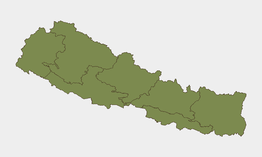
Koshi Province (risk 29.4) and Bagamati Province (risk 29.4) are driving Nepal's composite threat score, primarily due to the Sunsari District escalation and ongoing administrative sanctions. Koshi's risk is directly attributable to the July 26–28 communal violence, police response, curfew implementation, and resulting disruption of the East–West Highway—a critical economic and logistical artery near the Indian border. Bagamati's elevated score reflects spillover administrative and political activity in Kathmandu and peripheral areas responding to the eastern crisis. Remaining provinces carry minimal risk (1.3–9.6), with Lumbini showing elevated but secondary concern. Organizations with operations in Sunsari or transit dependency on the East–West Highway face the highest near-term exposure.
How GeoBit Would Assist
GIS and spatial analysis with persistent AOI monitoring would enable continuous watch on Sunsari curfew boundaries and the East–West Highway corridor, with alerting on curfew expansion, lifting, or escalation. Routing and network analysis capabilities would provide real-time alternative route planning and journey-risk assessment for personnel and freight transiting central and eastern Nepal. Intel Sweep and multi-language OSINT fusion would track evolving political statements, police briefings, and community responses to assess de-escalation probability and inform duty-of-care decisions.
7-Day Outlook
The Sunsari curfew is likely to remain in place for at least 7–10 days while central and all-party meetings work to broker local-level resolution and prevent recurrence. East–West Highway transit delays and Inaruwa service disruptions are expected to persist, with logistics and personnel movement significantly constrained. Road-accident risk remains endemic; landslide risk on mountain corridors will increase with the onset of monsoon season (June–September), further elevating travel disruption likelihood.
Highest-Risk Areas — Ranked
| # | State / Region | Risk |
|---|---|---|
| 1 | Koshi Province | 31.3 |
| 2 | Bagamati Province | 29.4 |
| 3 | Lumbini Province | 9.6 |
| 4 | Gandaki Province | 2.2 |
| 5 | Madhesh Province | 2.2 |
| 6 | Karnali Province | 1.6 |
| 7 | Sudurpashchim Province | 1.3 |
Sources
Previous Daily Briefs
A new Nepal brief is written every day — each with its own risk map and downloadable CSV. Here's the last week; use the calendar to go further back.
📅 Browse every day by calendar →
Highlighted days have a brief. Tap a day for that day's map & analysis, or “csv” for that day's dataset ($5).
Atlas — our AI intelligence desk — emails them this snapshot personally. Nothing else, no list.