Situation Summary
Syria remains at #14 global threat ranking (composite 93/275 tracked events) with Damascus Governorate experiencing the highest sub-national risk (94.9). A pattern of bombings in central Damascus over the past 48 hours—including attacks near the Four Seasons Hotel and a Justice Palace café—indicates renewed urban terrorism or coordinated political violence targeting high-profile locations and diplomatic presence. Concurrent government-force clashes with Druze elements and multiple arrest/detention events signal intensified internal security operations alongside external attack activity.
Key Developments
- Damascus (Four Seasons Hotel vicinity), 7 July 2026 – Two improvised explosive devices detonated near the hotel where French President Macron had stayed the previous night, injuring at least 18 people including four police officers. One device was placed in a dumpster, another in a nearby vehicle; Macron had departed for the presidential palace before detonation.
- Central Damascus (presidential palace route), 7 July 2026 – Large explosions struck central Damascus shortly after Macron's arrival at the presidential palace; Syrian state TV attributed incidents to explosive devices with no immediate responsibility claim.
- Damascus (Justice Palace café area), early week of 6–8 July 2026 – A bomb detonated killing at least 10 people and wounding ~20, occurring less than one week before the hotel-area attacks and establishing a pattern of bombings in central districts.
- Jaramana checkpoint, Damascus countryside, 6–8 July 2026 – A gunman attacked security forces during identity check, firing shots and throwing two hand grenades that wounded three personnel; a third grenade detonated in the attacker's hand, killing him.
- Government Forces vs. Druze (location unspecified), 7–8 July 2026 – Conventional military engagement reported between government forces and Druze elements, indicating active internal armed conflict beyond urban terrorism.
- Ministry arrest/detention operations, 7 July 2026 – Multiple arrest and detention events logged by Ministry and prison authorities, alongside police mobilization across the capital.
- International diplomatic statements, 9 July 2026 – Public statements from a U.S. Senator, foreign ministry, and Administration officials regarding Syria, reflecting heightened international attention to the security deterioration.
Highest-Risk Areas
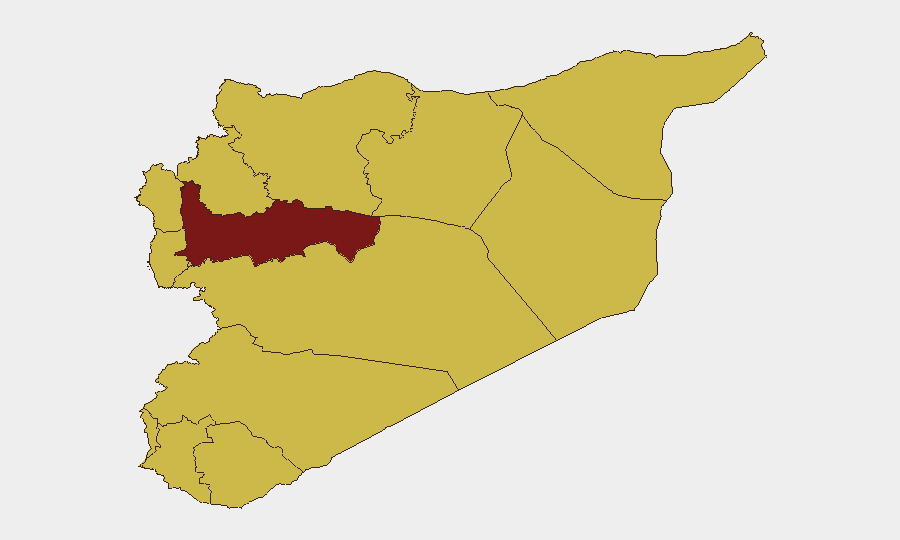
Damascus Governorate dominates the risk landscape at 94.9, driven by the concentration of recent bombings, government presence, and diplomatic activity. Hama Governorate follows at 82, reflecting ongoing internal instability. A secondary cluster of ten governorates (Ar-Raqqa, Aleppo, Lattakia, Tartus, Al-Quneitra, Dar'a, Idleb, Homs, Rif Dimashq, plus the UNDOF zone) all register 64.9 risk, indicating endemic sectarian, military, and extremist threats across non-Damascus regions. The concentration of recent bombings and arrests in Damascus, coupled with military clashes in secondary zones, suggests both centralized political-security tensions and dispersed armed conflict.
How GeoBit Would Assist
Teams with personnel or assets in Syria should activate AOI Monitoring & Early Warning on Damascus Governorate (hotels, government facilities, diplomatic compounds) and Intel Sweep with OSINT fusion (Telegram, X, local media) to detect attack indicators 24–48 hours in advance. Conflict & Military battle mapping and Network & Actor Analysis would clarify Druze positioning and government-force deployment patterns, enabling Routing & Network Analysis for safe passage planning around Damascus and secondary conflict zones.
7-Day Outlook
The frequency of bombings in central Damascus and concurrent military activity suggest a period of elevated tactical volatility over the next 7 days. International diplomatic presence (Macron's visit, subsequent statements) may catalyze further symbolic attacks or government counter-operations. Organizations should assume heightened checkpoint activity, possible curfews, and restricted movement in Damascus and monitor Hama and secondary governorates for escalation.
Highest-Risk Areas — Ranked
| # | State / Region | Risk |
|---|---|---|
| 1 | Damascus Governorate | 94.9 |
| 2 | Hama Governorate | 82 |
| 3 | Ar-Raqqa Governorate | 68.2 |
| 4 | Aleppo Governorate | 65.7 |
| 5 | Lattakia Governorate | 64.9 |
| 6 | Tartus Governorate | 64.9 |
| 7 | UNDOF | 64.9 |
| 8 | Al-Quneitra Governorate | 64.9 |
| 9 | Dar'a Governorate | 64.9 |
| 10 | Idleb Governorate | 64.9 |
| 11 | Homs Governorate | 64.9 |
| 12 | Rif Dimashq Governorate | 64.9 |
Sources
Previous Daily Briefs
A new Syria brief is written every day — each with its own risk map and downloadable CSV. Here's the last week; use the calendar to go further back.
📅 Browse every day by calendar →
Highlighted days have a brief. Tap a day for that day's map & analysis, or “csv” for that day's dataset ($5).
Atlas — our AI intelligence desk — emails them this snapshot personally. Nothing else, no list.