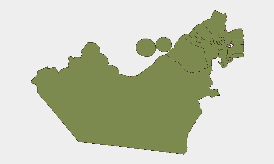
Situation Summary
The United Arab Emirates faces an acute and escalating security crisis driven by regional ballistic-missile and drone exchanges centred on Iran–US–Gulf state tensions. Over the past 48 hours, Iranian missile and drone barrages targeting UAE territory have resulted in civilian casualties, infrastructure damage, and widespread air-defence activations across multiple emirates. Critical energy and industrial assets—including the Habshan gas complex and Emirates Global Aluminium facilities—have sustained direct hits or debris impact, while civilian populations in Dubai and Abu Dhabi residential zones have experienced casualties from both incoming threats and interceptor debris. The threat trajectory is rising and remains active.
Key Developments
- Abu Dhabi, 16–17 July: Iranian missile strike or debris impact killed one Palestinian national in a residential area; separate interception debris incidents in Abu Dhabi caused at least one additional civilian fatality and injuries. Civilian zones remain exposed to both incoming and falling debris.
- Abu Dhabi – Emirates Global Aluminium (EGA), 16–17 July: Iranian strikes and interceptor debris caused significant damage to the world's largest aluminium producer; facility emergency closure initiated; 12 workers injured (predominantly Nepali and Indian nationals).
- Abu Dhabi – Habshan Gas Complex, 16–17 July: Large Iranian barrage (17 missiles and 35 drones) largely intercepted by UAE air defences, but falling debris struck the complex, injuring three personnel and underscoring vulnerability of critical energy infrastructure.
- Dubai Southern Residential Areas, 16–17 July: UAE air defences intercepted hostile UAVs; interception debris fell on houses, injuring four civilians (two Indian, one Bangladeshi, one Sri Lankan national). Debris impact—not direct hits—caused civilian harm.
- Dubai Downtown, 16 July: Residents reported loud explosions linked to possible drone incident; Government of Dubai Media Office publicly denied reports as false, though coverage confirms air-defence activity in the zone.
- Nationwide Airspace & Transport, ongoing through mid-July: European Union Aviation Safety Agency has advised operators to avoid Gulf airspace until at least 29 July 2026; flight disruptions and sudden closures are expected; missile-alert systems remain activated nationwide.
Highest-Risk Areas
Abu Dhabi Emirate (risk score 31.8) is by far the highest-risk zone, driven by direct impact on critical energy and aluminium-production infrastructure, civilian casualties in residential areas, and ongoing missile/drone exchange activity. Dubai (risk 15.4) ranks second and has experienced air-defence interceptions and debris falls affecting residential districts and causing civilian injuries. The remaining emirates (Ras al-Khaimah, Fujairah, Sharjah, Ajman, Umm al-Quwain) carry minimal current risk scores but remain subject to nationwide alert protocols and potential debris fallout.
How GeoBit Would Assist
Organisations with personnel or assets in the UAE should deploy AOI Monitoring & Early Warning on critical facilities (energy, aluminium, port, transport hubs) to detect incoming threats and air-defence activity in real time. Parallel use of Conflict & Military (force-structure and weapons-capability tracking) and Intelligence & OSINT (event feeds, sentiment analysis, multi-language regional media monitoring) will clarify intent, trajectory, and targeting patterns. Routing & Network Analysis enables rapid identification of alternative transport corridors and safe assembly points as airspace closures and debris zones evolve.
7-Day Outlook
Regional missile and drone activity is expected to persist through at least 29 July, with continued risk of debris impact in populated and industrial zones across Abu Dhabi and Dubai. Civilian infrastructure—particularly energy and transport—will remain under stress; flight disruptions are likely to extend. Duty-of-care teams should maintain heightened alertness for sudden shelter-in-place directives and asset-evacuation scenarios.
Highest-Risk Areas — Ranked
| # | State / Region | Risk |
|---|---|---|
| 1 | Abu Dhabi Emirate | 31.8 |
| 2 | Dubai | 15.4 |
| 3 | Ras al-Khaimah | 2.1 |
| 4 | Fujairah Emirate | 2.1 |
| 5 | Sharjah Emirate | 1.8 |
| 6 | Ajman Emirate | 1.8 |
| 7 | Umm al-Quwain | 1.8 |
Sources
Previous Daily Briefs
A new United Arab Emirates brief is written every day — each with its own risk map and downloadable CSV. Here's the last week; use the calendar to go further back.
📅 Browse every day by calendar →
Highlighted days have a brief. Tap a day for that day's map & analysis, or “csv” for that day's dataset ($5).
Atlas — our AI intelligence desk — emails them this snapshot personally. Nothing else, no list.