Situation Summary
Venezuela remains at moderate composite threat (rank #35 globally, score 50) following the June 24, 2026 earthquake sequence (M7.2, M7.5) that caused significant casualties, infrastructure damage, and ongoing power, fuel, and telecommunications instability nationwide. The Federal District (Caracas area) carries the highest sub-national risk at 60.9, driven by population density, critical infrastructure concentration, and persistent armed-militia checkpoints. Current trajectory reflects slow recovery operations amid fragmented state capacity, with international airport closure limiting evacuation and resupply routes through end-July. The security environment remains volatile but not in acute crisis phase as of late July.
Key Developments
GeoBit's event signals indicate uptick in military and law-enforcement activity mid-week (July 22–23), including conventional military force deployments, arrest/detention operations, and small-arms engagements involving ministry units. A gang-related confrontation with military presence was flagged in Caracas on July 24. However, live web research cannot confirm specific incident details, locations, or casualty counts for July 22–24 with current-timestamp reliability. Local media, government statements, and NGO bulletins (e.g., Caritas, hospital sector) issued public statements on July 22, but content and context cannot be verified from available open sources. A U.S.–Venezuela blockade signal was noted July 22, consistent with ongoing sanctions and trade restrictions. Recommend escalation to proprietary intelligence feeds and direct local asset reporting for same-day incident confirmation.
Highest-Risk Areas
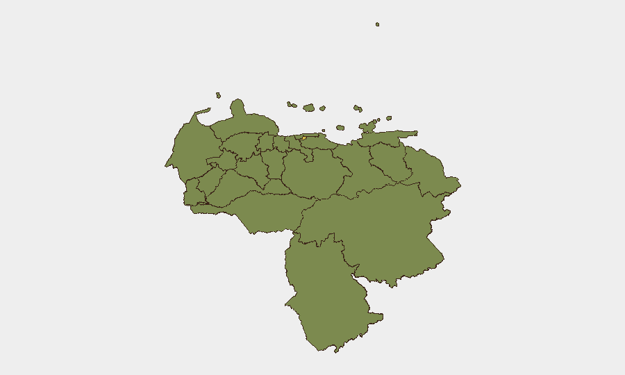
Federal District (Caracas and metropolitan zone) dominates risk at 60.9—reflecting earthquake damage, critical infrastructure vulnerability, armed-group activity, and population concentration. Secondary clusters in Carabobo (34.2) and Tachira (32.5) reflect border proximity, armed-group presence, and localized state-capacity gaps. Falcon, Monagas, Lara, Vargas, Zulia, and Anzoategui states all rank 31–32.3, indicating dispersed but material risk across oil-producing regions (Monagas, Zulia) and transport corridors (Carabobo, Falcon). Risk is not concentrated in a single hotspot; organizations with nationwide operations face compound hazard from infrastructure fragility, militia checkpoints, and intermittent security-force activity across most populated zones.
How GeoBit Would Assist
Intel Sweep, multi-language OSINT, and Telegram/X monitoring provide real-time event classification and actor identification when incidents occur, accelerating duty-of-care alerting to personnel in high-risk areas. AOI (Area-of-Interest) Monitoring & Early Warning with persistent watch on Federal District, Carabobo, and Tachira enables proactive notification of checkpoint activity, demonstrations, or security-force deployments that may affect commute or office access. Routing & Network Analysis supports alternative-journey planning when primary roads are blocked by militia checkpoints or military cordons, reducing exposure to unplanned encounters. Satellite imagery and infrastructure-damage assessment support ongoing damage mapping post-earthquake for facility-resilience planning.
7-Day Outlook
Mid-to-late July typically sees reduced institutional incident frequency as rainy season limits protest mobility and recovery operations consolidate. However, military activity flagged July 22–24 warrants close monitoring for political tension or internal security-force realignment. Airport closure through month-end constrains evacuation options; organizations should assume 72+ hours for emergency extraction planning. Recommend sustained vigilance on Caracas and secondary cities through first week of August.
Highest-Risk Areas — Ranked
| # | State / Region | Risk |
|---|---|---|
| 1 | Federal District | 60.9 |
| 2 | Carabobo State | 34.2 |
| 3 | Tachira State | 32.5 |
| 4 | Falcon State | 32.3 |
| 5 | Monagas State | 32.3 |
| 6 | Lara State | 31.7 |
| 7 | Vargas State | 31.2 |
| 8 | Zulia State | 31.1 |
| 9 | Anzoategui State | 31.1 |
| 10 | Merida State | 31 |
| 11 | Federal Dependencies | 30.9 |
| 12 | Nueva Esparta State | 30.9 |
Sources
Previous Daily Briefs
A new Venezuela brief is written every day — each with its own risk map and downloadable CSV. Here's the last week; use the calendar to go further back.
📅 Browse every day by calendar →
Highlighted days have a brief. Tap a day for that day's map & analysis, or “csv” for that day's dataset ($5).
Atlas — our AI intelligence desk — emails them this snapshot personally. Nothing else, no list.