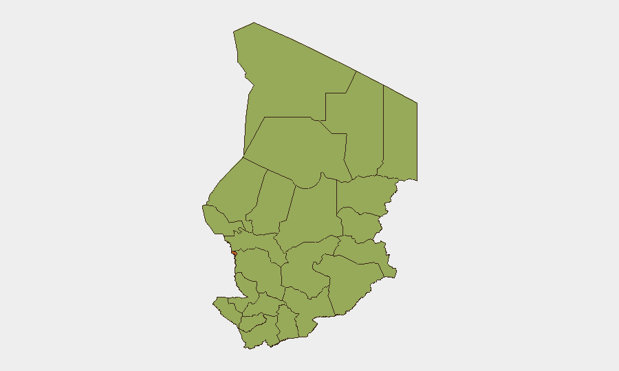
Situation Summary
Chad remains a Level 4 "Do Not Travel" jurisdiction, driven by persistent terrorism, armed-group activity, violent crime, and border instability rather than acute escalations. The most recent 24–48-hour monitoring cycle (through 2026-07-22) shows no verified major new security, conflict, or civil-unrest incidents—a relative quiet period within an otherwise high-baseline threat environment. N'Djamena (composite risk 75.8) dominates the national risk profile, while eleven peripheral regions cluster at moderate risk (45.8), primarily due to terrorist and militant operations in Lake Chad and Sahel zones. The overall threat trajectory remains stable but structurally elevated.
Key Developments
- No major new incidents verified in Chad within the last 24–48 hours (as of 2026-07-22). Open-source and consolidated security bulletins explicitly document a quiet period; ongoing risk is driven by persistent structural factors rather than fresh acute events.
- Recent but pre-48h context (Lake Chad region, Lac Province, ~16 July): Boko Haram fighters attacked fishermen near Bagassola, killing 7 civilians and 10 jihadists; Chadian anti-terrorist units responded. This represents the latest clearly documented armed-violence event but falls outside the strict 24–48-hour window.
- Recent but pre-48h context (Sarh, Moyen-Chari Province, 17 July): A security operation arrested three armed suspects following days of local disturbance in the Kemian neighborhood, restoring calm. Two detainees were armed.
- Recent but pre-48h context (N'Djamena, Camp 27 corridor, 15 July, ~22:00): A motorcyclist in his twenties was assaulted by unidentified attackers near Camp 27; camp sentinels assisted and police evacuated him to the Central Hospital. The incident prompted local criticism of security measures around the camp.
- Nationwide travel advisory remains "Do Not Travel" due to terrorism, kidnapping, and violent-crime risks; official emergency contacts and police-reporting procedures remain in effect.
Highest-Risk Areas
N'Djamena dominates the national risk landscape at 75.8 composite score—more than 60% higher than any peripheral region—reflecting its status as the capital, administrative hub, and flashpoint for urban crime, armed-group penetration, and militant activity. The eleven outlying regions (Ennedi-Ouest, Wadi Fira, Ouaddaï, Sila, Salamat, East Ennedi, Kanem, Lac, Hadjer-Lamis, Chari-Baguirmi, and Tibesti) cluster at 45.8, driven primarily by terrorist and armed-group operations in Lake Chad and the Sahel frontier zones. Lac Province and Ouaddaï are of particular concern due to recurring Boko Haram and affiliated-militant activity; border regions face cross-border militia incursions. Risk in peripheral zones is structurally high but less operationally dense than the capital.
How GeoBit Would Assist
Security teams monitoring Chad should employ Intel Sweep and global event feeds with multi-language OSINT (X/Twitter, Telegram, open-source bulletins) to detect emerging incidents in real time, particularly in N'Djamena and Lake Chad border zones. AOI Monitoring & Early Warning with persistent geographic watches on N'Djamena, Lac Province, and cross-border corridors will provide alerting on new armed-group activity or mass-casualty events before they escalate. Conflict & Military battle mapping and Network & Actor Analysis enable tracking of Boko Haram and militia force movements, while Routing & Network Analysis supports alternative journey planning and duty-of-care decisions for personnel in high-risk areas.
7-Day Outlook
No major escalation is expected in the coming week; the security environment is expected to remain within its current baseline of persistent but non-acute structural risk. Terrorist and armed-group activity in peripheral regions (especially Lake Chad and border zones) will likely continue at observed operational tempo. Monitor N'Djamena for urban crime and military/political signaling; any change in cross-border militia activity or Boko Haram operations should be treated as potential early warning of broader regional shift.
Highest-Risk Areas — Ranked
| # | State / Region | Risk |
|---|---|---|
| 1 | N'Djamena | 75.8 |
| 2 | Ennedi-Ouest | 45.8 |
| 3 | Wadi Fira | 45.8 |
| 4 | Ouaddaï | 45.8 |
| 5 | Sila | 45.8 |
| 6 | Salamat | 45.8 |
| 7 | East Ennedi | 45.8 |
| 8 | Kanem | 45.8 |
| 9 | Lac | 45.8 |
| 10 | Hadjer-Lamis | 45.8 |
| 11 | Chari-Baguirmi | 45.8 |
| 12 | Tibesti | 45.8 |
Sources
Previous Daily Briefs
A new Chad brief is written every day — each with its own risk map and downloadable CSV. Here's the last week; use the calendar to go further back.
📅 Browse every day by calendar →
Highlighted days have a brief. Tap a day for that day's map & analysis, or “csv” for that day's dataset ($5).
Atlas — our AI intelligence desk — emails them this snapshot personally. Nothing else, no list.