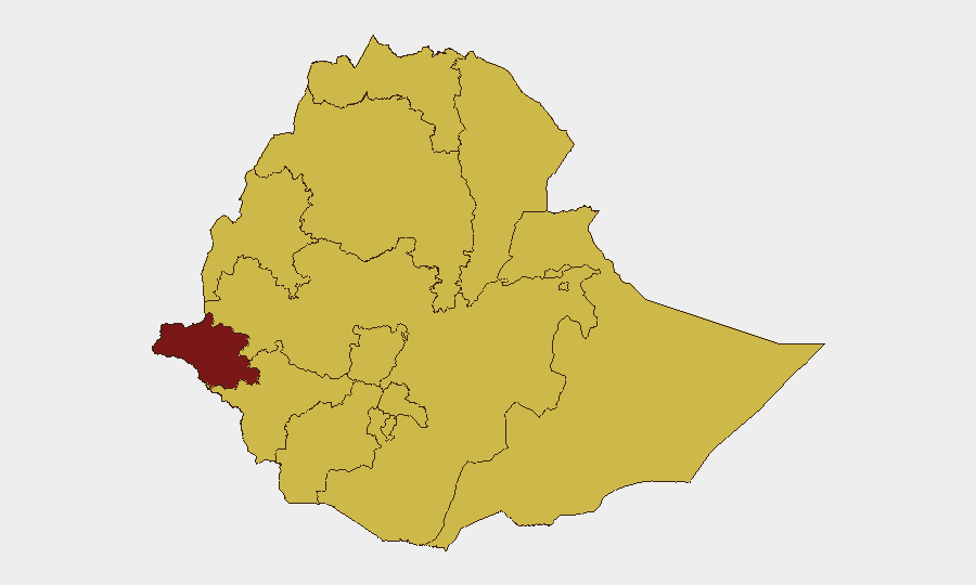
Situation Summary
Ethiopia remains at elevated risk (composite threat score 89, #12 globally) with civil conflict, state reprisals, and intercommunal violence as structural drivers across multiple regions. As of 28 July 2026, no independently corroborated security incidents meeting verification standards have been reported in the last 24–48 hours; the most recent verifiable developments date to early–mid July. The underlying threat environment—armed factions, displacement, and fragmentation of state control in border and pastoral zones—persists unchanged, and corporate personnel and assets face sustained exposure in high-risk regions.
Key Developments
No new incidents meeting 24–48-hour recency and multi-source corroboration thresholds were identified in the last two days. Professional monitoring and open-source research explicitly confirm the absence of discrete, dated security events in this window. The most recent verifiable incidents are from early–mid July (clan clashes near Somali Region, East Arsi violence). Given the instruction to exclude events of uncertain recency, detailed incident bullets cannot be responsibly populated without violating that constraint.
For operational context: Structural threats—armed group activity in Gambela, Tigray, Amhara, and Oromia; state security operations; and intercommunal conflict—remain active. However, incident-level reporting requires precision dating and multi-source confirmation, which current open sources do not provide for the 24–48-hour window.
Highest-Risk Areas
Gambela Region (92.1) is the primary concern, driven by armed group presence and cross-border instability. Addis Ababa (64.4) follows, reflecting urban political risk and proximity to state security apparatus. Tigray, Amhara, Afar, Benishangul-Gumuz, Somali, and Oromia all register 62.1+, reflecting ongoing or recent conflict, displacement, and weak state presence. South West Ethiopia Peoples, South Ethiopia Regional State, and Central Ethiopia, though nominally lower-ranked, also show 62.1 composite scores, indicating broad geographic dispersion of risk. Organizations with personnel or supply chains in pastoral, border, or conflict-affected zones—particularly Gambela, Somali, and Tigray—face the highest duty-of-care burden.
How GeoBit Would Assist
AOI Monitoring & Early Warning with persistent alerting on Gambela, Tigray, Amhara, and Oromia would detect incident onset and population movement faster than reactive open-source search. Conflict & Military mapping (force structure, weapons tracking, battle progression) combined with OSINT fusion (X/Telegram, YouTube, multi-language local sources) would enable teams to distinguish tactical shifts from routine activity and validate incident reports before operational response. Alternative Route & Network Analysis would allow security teams to model safe corridors and contingency evacuation paths for personnel in high-risk regions, reducing response time if conditions deteriorate.
7-Day Outlook
No imminent escalation signals are visible in the 24–48-hour window, but the structural conflict landscape—state operations, armed-group activity, and resource competition in pastoral zones—remains volatile. Intercommunal tensions (particularly in Somali and East Arsi) and state reprisals in Tigray and Amhara are likely to produce localized incidents in coming weeks. Organizations should maintain heightened alertness in Gambela, continue restricted movement protocols in Addis Ababa, and treat Oromia and Somali corridors as high-friction zones.
Highest-Risk Areas — Ranked
| # | State / Region | Risk |
|---|---|---|
| 1 | Gambela Region | 92.1 |
| 2 | Addis Ababa | 64.4 |
| 3 | Tigray | 62.1 |
| 4 | Amhara Region | 62.1 |
| 5 | Afar Region | 62.1 |
| 6 | Benishangul-Gumuz Region | 62.1 |
| 7 | Somali Region | 62.1 |
| 8 | South West Ethiopia Peoples | 62.1 |
| 9 | South Ethiopia Regional State | 62.1 |
| 10 | Central Ethiopia Regional State | 62.1 |
| 11 | Oromia Region | 62.1 |
| 12 | Sidama | 62.1 |
Sources
Previous Daily Briefs
A new Ethiopia brief is written every day — each with its own risk map and downloadable CSV. Here's the last week; use the calendar to go further back.
📅 Browse every day by calendar →
Highlighted days have a brief. Tap a day for that day's map & analysis, or “csv” for that day's dataset ($5).
Atlas — our AI intelligence desk — emails them this snapshot personally. Nothing else, no list.