Situation Summary
France faces a converging multi-hazard threat environment driven by an unprecedented heatwave (49 departments under red alert as of July 30) and a major wildfire in Gironde affecting ~84,000 residents and potentially France's largest peacetime evacuation. Urban security concerns persist, with a knife attack in Paris on July 27 signalling continued violent-crime risk in major transit hubs. Overall threat ranking remains moderate (#99 globally, composite score 8), but regional concentration in Nouvelle-Aquitaine and Île-de-France creates acute duty-of-care exposure for corporate operations.
Key Developments
- Gironde (southwest France) – July 30 – Authorities allowed partial resident return to nine towns (Mios, Le Barp, Cestas, Saint-Jean-d'Illac and others) affecting ~84,000 people; simultaneously ordered evacuation of ~4,000 from Atlantic-coast tourist sites near Lège-Cap Ferret as wildfire remains volatile across ~420 km² burned area.
- Southwest France – July 29–30 – Météo-France confirmed historic heatwave with record 49 departments under red alert and 40 under orange alert since system inception; directly driving wildfire propagation, infrastructure strain, and health/security cascades across much of the country.
- Paris, Porte de Clichy – July 27 – Male attacker with two kitchen knives wounded three women (ages 19, 24, 36) at ~11:30 a.m. in northwest Paris; two critically injured (lower back, abdomen), all hospitalised; bystanders and off-duty officer subdued perpetrator; national anti-terror prosecutor monitoring for possible political/terror nexus.
- France, national – July 30 – UK diplomatic mission updated travel advisory referencing wildfires and established dedicated public information line for Gironde fires (09:00–17:00 local); signals elevated foreign-visitor disruption and heightened official concern over travel logistics.
- Southwest France, wildfire response – July 30 (ongoing) – Military aircraft deployed dropping flame retardant; substantial civil-protection and security-asset mobilisation diverts resources from routine operations, reducing regional resilience elsewhere.
Highest-Risk Areas
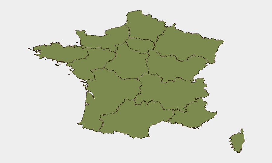
Nouvelle-Aquitaine (risk 31.8) dominates the risk landscape, driven almost entirely by the active Gironde wildfire, evacuation disruption, and infrastructure impact on southwest France. Île-de-France (risk 23.3) reflects persistent urban-security concerns including the Porte de Clichy knife attack and routine Paris metropolitan crime/protest dynamics. Together these two regions account for the majority of tracked-event concentration. Mid-tier regions (Centre-Val de Loire, Bourgogne–Franche-Comté, Hauts-de-France) show moderate civil-unrest and localised event activity but pose lower operational risk to most corporate footprints. The heatwave alert pattern is national, but southwest and central zones face the highest compounding hazard from simultaneous heat + wildfire + evacuation.
How GeoBit Would Assist
AOI Monitoring & Early Warning would track Gironde wildfire perimeter, evacuation zones, and re-entry timelines in real time, alerting security teams to short-notice road closures or transport disruption affecting personnel or supply chains. Routing & Network Analysis would model alternative transport corridors and identify safe transit windows around the affected zone, critical for duty-of-care compliance in the region. Multi-language OSINT fusion (social media, local authority feeds, transport operator updates) would aggregate evacuation orders, health alerts, and infrastructure status changes faster than traditional news cycles, enabling proactive staff notification and asset repositioning.
7-Day Outlook
Heatwave conditions and elevated wildfire risk are forecast to persist through early August; Gironde fire stabilisation remains uncertain pending wind/temperature shifts, meaning evacuation orders could expand or compress within 48–72 hours. Urban crime in Paris and other major metros will likely remain at baseline elevated levels; no major incident spike is indicated, but transport hubs warrant continued awareness. Corporate travel and logistics planners should assume southwest France corridor disruption through at least August 2.
Highest-Risk Areas — Ranked
| # | State / Region | Risk |
|---|---|---|
| 1 | Nouvelle-Aquitaine | 31.8 |
| 2 | Ile-de-France | 23.3 |
| 3 | Centre-Val de Loire | 6.4 |
| 4 | Bourgogne – Franche-Comté | 4.9 |
| 5 | Hauts-de-France | 4.2 |
| 6 | Provence-Alpes-Côte d'Azur | 3.8 |
| 7 | Grand Est | 3.6 |
| 8 | Pays de la Loire | 2.1 |
| 9 | Occitania | 2.1 |
| 10 | Brittany | 1.9 |
| 11 | Auvergne-Rhône-Alpes | 1.9 |
| 12 | Normandy | 1.8 |
Sources
Previous Daily Briefs
A new France brief is written every day — each with its own risk map and downloadable CSV. Here's the last week; use the calendar to go further back.
📅 Browse every day by calendar →
Highlighted days have a brief. Tap a day for that day's map & analysis, or “csv” for that day's dataset ($5).
Atlas — our AI intelligence desk — emails them this snapshot personally. Nothing else, no list.