Situation Summary
Nepal's composite threat score remains moderate (#155 globally, score 3), but a sharp escalation of communal violence in the eastern Terai has created acute localized risk as of July 30–31, 2026. Koshi Province—particularly Sunsari District—is experiencing active clashes between Hindu and Muslim communities, with at least one civilian death, police firing, arson, road blockades, and Nepal Army deployment. The unrest has spread to neighboring Madhesh Province districts (Saptari, Dhanusha, Siraha) and persists despite indefinite curfew orders, indicating containment challenges and command-level vulnerabilities in border security.
Key Developments
- Sunsari District communal violence and army deployment (July 30–31): Active clashes in Kaptanganj, Dewanganj RM-3, and Inaruwa have resulted in at least one civilian fatality, over 20 injured (13 security personnel), arson, looting, and road blockades along the East–West Highway. Nepal Army units with armoured vehicles and additional police reinforcements were deployed; indefinite curfew imposed covering the highway from Pakali Chowk to Koshi Barrage bridge, 200m buffer on both sides.
- East–West Highway curfew expansion (July 30): Sunsari District Administration widened movement restrictions on major national highway corridor, banning all gatherings, demonstrations, and general movement in designated zones. Violations subject to legal action; significant disruption to transit and commerce anticipated.
- Communal unrest spread to Madhesh Province (July 31): Following Sunsari clashes, authorities imposed indefinite curfew in Saptari District (including Rajbiraj municipality), Dhanusha, and Siraha. At least three deaths and dozens injured reported over four days across all affected Terai districts near India border.
- Curfew defiance and secondary protests (July 30–31): Hundreds of demonstrators gathered in Kaptanganj despite restrictions, burning tyres, blocking roads, and vandalising local businesses (pharmacy, shops, repair facilities). Riot-control teams deployed from other Koshi Province districts; district-wide rather than localized unrest evident.
- Highway spillover incidents (July 30–31): Road blockades and demonstrations reported in Laukahi and Phool Chowk; East–West Highway transit severely disrupted during 24-hour period, affecting regional commerce and civilian movement.
- Central Security Committee convened (July 30–31): Government response initiated in Kathmandu; Home Minister and Armed Police Force leadership came under scrutiny over "command vacuum" in border security—eight APF battalion commanders not appointed after tenure expiration, exposing capacity gaps in crisis management.
- Formal investigation launched (July 30–31): Ministry of Home Affairs constituted five-member probe committee (led by Joint Secretary Bhupendra Thapa) to examine communal violence and security-force firing; report due within one week.
- Concurrent road-safety crisis: Nepal Police reported seven deaths and 105 injuries from traffic accidents in past 24 hours nationwide, compounding mass-casualty risk during monsoon season.
Highest-Risk Areas
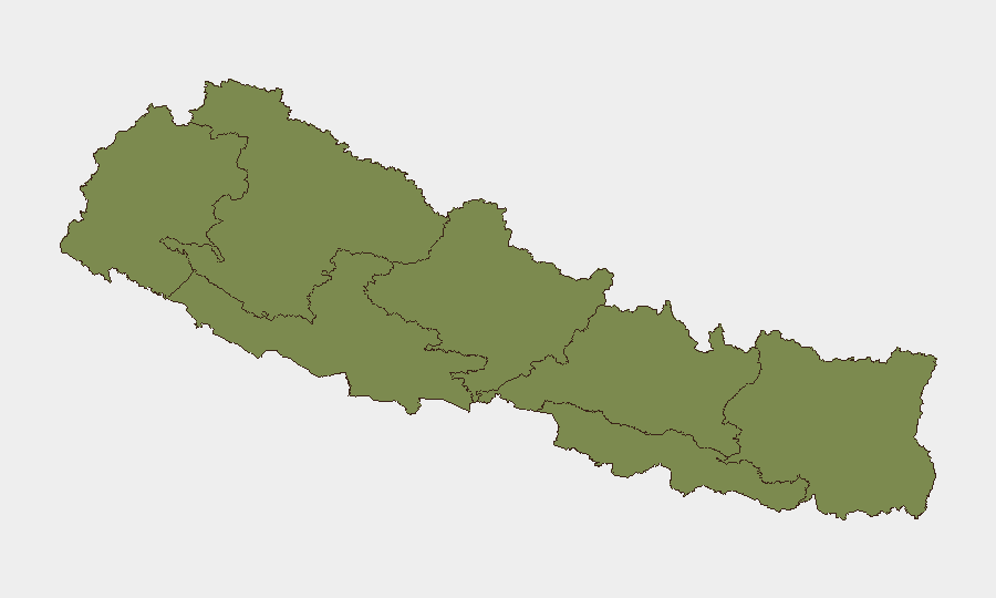
Koshi Province (risk 31.4) dominates the threat landscape, driven entirely by active communal violence and security-force operations in Sunsari District. Bagamati Province (11.9) ranks second, likely reflecting political instability and administrative risk in Kathmandu region. Madhesh Province (9.4) has rapidly escalated due to spread of Sunsari clashes into border-adjacent Terai districts. Western provinces (Sudurpashchim, Karnali, Lumbini) remain relatively stable at 1.4 each. The Terai corridor (Koshi + Madhesh) is the active crisis zone; all corporate and duty-of-care teams with personnel on or near the East–West Highway should assume heightened risk through at least early August.
How GeoBit Would Assist
GeoBit's AOI Monitoring & Early Warning and Routing & Network Analysis capabilities enable real-time alerts on curfew zones, road blockades, and alternative transit corridors for supply chains and personnel movement. Intel Sweep, OSINT fusion, and sentiment analysis on Telegram, Twitter, and local media provide 24–48 hour lead time on secondary protest spread and security deployments. GIS & Spatial Analysis coupled with conflict event mapping clarify which districts and highway segments remain passable and which face imminent closure.
7-Day Outlook
Unless curfew enforcement and community mediation produce rapid de-escalation, Sunsari and adjacent Terai districts will likely remain under movement restrictions through early August, with secondary protests possible in larger Terai towns. East–West Highway transit risk will remain elevated for at least 5–7 days. Government investigation and compensation pledges may stabilize sentiment by mid-August, but institutional command gaps in border security suggest slower underlying resolution.
Highest-Risk Areas — Ranked
| # | State / Region | Risk |
|---|---|---|
| 1 | Koshi Province | 31.4 |
| 2 | Bagamati Province | 11.9 |
| 3 | Madhesh Province | 9.4 |
| 4 | Gandaki Province | 6.6 |
| 5 | Sudurpashchim Province | 1.4 |
| 6 | Karnali Province | 1.4 |
| 7 | Lumbini Province | 1.4 |
Sources
Previous Daily Briefs
A new Nepal brief is written every day — each with its own risk map and downloadable CSV. Here's the last week; use the calendar to go further back.
📅 Browse every day by calendar →
Highlighted days have a brief. Tap a day for that day's map & analysis, or “csv” for that day's dataset ($5).
Atlas — our AI intelligence desk — emails them this snapshot personally. Nothing else, no list.