Situation Summary
Syria remains in the #15 global threat position (composite score 89) with civil conflict as the primary driver across 364 tracked events. The capital Damascus is experiencing a marked spike in coordinated IED attacks and subsequent security crackdowns, signaling either a breakdown in counterterrorism capacity or a deliberate escalation by opposition cells. Concurrent detention sweeps in Hama and ongoing UXO hazards in eastern sectors reflect a state security apparatus in reactive posture across multiple fronts.
Key Developments
- Damascus – Central district IED attacks (July 7, 2026): Two IED blasts near the Ministry of Tourism and Justice Palace area injured one deputy minister, four police officers, and 13+ civilians; a separate café bombing in Hijaz district killed 10 civilians and wounded 21. Attacks described as exposing a capital-level security vacuum.
- Damascus – Security operations and mass arrests (July 8–9, 2026): Syrian authorities arrested multiple suspects allegedly linked to the July 7 IED incidents and framed as IS-affiliated cells. Detentions accompanied by intensified checkpoints, street closures, and visible military deployments near key government buildings.
- Sahl al-Ghab, Hama – Anti-government cell dismantled (July 5, 2026): Ministry of Interior announced detention of seven insurgents described as forming an assassination cell; follow-on sweeps reported ongoing through July 9, indicating broader counter-insurgency operations in the region.
- Uqayribat, eastern Hama – UXO casualty (July 6, 2026): Ministry of Defense engineer injured when attempting to render safe an unexploded landmine. Clearance operations and residual ordnance hazard remain active in the sector.
- Citywide curfew and movement restrictions (July 8–9, 2026): Post-blast security measures include expanded surveillance, military presence intensification, and sporadic curfews in sensitive Damascus districts; implications for staff commute and asset movement routines.
Highest-Risk Areas
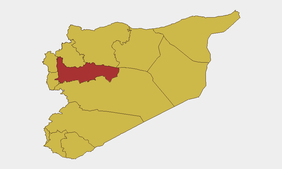
Damascus Governorate (92.1) dominates the sub-national ranking, driven by the July 7–9 bombing campaign and resulting security operations that have created both acute attack risk and elevated checkpoint/detention exposure. Hama Governorate (77.6) ranks second due to concurrent detection of organized anti-government cells and active UXO clearance requirements. Ar-Raqqa and Aleppo (65.1 and 62.8 respectively) reflect ongoing residual conflict-zone conditions. The cluster of governorates at 62.1 (Lattakia, Tartus, UNDOF, Al-Quneitra, Dar'a, Idleb, Homs, Rif Dimashq) indicates persistent baseline civil-conflict risk across the periphery.
How GeoBit Would Assist
Security teams with personnel or assets in Syria should leverage AOI Monitoring & Early Warning to track Damascus districts in real time and receive automated alerts on police mobilization, checkpoints, and curfew announcements. Intel Sweep and multi-language OSINT fusion (X, Telegram, Arabic media) enable continuous tracking of claimed cell dismantling operations and security narrative shifts to anticipate sweep cycles and detention risk. Routing & Network Analysis can model alternative commute and supply routes around active cordoned areas and checkpoints to minimize staff exposure to secondary incidents or security sweeps.
7-Day Outlook
The Damascus IED campaign and state response are likely to persist through mid-July, with additional arrests and checkpoints expected as authorities pursue remaining suspects. Risk of secondary attacks or copycat bombings remains elevated given the security vacuum narrative in open reporting. Travel delays, checkpoint denials, and temporary movement restrictions should be anticipated as routine; further escalation in Hama or spillover to other governorates would elevate the composite score materially.
Highest-Risk Areas — Ranked
| # | State / Region | Risk |
|---|---|---|
| 1 | Damascus Governorate | 92.1 |
| 2 | Hama Governorate | 77.6 |
| 3 | Ar-Raqqa Governorate | 65.1 |
| 4 | Aleppo Governorate | 62.8 |
| 5 | Lattakia Governorate | 62.1 |
| 6 | Tartus Governorate | 62.1 |
| 7 | UNDOF | 62.1 |
| 8 | Al-Quneitra Governorate | 62.1 |
| 9 | Dar'a Governorate | 62.1 |
| 10 | Idleb Governorate | 62.1 |
| 11 | Homs Governorate | 62.1 |
| 12 | Rif Dimashq Governorate | 62.1 |
Sources
Previous Daily Briefs
A new Syria brief is written every day — each with its own risk map and downloadable CSV. Here's the last week; use the calendar to go further back.
📅 Browse every day by calendar →
Highlighted days have a brief. Tap a day for that day's map & analysis, or “csv” for that day's dataset ($5).
Atlas — our AI intelligence desk — emails them this snapshot personally. Nothing else, no list.