Situation Summary
Angola remains stable with a composite threat ranking of #52 globally and no credible reports of armed conflict, civil unrest, major crime waves, or infrastructure failures in the past 24–48 hours. The security environment is characterized as routine rather than acute, with risk concentrated in specific sub-national jurisdictions rather than driven by nationwide incidents. Luanda Province dominates the risk profile, while northern and eastern border regions face chronic structural challenges related to illicit resource activity and law-enforcement gaps.
Key Developments
- Angola-wide, 27–28 July 2026 – Multi-source open-source security feeds report no corroborated armed clashes, terrorist attacks, major protests, or nationally significant crime incidents in the last 24–48 hours; no events targeting expatriates or strategic assets have been documented.
- Angola-wide, 27–28 July 2026 – No major infrastructure failures (national power grid, airports, ports) impacting travel or operations at national scale during the last 24–48 hours; routine localized outages do not meet significance threshold.
- Luanda, Luanda Province, late July 2026 (ongoing) – The capital remains stable with baseline urban crime and routine policing; no new reports in the last 24–48 hours of mass crime incidents, civil unrest, or security operations affecting foreigners or key business districts beyond normal levels.
- Northern and eastern border provinces, late July 2026 (ongoing) – Resource-rich zones (Lunda Norte, Lunda Sul, Cabinda, Zaire) remain the primary structural risk concentration owing to illicit mining, smuggling, and law-enforcement challenges; no new armed clashes or escalations reported in the last 24–48 hours.
- Angola-wide, late July 2026 (ongoing) – Seasonal wildfire activity persists across northern and eastern provinces, causing localized air-quality issues and temporary secondary-road closures; no new reports in the last 24–48 hours of fires triggering evacuations, fatalities, or major transport disruption.
- Luanda, 22 July 2026 (judicial/backdrop context, not current incident) – An Angolan court sentenced two Russian nationals to 8 and 11 years' imprisonment for terrorism and espionage linked to unrest during taxi-driver protests in July 2025; this judicial outcome does not correspond to fresh unrest in the assessment window.
Highest-Risk Areas
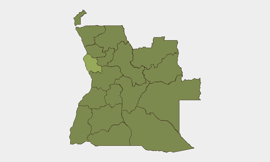
Luanda Province (risk score 53.4) is the dominant risk driver, reflecting capital-city concentration of crime, civil unrest potential, and operational visibility. The remaining eleven ranked provinces (Lunda Norte, Lunda Sul, Cabinda, Zaire, Bengo, Uíge, Cuanza Norte, Cuanza Sul, Malanje, Bié, Moxico) cluster at risk score 23.4, indicating relatively homogeneous secondary-tier risk. Northern and eastern border regions—particularly the Lunda provinces and Cabinda—sustain elevated baseline risk owing to illicit diamond and mineral extraction, transnational smuggling networks, and weak state capacity rather than acute recent incidents.
How GeoBit Would Assist
Security teams operating in Angola would leverage AOI Monitoring & Early Warning to establish persistent watch over Luanda and border provinces, triggering alerts on labor unrest, protest activity, or criminal incidents affecting expatriate presence or supply chains. Intel Sweep and multi-language OSINT fusion would track social media, local news, and open-source feeds to detect emerging civil tensions or cross-border trafficking activity before escalation. Routing & Network Analysis would support contingency planning and alternative-route identification should localized unrest or wildfire activity disrupt primary transport corridors.
7-Day Outlook
The security environment is expected to remain stable over the next seven days absent significant external shocks or labor-sector escalation. Seasonal wildfire activity will likely continue in northern and eastern provinces with localized air and transport impact. Chronic border-region challenges will persist as baseline risk; no indicators suggest imminent acute deterioration.
Highest-Risk Areas — Ranked
| # | State / Region | Risk |
|---|---|---|
| 1 | Luanda Province | 53.4 |
| 2 | Lunda Norte Province | 23.4 |
| 3 | Lunda Sul Province | 23.4 |
| 4 | Cabinda Province | 23.4 |
| 5 | Zaire Province | 23.4 |
| 6 | Bengo Province | 23.4 |
| 7 | Uíge Province | 23.4 |
| 8 | Cuanza Norte Province | 23.4 |
| 9 | Cuanza Sul Province | 23.4 |
| 10 | Malanje Province | 23.4 |
| 11 | Bié Province | 23.4 |
| 12 | Moxico Province | 23.4 |
Sources
Previous Daily Briefs
A new Angola brief is written every day — each with its own risk map and downloadable CSV. Here's the last week; use the calendar to go further back.
📅 Browse every day by calendar →
Highlighted days have a brief. Tap a day for that day's map & analysis, or “csv” for that day's dataset ($5).
Atlas — our AI intelligence desk — emails them this snapshot personally. Nothing else, no list.