Situation Summary
Canada remains a relatively stable operating environment (global rank #151, composite threat score 4), but is experiencing acute operational challenges across multiple threat vectors: active wildfire incidents affecting air quality and population displacement in Ontario and British Columbia, a recent mass shooting linked to gang activity in Toronto, and organized crime enforcement activity. Ontario and British Columbia together account for over 70% of tracked domestic threat events, driven primarily by environmental hazards and urban violence. The overall risk trajectory is elevated but localized.
Key Developments
- Toronto, Ontario (July 16) – Mass shooting at a street festival in northwest Toronto killed at least 2 people and wounded multiple others; police report several suspects remain at large and are investigating suspected gang involvement. This represents an acute violent crime incident in Canada's largest metropolitan area.
- Namaygoosisagagun First Nation, Northwestern Ontario (July 16) – A wildfire spanning over 350,000 hectares has destroyed the community with extensive infrastructure loss and population displacement; emergency response and firefighting operations are ongoing.
- Greater Toronto Area, Ontario (July 16) – Orange-level air quality warning issued due to wildfire smoke; Environment Canada has advised residents, particularly those with respiratory or cardiac conditions, to restrict outdoor activity.
- Pemberton, British Columbia (July 16) – An out-of-control wildfire near Pemberton has triggered evacuation alerts for the village with officials warning of rapidly changing fire conditions and potential expansion of evacuation orders.
- Jasper National Park, Alberta (July 16) – A popular hiking trail has been closed following a close encounter between a hiker and a grizzly bear; Parks Canada has implemented access restrictions and issued warnings regarding heightened wildlife activity.
- Windsor, Ontario (July 16) – A court conviction of Daniel Gerow on 10 charges related to torture and confinement of homeless individuals raises current concerns about violent crime severity and sentencing practices in the region.
Highest-Risk Areas
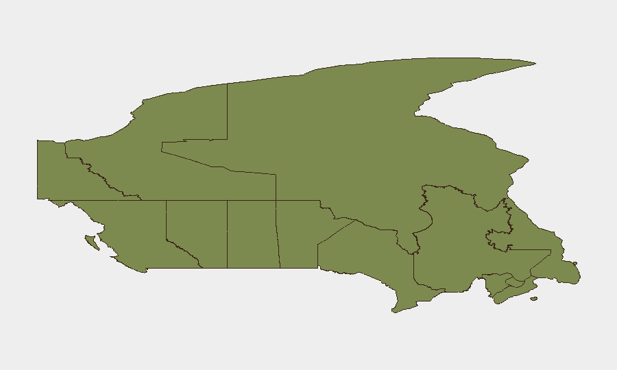
Ontario (risk 31.9) and British Columbia (risk 27.7) drive the majority of tracked threat activity. Ontario's elevated score reflects a concentration of urban violence (gang-related shootings, organized crime enforcement), environmental hazards (wildfires, air quality degradation), and population density that amplifies incident exposure. British Columbia similarly faces significant wildfire risk with active evacuation operations. Nunavut (risk 26), despite lower population density, shows elevated composite risk likely driven by environmental and logistical vulnerabilities. Alberta, Quebec, and Manitoba pose substantially lower but measurable risk profiles.
How GeoBit Would Assist
Security teams with personnel or assets in Canada should employ AOI Monitoring & Early Warning to track active wildfire zones and air quality developments in Ontario and British Columbia with persistent alerts for operational disruption. Intel Sweep and multi-language OSINT capabilities enable continuous monitoring of gang activity, organized crime enforcement operations, and public safety incidents in high-risk urban corridors (GTA, Metro Vancouver). Environmental & Health data modules provide real-time tracking of air quality warnings and evacuation orders affecting site operations and personnel welfare.
7-Day Outlook
Wildfire conditions across Ontario and British Columbia are expected to persist, with smoke dispersion affecting air quality in populated regions and continued evacuation risk in western communities. Urban crime activity in Toronto and organized crime enforcement operations will likely remain at elevated operational awareness levels. Overall risk trajectory remains localized but acute across environmental and public safety domains.
Highest-Risk Areas — Ranked
| # | State / Region | Risk |
|---|---|---|
| 1 | Ontario | 31.9 |
| 2 | British Columbia | 27.7 |
| 3 | Nunavut | 26 |
| 4 | Alberta | 9.8 |
| 5 | Quebec | 8.1 |
| 6 | Manitoba | 7.2 |
| 7 | Saskatchewan | 5.2 |
| 8 | Prince Edward Island | 4.7 |
| 9 | New Brunswick | 3.1 |
| 10 | Nova Scotia | 2.3 |
| 11 | Yukon | 1.9 |
| 12 | Northwest Territories | 1.9 |
Previous Daily Briefs
A new Canada brief is written every day — each with its own risk map and downloadable CSV. Here's the last week; use the calendar to go further back.
📅 Browse every day by calendar →
Highlighted days have a brief. Tap a day for that day's map & analysis, or “csv” for that day's dataset ($5).
Atlas — our AI intelligence desk — emails them this snapshot personally. Nothing else, no list.