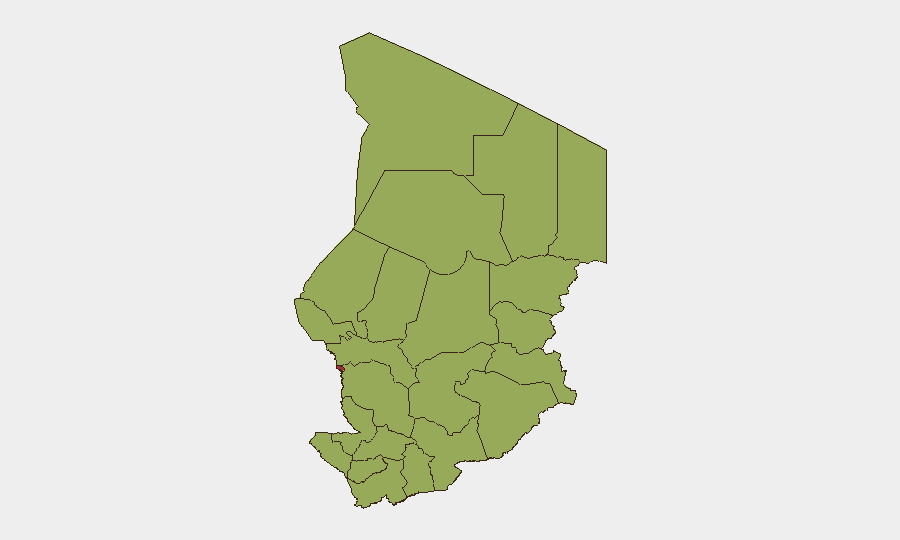
Situation Summary
Chad remains at composite threat level 70 (global rank #30), with baseline risks of transnational militancy, smuggling, and sporadic banditry persisting across most regions. No confirmed armed clashes, civil unrest, or major crime incidents have been independently verified on Chadian territory within the last 24–48 hours. A suspected drone strike originating from Sudanese territory near the Bamina region (eastern Chad, near Sudan border) in late July reportedly resulted in civilian casualties and market damage, but Chadian authorities have neither confirmed nor denied the incident, leaving its precise timing and impact unverified.
Key Developments
- N'Djamena – 2026-07-25 (concurrent)
Public statements and government–military-related arrest/detention activities reported; no confirmed operational security incidents within the capital in the last 24 hours.
- N'Djamena/National – 2026-07-24
Government and military-related public statements and one arrest/detention event involving government and army personnel; civil–community tension signaled in a separate public statement; one U.S.–Chad-related arrest/detention event recorded.
- Chad–Nigeria border region – 2026-07-23
Multiple conventional military force movements reported between Chad and Nigeria; nature and scale of deployment not yet clarified by open sources.
- Bamina area, eastern Chad (Sudan border) – circa 2026-07-21 (unconfirmed timing)
Chadian local media reports allege a drone originating from Sudanese territory struck a vehicle near Bamina, killing civilians and damaging a local market; Chadian authorities have not officially confirmed or denied the report.
- Chad-wide – health advisory
Hepatitis E case activity noted in recent epidemiological monitoring; impact scope and current caseload not detailed in 24–48h reporting.
*Note: Open-source security reporting for Chad in the last 24–48 hours contains few independently confirmed acute incidents. The above reflects available timestamped signals; unconfirmed reports (e.g., the Bamina drone strike) are included for situational awareness but should not be treated as verified facts for operational planning.*
Highest-Risk Areas
N'Djamena dominates the risk profile (79.3), driven by capital-level political dynamics, government–military tensions, and transnational security actors. A broad band of eastern and northern regions—Ennedi-Ouest, Wadi Fira, Ouaddaï, Sila, Salamat, East Ennedi, Kanem, Lac, Hadjer-Lamis, Chari-Baguirmi, and Tibesti—each score 49.3, reflecting persistent exposure to cross-border militancy, smuggling networks, and the Sudan–Chad border volatility (especially Bamina and surrounding areas). The eastern corridor and border zones warrant elevated monitoring given the unconfirmed Sudanese drone activity and conventional military movements near the Nigeria frontier.
How GeoBit Would Assist
Security teams should deploy AOI Monitoring & Early Warning on N'Djamena and the eastern border corridor (Bamina, Ennedi, Ouaddaï) to detect rapid escalation in militancy, trafficking, or cross-border strikes. Intel Sweep, multi-language OSINT, and Telegram/X monitoring enable near-real-time detection of unconfirmed incidents (e.g., the Bamina strike) and official denials, supporting rapid duty-of-care decisions. Conflict & Military force-structure tracking and Network & Actor Analysis help distinguish routine military repositioning (Chad–Nigeria) from destabilization moves. Routing & Network Analysis supports evacuation and alternative logistics planning should N'Djamena or eastern zones deteriorate.
7-Day Outlook
Political and military dynamics in N'Djamena will likely remain fluid; arrest/detention activity and public statements suggest ongoing institutional friction that could produce policy or security posture shifts. The Sudan–Chad border, particularly the eastern regions, faces sustained risk from transnational actors and unconfirmed hostile fire; a pattern of unacknowledged strikes may indicate a shift in Sudanese operational tempo. No major escalation is forecasted in the next seven days, but duty-of-care teams should remain alert for sudden announcement of border closures, curfews, or military mobilization.
Highest-Risk Areas — Ranked
| # | State / Region | Risk |
|---|---|---|
| 1 | N'Djamena | 79.3 |
| 2 | Ennedi-Ouest | 49.3 |
| 3 | Wadi Fira | 49.3 |
| 4 | Ouaddaï | 49.3 |
| 5 | Sila | 49.3 |
| 6 | Salamat | 49.3 |
| 7 | East Ennedi | 49.3 |
| 8 | Kanem | 49.3 |
| 9 | Lac | 49.3 |
| 10 | Hadjer-Lamis | 49.3 |
| 11 | Chari-Baguirmi | 49.3 |
| 12 | Tibesti | 49.3 |
Sources
Previous Daily Briefs
A new Chad brief is written every day — each with its own risk map and downloadable CSV. Here's the last week; use the calendar to go further back.
📅 Browse every day by calendar →
Highlighted days have a brief. Tap a day for that day's map & analysis, or “csv” for that day's dataset ($5).
Atlas — our AI intelligence desk — emails them this snapshot personally. Nothing else, no list.