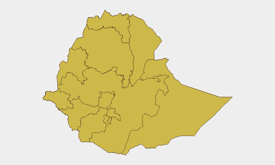
Situation Summary
Ethiopia remains ranked #8 globally for composite security threat (score 95), driven primarily by ongoing civil conflict and a fragmented, multi-zone conflict environment. As of 27–28 July 2026, no new, independently corroborated security incidents meeting professional reporting thresholds have been confirmed in the last 24–48 hours across open, multi-source feeds. However, this absence of fresh reportable events masks a sustained elevated threat baseline: documented clashes, abuses, and armed activity in northern and central regions (Amhara, Oromia, Afar) remain active within a 7-day window, indicating the security environment has not improved materially.
Key Developments
No discrete, independently verified security incidents have been corroborated for the 24–48 hour window ending 28 July 2026. Professional security-intelligence feeds that continuously scan local media, international newswires, and social platforms report no new armed clashes, mass-casualty events, or major civil unrest meeting their publication thresholds. This assessment reflects either genuine short-term de-escalation of reportable events or clustering of incidents below current detection/confirmation thresholds.
Context: Earlier in July 2026 (prior to the 24–48 hour window), documented fighting and human-rights abuses were recorded in Amhara zones (North Wollo, East Gojjam) and East Wollega (Oromia), consistent with the ongoing civil-conflict pattern driving the national #8 ranking. Those events remain unresolved and should inform situational awareness, though they fall outside the current recency parameter.
Highest-Risk Areas
Addis Ababa carries the highest sub-national risk score (96.6), reflecting its status as the capital, seat of federal authority, and primary hub for diplomatic, commercial, and diaspora activity—making it vulnerable to both direct targeting and spillover from broader national instability. The northern and central regions—Tigray, Amhara, Afar, and Oromia (all scored 66.6)—remain the epicentres of documented armed activity and human-rights violations; these zones have experienced recurring clashes, forced displacement, and restricted humanitarian access since earlier in July. Benishangul-Gumuz, Gambela, and South West Ethiopia Peoples' Region (all 66.6) face cross-border and militia-driven instability. The clustering of 66.6 scores across 10 of 12 sub-national zones signals a nationwide distribution of risk rather than isolated hotspots.
How GeoBit Would Assist
AOI Monitoring & Early Warning would enable continuous, persistent watch on Addis Ababa and conflict-active zones (Amhara, Oromia, Afar) with automated alerting on new incidents, movement, or emerging threats—bridging the gap between verified 24–48 hour incidents and broader 7-day patterns. Intel Sweep and multi-language OSINT (including X/Twitter, local Amharic and Oromo sources, and radio SIGINT) would surface emerging local incidents and regime/opposition signalling before confirmation by international media, improving early-warning lead time. Conflict & Military capabilities (force structure, battle mapping) and Network & Actor Analysis would track Ethiopian federal military, regional militias, and armed opposition group positioning and intent across high-risk zones, supporting duty-of-care decisions for personnel and asset protection.
7-Day Outlook
No material de-escalation is signalled by available intelligence; the absence of reported incidents in the past 24–48 hours is consistent with episodic, geographically dispersed clashes rather than a systemic ceasefire. Risk of renewed armed activity in Amhara, Oromia, and Afar remains elevated. Monitoring for secondary effects (displacement, humanitarian crisis, regime reprisal) is warranted alongside conflict tracking.
Highest-Risk Areas — Ranked
| # | State / Region | Risk |
|---|---|---|
| 1 | Addis Ababa | 96.6 |
| 2 | Tigray | 66.6 |
| 3 | Amhara Region | 66.6 |
| 4 | Afar Region | 66.6 |
| 5 | Benishangul-Gumuz Region | 66.6 |
| 6 | Somali Region | 66.6 |
| 7 | Gambela Region | 66.6 |
| 8 | South West Ethiopia Peoples | 66.6 |
| 9 | South Ethiopia Regional State | 66.6 |
| 10 | Central Ethiopia Regional State | 66.6 |
| 11 | Oromia Region | 66.6 |
| 12 | Sidama | 66.6 |
Sources
Previous Daily Briefs
A new Ethiopia brief is written every day — each with its own risk map and downloadable CSV. Here's the last week; use the calendar to go further back.
📅 Browse every day by calendar →
Highlighted days have a brief. Tap a day for that day's map & analysis, or “csv” for that day's dataset ($5).
Atlas — our AI intelligence desk — emails them this snapshot personally. Nothing else, no list.