Situation Summary
Iran remains engaged in active military operations and high-tension diplomatic exchanges following recent strikes against U.S. and coalition positions in the Gulf region. Threat signals from July 4–5 indicate a volatile state characterized by military posturing, shipping disruption threats, and public statements targeting Israel and Western powers. Tehran Province continues to dominate the risk landscape, but escalation in the Strait of Hormuz and northern border regions is driving elevated sub-national threat across multiple provinces. The trajectory remains unstable, with maritime chokepoints and military infrastructure as primary flashpoints.
Key Developments
- Strait of Hormuz (July 4): Iran's deputy foreign minister warned the U.K. and France against military activity in the strait, following their statement of intent to protect shipping through Omani waters. Iranian Supreme Leader military adviser Yahya Rahim Safavi explicitly warned that Iran could use the Strait of Hormuz and Bab al Mandeb as leverage if U.S. commitments are violated.
- Kuwait — Al Asad Air Base (July 5): Iranian forces claimed missile/drone strikes on Al Asad Air Base and Ali al-Salem base in Kuwait. U.S. and ABC reporting indicate strikes were intercepted or failed to achieve target impact; no confirmed U.S. casualties reported.
- Bahrain — Port Salman (July 5): Iran's Revolutionary Guard claimed strikes on the Fifth Fleet naval base in Port Salman, Bahrain. U.S. reports confirm no impacts or casualties at American installations.
- Shipping Disruption — Strait of Hormuz (July 2–3): At least eight vessels reversed course when attempting to exit the strait along the Omani coast, consistent with Iranian pressure on maritime transit; vessels later resumed movement through Iran's traffic separation scheme.
- Military Leadership Restructuring (July 4): ISW/CTP reporting indicates the Iranian regime is undergoing a reshuffle of senior military positions post-conflict, though specific personnel and locations remain unclear.
- Demonstration Activity (July 5): Iranian public demonstrations occurred, concurrent with military posturing and official statements, suggesting domestic mobilization around ongoing military operations.
Highest-Risk Areas
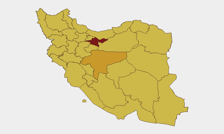
Tehran Province (risk 94) remains the epicenter of threat due to political control concentration and command authority. Isfahan, Razavi Khorasan, West and East Azerbaijan provinces (risks 66–72) form a secondary tier driven by military infrastructure, border proximity, and logistical nodes. The northern provinces (West/East Azerbaijan, North Khorasan) and western rim (Kermanshah, Ilam) face elevated risk due to cross-border military activity and proximity to Iraq and Turkey. Maritime-facing Hormozgan (risk 64.3) is acutely sensitive to Strait of Hormuz escalation and shipping interdiction operations.
How GeoBit Would Assist
Intel Sweep and OSINT Fusion would consolidate fragmented reporting on Iranian military statements, ship movements, and force repositioning into a single corroborated timeline. Maritime Tracking and AOI Monitoring with persistent alerting would flag vessel diversions, military asset movements in the Gulf, and sanctions-evasion shipping patterns in real time. Battle Mapping and Force Structure Analysis would track Iranian military unit deployments, air defense posture, and command authority realignment across provinces—critical for assessing response patterns and escalation risk.
7-Day Outlook
Immediate risk remains elevated across maritime and military domains, with the Strait of Hormuz as the most sensitive trigger point. Further Iranian claims of strikes or retaliatory action are probable if U.S. or coalition operations continue; corroboration of actual impact will be critical to assessing whether rhetoric is masking degraded capability. Watch for sustained military messaging, additional shipping incidents, and any changes in command structure or deployment patterns in northern and western border regions.
Highest-Risk Areas — Ranked
| # | State / Region | Risk |
|---|---|---|
| 1 | Tehran Province | 94 |
| 2 | Isfahan Province | 72.7 |
| 3 | Razavi Khorasan | 70 |
| 4 | West Azerbaijan Province | 69.9 |
| 5 | East Azerbaijan Province | 68.9 |
| 6 | Kermanshah Province | 66.5 |
| 7 | South Khorasan Province | 64.9 |
| 8 | Semnan Province | 64.5 |
| 9 | Hormozgan Province | 64.3 |
| 10 | Fars Province | 64.2 |
| 11 | North Khorasan Province | 64 |
| 12 | Ilam Province | 64 |
Sources
Previous Daily Briefs
A new Iran brief is written every day — each with its own risk map and downloadable CSV. Here's the last week; use the calendar to go further back.
📅 Browse every day by calendar →
Highlighted days have a brief. Tap a day for that day's map & analysis, or “csv” for that day's dataset ($5).
Atlas — our AI intelligence desk — emails them this snapshot personally. Nothing else, no list.