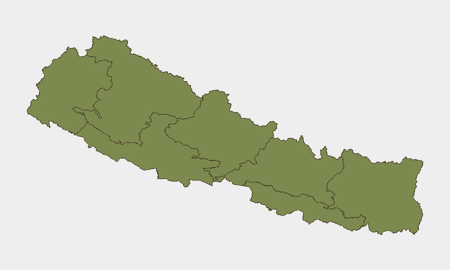
Situation Summary
Nepal is experiencing acute communal tension centred in the Terai region following Hindu–Muslim clashes in Sunsari district (July 26–27), which have claimed three lives and triggered indefinite curfews across at least four neighbouring districts. Central and local authorities have deployed military assets, established prohibitory orders, and convened national security coordination meetings, signalling sustained concern about escalation. Overall threat remains moderate at the national level, but concentrated risk in Koshi Province (composite score 31.3) reflects active unrest and security-force deployment in a volatile border-proximate zone.
Key Developments
- Sunsari district (Kaptanganj Bazaar, Inaruwa) – July 30–31: Indefinite curfew maintained; Nepal Army armored vehicles deployed and security meetings convened after communal clashes on July 26–27. Protests continued despite curfew orders.
- Rajbiraj, Saptari district – July 31: Authorities imposed an indefinite curfew from 08:00 following protests linked to communal violence in neighbouring Sunsari, restricting movement and public gatherings.
- Sarlahi district (India border) – July 31: District Security Committee mandated valid identity documents for all persons entering Nepal from India, tightening border-control measures in response to regional unrest.
- Dhanusha and Siraha districts – July 30–31: Curfews extended as officials reported difficulty containing tensions; no new violence reported but prohibitory orders remain in force.
- Central Security Committee – Kathmandu, July 31: Committee convened to review the Sunsari situation; Prime Minister issued public appeal for calm and social harmony, confirming heightened nationwide coordination.
- Nine major highways nationwide – July 30–31: Monsoon-related landslides and erosion blocked routes; at least seven fatalities and 105 injuries recorded in 24-hour cycle, severely constraining overland travel.
- Rautahat district (Gaur) – July 30–31: Police continued intensive operations including arrests of 21 convicted fugitives and drone surveillance, indicating sustained law-enforcement activity in this border-proximate zone.
Highest-Risk Areas
Koshi Province (risk 31.3) dominates the threat landscape, driven by active communal unrest in Sunsari and immediate spillover effects in adjoining Saptari, Dhanusha, and Siraha districts. The curfews, military deployment, and multi-agency security response are concentrated here. Madhesh Province (20.7) reflects broader Terai instability and porous India borders where law-enforcement operations and border-control tightening are ongoing. Gandaki and Bagamati provinces show significantly lower scores; southern and western provinces (Sudurpashchim, Karnali, Lumbini) register minimal risk at present, though national-level coordination suggests authorities are monitoring for spread.
How GeoBit Would Assist
Security teams should employ AOI Monitoring & Early Warning on Sunsari, Saptari, and Sarlahi districts to detect renewed violence or curfew escalation in real time; Intel Sweep and multi-language OSINT fusion (X, local news, police statements) to track protest activity, government directives, and curfew timings; and Routing & Network Analysis to model alternative overland transit corridors around blocked highways and border restrictions. Sentiment & temporal analysis of social media will help distinguish protest momentum from subsidence.
7-Day Outlook
Curfews are expected to remain in place through early August pending police assessments of public order. Risk of renewed communal clashes is material if curfews are perceived as discriminatory; conversely, if tensions stabilize and restrictions ease, travel and commerce should resume. Highway restoration will likely lag; alternative routes and air/rail options should be prioritized for time-sensitive movement.
Highest-Risk Areas — Ranked
| # | State / Region | Risk |
|---|---|---|
| 1 | Koshi Province | 31.3 |
| 2 | Madhesh Province | 20.7 |
| 3 | Gandaki Province | 13.2 |
| 4 | Bagamati Province | 6.3 |
| 5 | Sudurpashchim Province | 1.3 |
| 6 | Karnali Province | 1.3 |
| 7 | Lumbini Province | 1.3 |
Sources
Previous Daily Briefs
A new Nepal brief is written every day — each with its own risk map and downloadable CSV. Here's the last week; use the calendar to go further back.
📅 Browse every day by calendar →
Highlighted days have a brief. Tap a day for that day's map & analysis, or “csv” for that day's dataset ($5).
Atlas — our AI intelligence desk — emails them this snapshot personally. Nothing else, no list.