Situation Summary
Chad remains a composite-risk environment (global rank #28, score 67/100) with significant volatility concentrated in N'Djamena and a secondary band of elevated instability across the Sahel and eastern frontier regions. The most recent confirmed development involves a reported cross-border drone strike from Sudan in eastern Chad (Bamina area, ~July 21–22), though Chadian authorities have not yet issued official statements. The broader security picture reflects ongoing border tension with Sudan, internal political signaling, and health-sector concerns (Hepatitis E circulation), with no indication of imminent systemic escalation but persistent fragility in capital and peripheral zones.
Key Developments
- Bamina area, eastern Chad – July 21–22, 2026 (reported): Unconfirmed local media reports indicate a drone originating from Sudanese territory struck a vehicle and nearby market in the Bamina region, resulting in civilian casualties and destruction of vehicles and shops. Chadian authorities have not issued official confirmation or denial. Regional sources characterize this as the fifth such cross-border drone incident in recent months, suggesting a pattern of Sudanese-based incursions.
- N'Djamena – multiple public statements, July 24–26, 2026: Government and non-state actors have issued public statements; arrest/detention events involving government-army actors (July 24) and a reported U.S.–Chad detainment incident (July 25) indicate internal political and diplomatic friction, though specific triggers remain unclear from open sources.
- Nigeria–Chad border messaging – July 26, 2026: A public statement from Nigeria touching on Chad reflects ongoing regional diplomatic engagement, context not yet detailed in available reporting.
- Hepatitis E circulation – ongoing: Active disease reporting in Chad; no acute outbreak event but continued health-sector risk requiring duty-of-care awareness.
Note: Open-source reporting explicitly confirms an absence of new confirmed security incidents *inside Chad proper* in the 24–48 hours prior to this brief, aside from the Sudan-sourced drone strike noted above and political statements.
Highest-Risk Areas
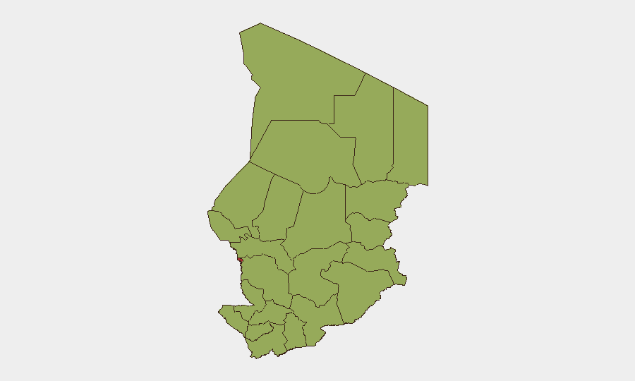
N'Djamena dominates the risk landscape at 76.9, driven by its role as the political and administrative core and exposure to inter-elite friction, civil-unrest potential, and cross-border spillover from Sudan. A secondary tier of 11 regions (Ennedi-Ouest through Tibesti, all scoring 46.9) reflects endemic instability across Chad's Sahel and eastern frontier—zones of weak state capacity, armed-group activity (including cross-border incursions from Sudan), herding-pastoralist tensions, and limited humanitarian access. The sharp differential between capital and hinterland reflects Chad's classic center-periphery fracture; security teams with personnel or assets in N'Djamena face acute political-security and kidnap risk, while field operations in the east and north remain exposed to low-intensity conflict, banditry, and health hazards.
How GeoBit Would Assist
Security teams should deploy AOI Monitoring & Early Warning on N'Djamena and eastern frontier zones (Bamina, Ennedi) to capture cross-border drone activity and political signals in near-real time. OSINT Fusion & Corroboration across social media, local media, and regional digests is essential to validate unconfirmed incidents (as with the Sudan drone strike) before operational response. Network & Actor Analysis combined with Conflict & Military mapping will clarify government-army fault lines and Sudanese-actor intentions. Humanitarian & NGO data feeds provide early warning on disease spread (Hepatitis E) and access constraints affecting duty-of-care.
7-Day Outlook
No imminent large-scale escalation is indicated, but cross-border drone strikes from Sudan are likely to recur, and N'Djamena's political temperature may fluctuate with arrests and public statements. Teams should expect continued low-level fragmentation in the east and persistence of hepatitis circulation; contingency protocols for evacuation, communications disruption, and medical response remain warranted.
Highest-Risk Areas — Ranked
| # | State / Region | Risk |
|---|---|---|
| 1 | N'Djamena | 76.9 |
| 2 | Ennedi-Ouest | 46.9 |
| 3 | Wadi Fira | 46.9 |
| 4 | Ouaddaï | 46.9 |
| 5 | Sila | 46.9 |
| 6 | Salamat | 46.9 |
| 7 | East Ennedi | 46.9 |
| 8 | Kanem | 46.9 |
| 9 | Lac | 46.9 |
| 10 | Hadjer-Lamis | 46.9 |
| 11 | Chari-Baguirmi | 46.9 |
| 12 | Tibesti | 46.9 |
Sources
Previous Daily Briefs
A new Chad brief is written every day — each with its own risk map and downloadable CSV. Here's the last week; use the calendar to go further back.
📅 Browse every day by calendar →
Highlighted days have a brief. Tap a day for that day's map & analysis, or “csv” for that day's dataset ($5).
Atlas — our AI intelligence desk — emails them this snapshot personally. Nothing else, no list.