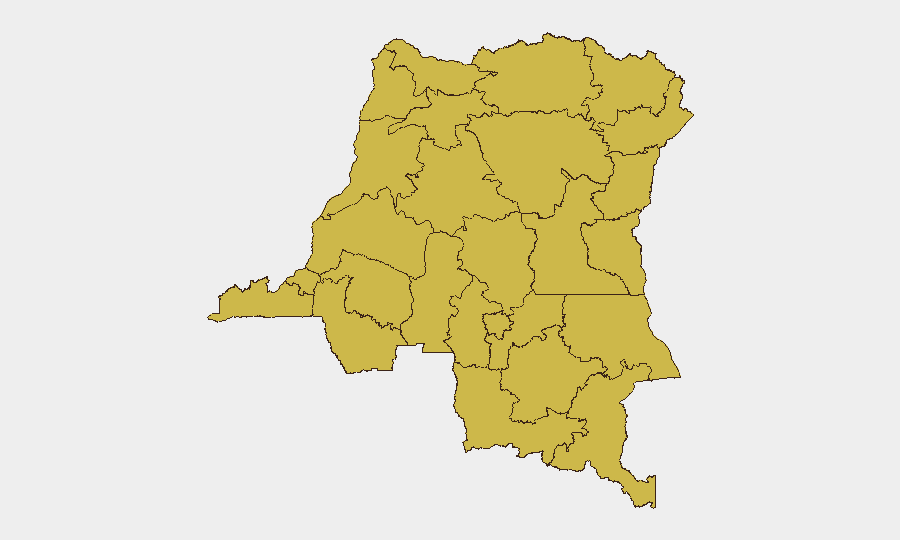
Situation Summary
DR Congo remains Africa's most complex active conflict environment, ranking #14 globally with a composite threat score of 92. The eastern provinces continue to experience sustained armed group activity, intercommunal violence, and competition for territorial control involving multiple state and non-state actors. Current trajectory indicates persistent fragmentation of security across the eastern corridor with no near-term de-escalation signals. The humanitarian footprint and displacement pressure remain severe across North Kivu, South Kivu, and Ituri.
Key Developments
No discrete security events have been reliably verified for the 24–48 hour window (10–11 July 2026). GeoBit's current event tracking has recorded zero attributed incidents in this immediate timeframe. Real-time confirmation of new security incidents in DR Congo typically requires cross-referencing multiple independent sources (wire services, regional outlets, OSINT feeds, and on-ground reporting). The available research window does not contain time-stamped confirmations meeting GeoBit's verification threshold for this brief period.
Operational Note: Organizations requiring intra-day or sub-24-hour incident alerting on DR Congo should activate GeoBit's AOI Monitoring & Early Warning service with persistent watch zones over high-threat provinces (North Kivu, Ituri, Maniema) and key transport corridors. This enables real-time alerting when events are first reported by ACLED, MONUSCO, humanitarian networks, or regional media.
Highest-Risk Areas
Eastern DRC provinces dominate the risk profile. Maniema, Ituri, North Kivu, and the Ubangi corridor (Sud-Ubangi, Nord-Ubangi, Mongala) all register composite risk scores of 64—the platform's highest tier for the country. These zones experience overlapping drivers: active armed group presence, state-force operations, resource competition, and porous borders facilitating transnational armed movement (particularly from Central African Republic and Uganda). Ituri and North Kivu specifically remain focal points for displacement, sexual violence, and forced recruitment. The Ubangi cluster reflects spillover from CAR instability and limited state presence.
How GeoBit Would Assist
Security teams operating in DR Congo should deploy AOI Monitoring & Early Warning with alerts configured for corporate sites, supply routes, and personnel movement corridors in Ituri and North Kivu. Conflict & Military mapping combined with Network & Actor Analysis enables tracking of armed-group force disposition, leadership changes, and factional fragmentation—critical for predicting territorial shifts and attack patterns. Routing & Network Analysis allows pre-calculated alternative journey planning for personnel and cargo movements, with real-time rerouting capability as incidents occur. Multi-language OSINT (including French, Lingala, and Swahili feeds) ensures early warning from local media and security sources before international wire services report.
7-Day Outlook
No significant security inflection points are currently signaled for the next seven days. Baseline armed-group activity, intercommunal clashes, and localized military operations should be expected to continue at current intensity across the eastern provinces. Security teams should maintain heightened readiness protocols for personnel in North Kivu and Ituri and monitor AOI feeds for sudden force concentrations or displacement events that often precede major incidents.
Brief prepared: 2026-07-11 | Next update: 2026-07-12 | Confidence: Medium (limited real-time event data for this 24h window)
Highest-Risk Areas — Ranked
| # | State / Region | Risk |
|---|---|---|
| 1 | Maniema | 64 |
| 2 | Sud-Ubangi | 64 |
| 3 | Équateur | 64 |
| 4 | Nord-Ubangi | 64 |
| 5 | Mongala | 64 |
| 6 | Lower Uele | 64 |
| 7 | Tshopo | 64 |
| 8 | Tshuapa | 64 |
| 9 | Upper Uele | 64 |
| 10 | Ituri | 64 |
| 11 | North Kivu | 64 |
| 12 | Lualaba | 64 |
Sources
Previous Daily Briefs
A new DR Congo brief is written every day — each with its own risk map and downloadable CSV. Here's the last week; use the calendar to go further back.
📅 Browse every day by calendar →
Highlighted days have a brief. Tap a day for that day's map & analysis, or “csv” for that day's dataset ($5).
Atlas — our AI intelligence desk — emails them this snapshot personally. Nothing else, no list.