Situation Summary
Ethiopia remains in a state of active civil conflict with composite threat score 88 (global rank #11), driven by ongoing armed confrontation across multiple regions and political tensions with regional actors. The security environment is characterized by asymmetric warfare, communal violence, and periodic state-actor disputes, with Addis Ababa carrying significantly elevated risk (91.9) relative to conflict-affected periphery zones (61.9). As of 30 July 2026, no discrete security incidents have been corroborated in open sources within the preceding 48 hours; the operating environment remains acute but currently without reported new tactical escalations in the immediate term.
Key Developments
Transparency note: Open-source intelligence does not currently surface specific, dated security incidents from the 24–48 hour window preceding this brief. The single dedicated Ethiopia security tracker explicitly reports no new corroborated incidents meeting that recency threshold as of 25 July 2026. Earlier July reporting documented conflict activity in Amhara (ongoing since late June), East Arsi/Oromia (escalation from 30 May onward), and Tigray (persistent low-level armed presence), but these do not constitute *new* developments as of 29–30 July. Diplomatic signals flagged in GEOBIT event feeds (Egyptian and Chinese statements, 27–28 July) reflect state-level positioning rather than field-level security incidents.
Operational implication: Security teams monitoring Ethiopia should expect reporting lag in open sources; duty-of-care assessments should rely on 7–10 day rolling windows and persistent area-of-interest monitoring rather than daily incident feeds.
Highest-Risk Areas
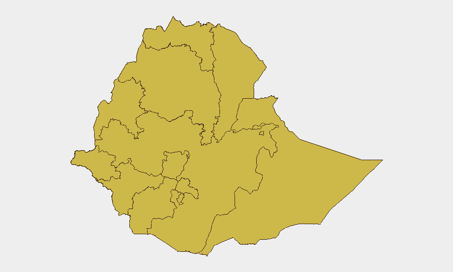
Addis Ababa (91.9) dominates the risk profile and reflects concentration of political authority, foreign missions, and civil service assets in an urban environment subject to both criminal-security and political contingency risk. The remaining 11 regions cluster at 61.9, indicating that conflict-affected zones—Tigray, Amhara, Afar, Benishangul-Gumuz, Oromia, Somali, Gambela, and others—carry comparable operational hazard from armed group activity, communal violence, and resource competition. Addis Ababa's outlier elevation suggests either elevated civil unrest risk, greater exposure of diaspora/foreign nationals, or modeling of urban-centered governance fragility. The even distribution of secondary zones indicates that the conflict is geographically dispersed rather than concentrated; assets in any of these 11 regions face similar material risk from armed activity or displacement.
How GeoBit Would Assist
Corporate security and duty-of-care teams would deploy AOI Monitoring & Early Warning on personnel locations and supply corridors in Amhara, Oromia, and Tigray to detect armed-group movement or violence escalation before media reporting. Conflict & Military capabilities (force structure, battle mapping) support scenario planning for regional armed-group capabilities and territorial control shifts. Routing & Network Analysis enables real-time alternative-route planning for staff movement in high-risk zones, circumventing active conflict areas. OSINT fusion (multi-language feeds, Telegram/radio SIGINT, entity extraction) accelerates identification of localized security deterioration when 24–48 hour lags in public reporting occur.
7-Day Outlook
Near-term trajectory remains contingent on Amhara and Oromia regional dynamics; no indicators suggest imminent nationwide escalation or capital-city civil unrest. Periodic diplomatic signaling from Egypt and external actors may reflect positioning around resource/border disputes but does not signal imminent military action. Personnel and asset security posture should remain at heightened alert with flexible movement protocols; sustained regional conflict is the baseline expectation.
Highest-Risk Areas — Ranked
| # | State / Region | Risk |
|---|---|---|
| 1 | Addis Ababa | 91.9 |
| 2 | Tigray | 61.9 |
| 3 | Amhara Region | 61.9 |
| 4 | Afar Region | 61.9 |
| 5 | Benishangul-Gumuz Region | 61.9 |
| 6 | Somali Region | 61.9 |
| 7 | Gambela Region | 61.9 |
| 8 | South West Ethiopia Peoples | 61.9 |
| 9 | South Ethiopia Regional State | 61.9 |
| 10 | Central Ethiopia Regional State | 61.9 |
| 11 | Oromia Region | 61.9 |
| 12 | Sidama | 61.9 |
Sources
Previous Daily Briefs
A new Ethiopia brief is written every day — each with its own risk map and downloadable CSV. Here's the last week; use the calendar to go further back.
📅 Browse every day by calendar →
Highlighted days have a brief. Tap a day for that day's map & analysis, or “csv” for that day's dataset ($5).
Atlas — our AI intelligence desk — emails them this snapshot personally. Nothing else, no list.