Situation Summary
Nepal is experiencing sustained communal unrest concentrated in the southeastern Terai belt (Koshi and Madhesh provinces), with Hindu–Muslim tensions having triggered curfews, military deployments, and at least three confirmed fatalities over the past 48 hours. Security forces have extended curfew orders across four districts (Sunsari, Dhanusha, Siraha, and Saptari) and deployed armored vehicles in key towns including Inaruwa and Kaptanganj. While the violence remains geographically contained to the border-adjacent southeast, national leadership has convened emergency security reviews, and authorities report ongoing risk of renewed protests and potential spread to neighboring districts. Concurrent monsoon-related infrastructure collapse (seven road fatalities, multiple highway blockages in past 24 hours) compounds mobility and supply-chain risk across the country.
Key Developments
- Rajbiraj municipality, Saptari district (Madhesh Province) – July 31, 2026: Indefinite daytime curfew imposed (08:00–onward) after protests erupted over spillover risk from adjacent communal violence in Sunsari; authorities cited high escalation potential in this border-adjacent town.
- Sunsari, Dhanusha, Siraha, and Saptari districts (Terai) – July 31–August 1, 2026: Curfew orders extended across all four southeastern districts as Hindu–Muslim tensions persist; three confirmed dead and over two dozen injured from earlier clashes; security forces conducted continuous riot-control operations, roadblocks, and patrols.
- Inaruwa and Kaptanganj, Sunsari district (Koshi Province) – July 31–August 1, 2026: Army units and armored vehicles remain deployed following sectarian violence involving arson, vandalism, stone-pelting, and attacks on government and private buildings; sporadic protests continued into the weekend.
- Central Security Committee, Kathmandu – August 1, 2026: Emergency meeting convened to review the Sunsari–Madhesh security situation; Ministry of Home Affairs investigation committee ordered to deliver findings within one week, signaling sustained high-level attention.
- Nationwide highways and rural areas – past 24 hours to August 1, 2026: Seven fatalities and over 100 injuries from monsoon-related road accidents and landslide-blocked highways, underlining concurrent infrastructure and mobility hazards independent of communal unrest.
- Gaur area, Rautahat district (Madhesh Province) – July 31–August 1, 2026: Police continued heightened crime-control operations and drone surveillance following recent arrest sweep of 21 convicted fugitives, indicating elevated law-enforcement activity across the central Terai corridor.
Highest-Risk Areas
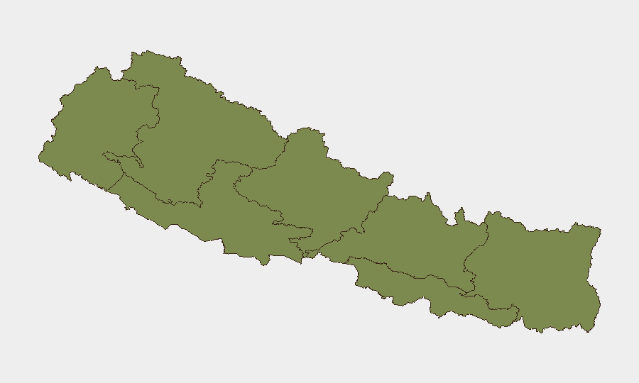
Koshi Province (composite risk 31.3) and Madhesh Province (16.4) are driving the current threat landscape, driven by active Hindu–Muslim communal violence, curfews, and military deployments in districts along the India border (Sunsari, Saptari, Dhanusha, Siraha). Bagamati Province (15) warrants monitoring for potential spread of unrest, given its proximity to the Terai epicenter and administrative connectivity to the capital. The remaining provinces (Gandaki, Sudurpashchim, Karnali, Lumbini) show minimal current activity, though the southeastern concentration reflects long-standing intercommunal friction in the border Terai belt, historically prone to rapid escalation.
How GeoBit Would Assist
Security teams would deploy AOI (area-of-interest) Monitoring & Early Warning on Sunsari, Saptari, and neighboring districts to track curfew enforcement, protest activity, and military movements in real time. Multi-language OSINT (X/Twitter, Telegram, local media) and entity extraction would enable rapid detection of inflammatory rhetoric, administrative announcements, or calls for expansion of violence. Routing & Network Analysis would support contingency planning for staff evacuation or supply chains disrupted by curfews and monsoon-blocked highways.
7-Day Outlook
Curfews and security operations are likely to persist across the four-district Terai zone through at least August 5–6 pending findings from the Ministry of Home Affairs investigation. Risk of renewed flashpoint violence remains elevated if inter-communal frictions reignite or if authorities perceive coordination across districts; monsoon travel hazards will continue to compound mobility challenges nationwide. No indication of armed-group involvement or spillover to central regions, but sustained unrest in the Terai may provoke reactive security-force escalation if tensions are not rapidly de-escalated.
Highest-Risk Areas — Ranked
| # | State / Region | Risk |
|---|---|---|
| 1 | Koshi Province | 31.3 |
| 2 | Madhesh Province | 16.4 |
| 3 | Bagamati Province | 15 |
| 4 | Gandaki Province | 9.9 |
| 5 | Sudurpashchim Province | 1.3 |
| 6 | Karnali Province | 1.3 |
| 7 | Lumbini Province | 1.3 |
Sources
Previous Daily Briefs
A new Nepal brief is written every day — each with its own risk map and downloadable CSV. Here's the last week; use the calendar to go further back.
📅 Browse every day by calendar →
Highlighted days have a brief. Tap a day for that day's map & analysis, or “csv” for that day's dataset ($5).
Atlas — our AI intelligence desk — emails them this snapshot personally. Nothing else, no list.