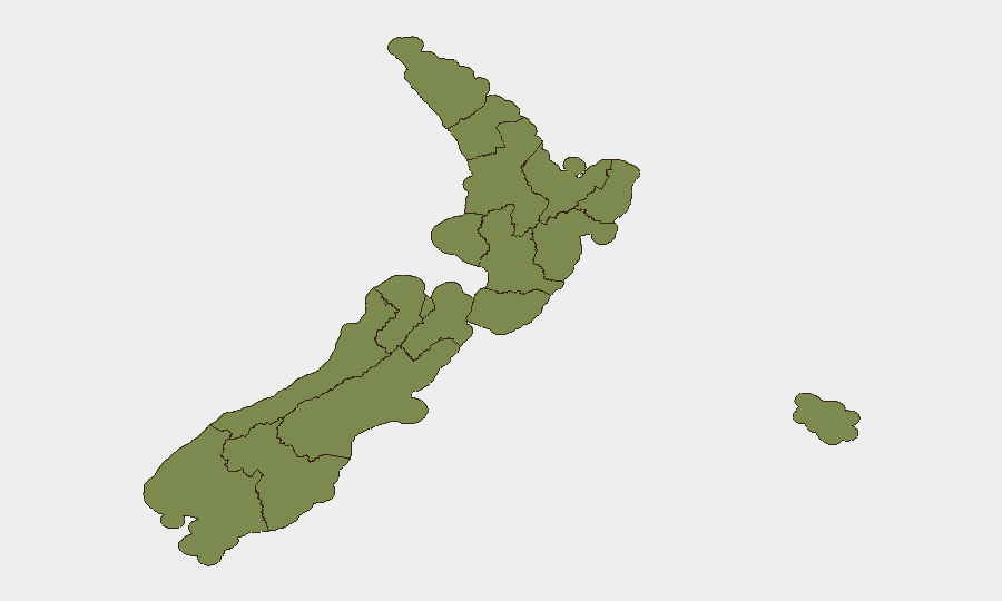
Situation Summary
New Zealand's composite threat score remains low globally (12/38 tracked events), but localized security incidents have concentrated in Auckland and Canterbury over the past 48 hours, creating operational risk for corporate and transport assets in those regions. A triple-homicide arrest in North Shore Auckland, multiple vehicle crashes in Canterbury, and a coordinated commercial crime spree in Christchurch signal elevated criminal activity and infrastructure disruption in the South Island. Wellington carries the highest regional risk score (31.3), though current incident density is highest in Auckland and Canterbury. The trajectory suggests sustained elevated activity in transport, property, and potentially cyber domains through the near term.
Key Developments
- Auckland, North Shore (Birkdale & Glenfield) – 29 Jul, evening: Police arrested a 41-year-old male following a stabbing on Seion Place and the discovery of two bodies on Lingfield Street; suspect now faces two murder charges and one attempted murder charge. Heightened police presence and community alert status in place.
- Christchurch, multiple commercial premises – 30 Jul, early morning: Police reported a concentrated "90-minute crime spree" involving property damage and theft across multiple businesses, indicating organized or opportunistic commercial targeting.
- Canterbury, Selwyn District – 30 Jul: A serious multi-vehicle crash resulted in more than a dozen injuries, including two critical, requiring multi-agency emergency response and ongoing medical assessment.
- Christchurch, Johns Road (Northwood) – 30 Jul, ~4:15 p.m.: A two-vehicle crash closed Johns Road, with diversions in place; ongoing transport disruption affecting local logistics and commuter routes.
- Canterbury, Cribb Creek Bridge – 30 Jul: Flooding caused Cribb Creek Bridge to be deemed unsafe; road closure and repair operations expected to persist, affecting regional transport connectivity.
- New Zealand, tertiary education sector (multiple locations) – disclosed 30 Jul: The National Cyber Security Centre confirmed a data breach affecting Canvas learning management systems across universities and educational institutions, exposing personal data of students and staff.
Highest-Risk Areas
Wellington's composite risk score (31.3) substantially exceeds other regions, driven by multi-domain event signals including judicial actions, administrative sanctions, and population-level disapproval statements. Waikato (23.2) and Bay of Plenty (17.4) follow as secondary concern areas. However, current 24–48 hour incident density is concentrated in Auckland (North Shore stabbing/homicide cluster) and Canterbury (crashes, flooding, coordinated property crime), indicating that real-time operational risk for corporate personnel and supply chains diverges from the longer-term composite rankings—suggesting either emerging flash-point conditions in Canterbury and Auckland or a lag in regional scoring updates. Security teams should weight current incident clustering alongside historical risk profiles when routing personnel and assets.
How GeoBit Would Assist
Security and risk teams monitoring New Zealand should deploy AOI Monitoring & Early Warning on Auckland North Shore, greater Christchurch, and Canterbury transport corridors to detect emerging crime or incident clustering in real time. Routing & Network Analysis capabilities enable alternative journey planning around current road closures (Johns Road, Cribb Creek Bridge) and identification of secondary transport vulnerabilities. Cyber & OSINT intelligence (including multi-language search and entity extraction) supports tracking of the Canvas breach exposure scope and related institutional notifications, informing data-loss response and third-party risk assessment for organizations using affected systems.
7-Day Outlook
Elevated criminal activity and transport disruption in Canterbury and Auckland are likely to persist through early August as emergency response and investigation operations continue. The Canvas breach may trigger cascading institutional security notifications and regulatory responses. Personnel travel to North Shore Auckland and Canterbury regions should factor heightened police activity, road closures, and ongoing flooding impacts into duty-of-care planning.
Highest-Risk Areas — Ranked
| # | State / Region | Risk |
|---|---|---|
| 1 | Wellington | 31.3 |
| 2 | Waikato | 23.2 |
| 3 | Bay of Plenty | 17.4 |
| 4 | Otago | 13 |
| 5 | Auckland | 7.1 |
| 6 | Manawatū-Whanganui | 4.2 |
| 7 | Hawke's Bay | 2.7 |
| 8 | West Coast | 2.7 |
| 9 | Chatham Islands | 1.3 |
| 10 | Northland | 1.3 |
| 11 | Taranaki | 1.3 |
| 12 | Gisborne | 1.3 |
Sources
Previous Daily Briefs
A new New Zealand brief is written every day — each with its own risk map and downloadable CSV. Here's the last week; use the calendar to go further back.
📅 Browse every day by calendar →
Highlighted days have a brief. Tap a day for that day's map & analysis, or “csv” for that day's dataset ($5).
Atlas — our AI intelligence desk — emails them this snapshot personally. Nothing else, no list.